Vetter Mountain facts for kids
Quick facts for kids Vetter Mountain |
|
|---|---|

Vetter Mountain fire lookout tower
|
|
| Highest point | |
| Elevation | 5,911 ft (1,802 m) NAVD 88 |
| Prominence | 708 ft (216 m) |
| Listing | Sierra Peaks Section |
| Geography | |
| Location | Los Angeles County, California, U.S. |
| Parent range | San Gabriel Mountains |
| Topo map | USGS |
| Climbing | |
| Easiest route | Forest road 3Na6 |
Vetter Mountain is a mountain located in the San Gabriel Mountains in Los Angeles County, California. It stands tall within the Angeles National Forest, reaching an elevation of 5,911 feet (about 1,802 meters).
The mountain was named around 1933 by a surveyor named Don McLain. He named it after Victor P. Vetter, a dedicated forest ranger and fire dispatcher. Victor Vetter was recognized for his excellent work in protecting forests and even won the USFS Bissell Medal in 1930. The famous Silver Moccasin Trail, a popular hiking path, crosses the eastern side of Vetter Mountain.
Contents
The Vetter Mountain Fire Lookout
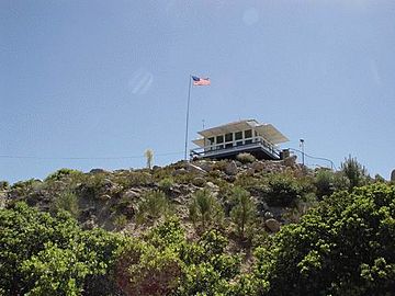
Vetter Mountain is home to a historic fire lookout tower. This special tower, known as a BC-3 type cab, is built directly on the ground. It helps people spot wildfires from a high point.
History of the Lookout Tower
The original lookout tower was built in 1937. It was used to watch for fires until 1981. A brave fire lookout named Ramona Merwin worked in the tower from 1953 until it closed. The tower was almost moved to a different location. However, a group of active citizens worked with the Forest Service to save it. They successfully rebuilt and restored the tower, making it operational again in 1998.
Volunteers from the Angeles National Forest Fire Lookout Association (ANFFLA) operated the tower. Sadly, the tower was destroyed by the large Station Fire on August 31, 2009. Even after the fire, these dedicated volunteers continued to watch for fires. They set up a temporary lookout at the base of the original tower's steps.
Rebuilding the Lookout Tower
The ANFFLA volunteers started rebuilding the fire lookout on July 12, 2014. They began by pouring a new concrete base, using a "bucket brigade" method. The new tower was designed to look just like the original one from the 1930s. Construction was completed in 2020, bringing the historic lookout back to life.
From the lookout, you can see many parts of the Angeles Crest Highway. It also offers clear views of Mount Wilson to the south and Mount Pacifico to the north.
Charlton Flats Picnic Area
Charlton Flats is a popular picnic area located on the northeast side of Vetter Mountain. It's about a 40-minute drive from the Interstate 210. This picnic spot has about 185 tables and stoves, perfect for outdoor meals. It is usually open from April 1 to November 15.
The area was originally called Pine Flat. It was later renamed Charlton Flats to honor Mr. R.H. Charlton. He was the very first forest supervisor for the Angeles National Forest, serving for 20 years from 1905 to 1925.
Plants and Trees on Vetter Mountain
Vetter Mountain has different types of plant life on its northern and southern slopes. This is because the sun hits the slopes differently, making some areas hotter and drier.
Northern Slope Plants
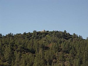
The northern side of Vetter Mountain is part of the "Montane Forest" zone. This area is cooler and has more moisture. Here, you can find larger trees like bigcone spruce, canyon oak, Jeffrey pine, sugar pine, incense cedar, and white fir.
Southern Slope Plants
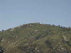
The southern side of Vetter Mountain is part of the "Chaparral" zone. This area is hot and dry, especially on the foothills of the San Gabriel Mountains. The plants here are usually chest-high, dense, and evergreen. They often have prickly leaves to help them survive in dry conditions. Common plants include chamise, yucca, Ceanothus, scrub oak, laurel sumac, white sage, black sage, and poison oak. At higher elevations, you might also see manzanita and mountain mahogany.
 | Isaac Myers |
 | D. Hamilton Jackson |
 | A. Philip Randolph |


