Angeles Crest Highway facts for kids
Quick facts for kids
Angeles Crest Highway |
|
|---|---|
| Lua error in Module:Infobox_road/map at line 15: attempt to index field 'wikibase' (a nil value).
Angeles Crest Highway highlighted in red
|
|
| Route information | |
| Maintained by Caltrans | |
| Length | 66.000 mi (106.217 km) |
| Existed | 1934–present |
| Tourist routes |
|
| Restrictions | No trucks with 3 or more axles, or over 4.5 tons between La Cañada Flintridge and Big Pines. |
| Major junctions | |
| West end | Foothill Blvd in La Cañada Flintridge |
| East end | |
| Location | |
| Counties: | Los Angeles, San Bernardino |
| Highway system | |
| State highways in California(list • pre-1964) History • Unconstructed • Deleted • Freeway • Scenic |
|
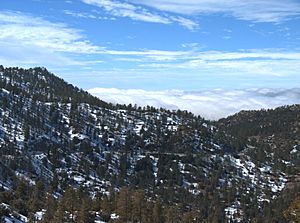
The Angeles Crest Highway is a special road that winds through the San Gabriel Mountains in Los Angeles County, California. It's a two-lane highway, meaning one lane goes each way. Most of this road is part of California State Route 2. It also passes through the beautiful San Gabriel Mountains National Monument and the Angeles National Forest.
This highway is about 66 miles (106 km) long. It starts in La Cañada Flintridge and ends near Wrightwood. Most of the road goes through the San Gabriel Mountains, which are north of the Los Angeles area. Parts of the road are very high up, reaching over 7,000 feet (2,100 m). The highest point is at Dawson Saddle, which is 7,903 feet (2,409 m) high. This makes it one of the highest roads in Southern California!
A part of the highway, from La Cañada Flintridge to the border between Los Angeles and San Bernardino counties, is called the Angeles Crest Scenic Byway. This means it's recognized as a special scenic road by both the national forest system and California.
Contents
Exploring the Angeles Crest Highway
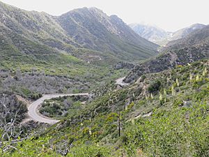
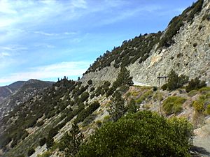
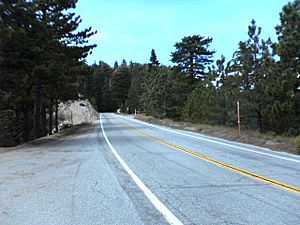
This road feels like you're deep in the mountains, far from cities. Since it goes through the protected San Gabriel Mountains National Monument and Angeles National Forest, you won't see many buildings. There's a place called Newcomb's Ranch, and some forest service campgrounds and visitor centers.
You can also find ski areas like Mountain High and Mt. Waterman along the way.
About 4.5 miles from the highway, you'll find Mount Wilson. This is where the famous Mount Wilson Observatory is located, along with many radio and TV towers. On clear days, you can see amazing views of the Los Angeles Basin from here. Sometimes, smog or clouds might block the view.
The western part of the highway is used by people who live in the Antelope Valley and work in the Los Angeles area. It's a way for them to avoid busier freeways like the Antelope Valley Freeway (State Route 14) and the Golden State Freeway (Interstate 5). However, since it's a two-lane road, it can't handle as much traffic as the freeways.
The rest of the Angeles Crest Highway is usually quieter. It's often used by people on vacation, sightseers, or locals enjoying the scenery. The Mountain High ski resort is also located near Wrightwood.
History of the Highway
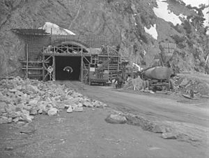
Building the Angeles Crest Highway started in 1929. It was first planned as a road to help firefighters reach fires. Construction stopped in 1941 because of World War II. After the war, work began again in 1946, and the highway finally opened in 1956.
Prisoners from Camp 37 helped build the road. Staff from the Division of Highways (now called CalTrans) used to live at a place called Cedar Springs. Their children went to a one-room school called Chilao Mountain School, which is now closed.
In the 1950s, there were plans to make the Angeles Crest Highway into a freeway. But engineers realized it would be too difficult because of the mountains, so those plans were dropped.
The highway has even been featured in movies! Parts of the film Donnie Darko (2001) were filmed here. In the movie, the highway is used for racing scenes in The Love Bug and Herbie Goes to Monte Carlo, where it pretended to be the "French Alps."
Access and Road Closures
There aren't many other roads that connect to the Angeles Crest Highway. This can be a problem if the road has to close because of things like landslides or fires. In the middle of the highway, there's a junction with State Route 39. However, State Route 39 is closed to cars because of ongoing landslides. So, if you're traveling on Angeles Crest Highway, you might need to use it for most of your trip or be ready to turn around if a section is closed.
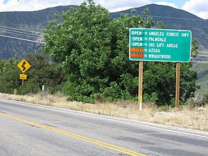
In winter, the Angeles Crest Highway often closes between Islip Saddle and Vincent Gap. This is because of dangers from falling rocks and avalanches.
Big winter storms in 2004 and 2005 caused a lot of landslides and damage to the highway. It stayed closed for a long time. Repairs were very expensive. A storm in March 2006 caused even more damage, washing away a large part of the road. This made the reopening even slower. The long closure made it hard for emergency services, like firefighters, to access the area. It also hurt businesses in Wrightwood.
After being closed for four and a half years, the highway finally reopened on May 20, 2009. Workers built a new bridge to help landslides pass underneath without damaging the road. This work cost $10.5 million.
In 2009, a rule was put in place to ban large trucks (with three or more axles, or over 4.5 tons) from a section of the highway. This was done to improve safety.
It can be hard to get cell phone service on the Angeles Crest Highway. The mountains block signals, and there aren't many cell towers nearby.
If you want to park by the side of the road and explore the wilderness for a short time, you can. But if you plan to stay longer, like for camping or hiking, you might need a National Forest Adventure Pass. This pass costs $5.00.
2009 Station Fire Closure
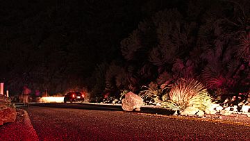
In 2009, a huge wildfire called the "Station Fire" burned through the mountains where Route 2 runs. The fire damaged signs, guardrails, and road markings. It also left many large rocks and debris on the road.
Because of this, Caltrans closed the highway until November 30, 2009. It reopened briefly, but then mudslides and rockslides in early 2010 forced another closure for a part of the highway. It finally reopened again on June 3, 2011.
See also
 In Spanish: Carretera Angeles Crest para niños
 | Calvin Brent |
 | Walter T. Bailey |
 | Martha Cassell Thompson |
 | Alberta Jeannette Cassell |


