Wardle, Greater Manchester facts for kids
Quick facts for kids Wardle |
|
|---|---|
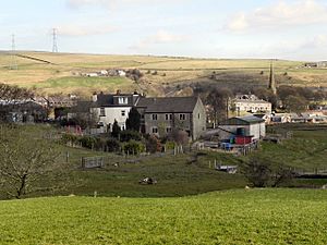
 A view towards Wardle |
|
| Population | 7,092 |
| OS grid reference | SD912168 |
| • London | 170 mi (270 km) SSE |
| Metropolitan borough |
|
| Metropolitan county | |
| Region | |
| Country | England |
| Sovereign state | United Kingdom |
| Post town | ROCHDALE |
| Postcode district | OL12 |
| Dialling code | 01706 |
| Police | Greater Manchester |
| Fire | Greater Manchester |
| Ambulance | North West |
| EU Parliament | North West England |
| UK Parliament |
|
Wardle is a village located in Greater Manchester, England. It is close to Littleborough and is part of the Metropolitan Borough of Rochdale. Wardle sits among the hills of the South Pennines. It is about 4 kilometres (2.5 miles) northwest of Rochdale and 19 kilometres (12 miles) northeast of the city of Manchester.
Historically, Wardle was part of Lancashire. Evidence shows that people lived here as far back as the Mesolithic period, which was the Middle Stone Age. The name "Wardle" might come from "Ward Hill," meaning a "fortified place." Brown Wardle Hill overlooks the village. Its name comes from an old Celtic word meaning "round."
During the Middle Ages, Wardle was known for making cloth. People made flannel and woollen cloth at home. Many of the old weavers' cottages from that time are still standing today. These old buildings are now protected as listed buildings.
Wardle is the most northern settlement in Greater Manchester. While some parts are close to the urban areas of Rochdale, the village still feels very rural. Watergrove Reservoir is just north of Wardle. It is the biggest reservoir in the Rochdale area, holding a huge amount of water. The village has many old stone churches, farmhouses, and cottages from the 17th and 18th centuries. The village square is kept as a special historic place.
How Wardle is Governed
Wardle has been part of Lancashire since the early 1100s. It was originally linked with a place called Wuerdle. Both were part of the larger area known as Hundersfield and the parish of Rochdale. Later, Wuerdle and Wardle became their own separate area, but still within the Rochdale parish.
Wardle got its first local government in 1874. This was a "Local Board of Health." Their job was to make sure the area was clean and healthy. In 1879, a part of the nearby area of Butterworth was added to their control.
In 1894, the area became the Wardle Urban District. This was a local government district within Lancashire. It helped manage local services for the people of Wardle.
However, in 1974, big changes happened to local government in England. The Wardle Urban District was removed. Since then, Wardle has been part of the Metropolitan Borough of Rochdale. This borough is part of Greater Manchester.
Exploring Wardle's Geography

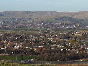
Wardle is located at the base of the Pennines mountain range. It sits on the edge of the Greater Manchester Urban Area. This is one of the largest city areas in the United Kingdom. As mentioned, Wardle is the most northern village in all of Greater Manchester.
The village is situated south of the large Watergrove Reservoir. It is also west of the town of Littleborough.
Learning in Wardle: Schools and Education
Wardle has a primary school called St James Primary School. For older students, there is a secondary school known as Wardle Academy.
 | Kyle Baker |
 | Joseph Yoakum |
 | Laura Wheeler Waring |
 | Henry Ossawa Tanner |


