Waun-oer facts for kids
Quick facts for kids Waun-oer |
|
|---|---|

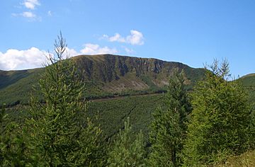
Waun-oer from the southeast
|
|
| Highest point | |
| Elevation | 670 m (2,200 ft) |
| Prominence | 119 m (390 ft) |
| Listing | Hewitt, Nuttall, HuMP |
| Naming | |
| English translation | Cold Bog |
| Language of name | Welsh |
| Geography | |
| Location | Snowdonia, Wales |
| Parent range | Cadair Idris |
| OS grid | SH785147 |
| Topo map | OS Explorer OL23 |
Waun-oer is a mountain located in the beautiful Snowdonia National Park in North Wales. It stands about four miles (or 6.4 kilometers) southwest of another mountain called Aran Fawddwy. This mountain is part of a group known as the Dyfi hills, which are a smaller part of the famous Cadair Idris mountain range.
Discovering Waun-oer Mountain
Where is Waun-oer?
Waun-oer is found in the stunning landscapes of Snowdonia, Wales. It's a key part of the Dyfi hills, a smaller collection of mountains. These hills are themselves connected to the larger and well-known Cadair Idris mountain group.
What's at the Top?
The very top of Waun-oer is a grassy area that isn't perfectly flat. At the highest point, you'll find a "trig point." A trig point is a special pillar made of concrete. It was used by mapmakers, like the Ordnance Survey, to help them create very accurate maps of the land. It marks the exact summit, or highest point, of the mountain.
Nearby Mountains
Waun-oer is connected to several other interesting peaks. To its east, you'll find Cribin Fawr. To the south, there's Mynydd Ceiswyn. Looking north from Waun-oer, you can see the impressive Cadair Idris mountain. To the west, another mountain called Tarren y Gesail stands. These connections make Waun-oer a central point in this part of the Welsh mountains.
 | William M. Jackson |
 | Juan E. Gilbert |
 | Neil deGrasse Tyson |

