Weald Moors facts for kids
Quick facts for kids Weald Moors
|
|
|---|---|
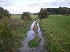
 The River Strine, here south of Cherrington, drains part of the Weald Moors. |
|
| Unitary authority | |
| Ceremonial county | |
| Region | |
| Country | England |
| Sovereign state | United Kingdom |
| EU Parliament | West Midlands |
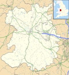
The Weald Moors are a special area in Shropshire, England. They stretch from the town of Newport towards Wellington, with the village of Kynnersley in the middle. Even though they are mostly farms now, this area used to be a large, wet marshland.
Contents
What's in a Name? The Meaning of Weald Moors
The name Weald Moors tells us about this area's past. The word weald here means "wild" or "uncultivated." This is because the land was once wild and not farmed. A moor in Shropshire means a marsh or a wet, boggy area. So, the name means "wild marshes."
Old documents show different spellings like "Wildmore" or "Wyldemore" from the 1300s to the 1500s. The name "Wildmoor" was used even into the 1800s.
A Look Back: The History of Weald Moors
How the Moors Were Formed
The Weald Moors became a marshy area after the last Ice Age. Back then, this land was part of a big glacial lake called Lake Newport. Over time, a lot of peat built up. Peat is partly decayed plant matter that forms in wet places. This peat created a large, waterlogged basin.
In the Middle Ages, most towns were built on the edges of this wet land. But people did live here earlier. An Iron Age fort at Wall Camp shows that ancient people used the marsh for protection.
Royal Forests and Early Farming
For a while, part of the Weald Moors was a royal forest. This was called Vasta Regalis. A royal forest was an area where the king had special hunting rights. Sir Humphrey de Eyton was in charge of this forest in 1390. Even in the 1800s, people remembered the old name in a place called "The Gales."
Draining the Land: Early Attempts
From the mid-1500s to the mid-1600s, people tried to drain and enclose parts of the moor. This led to arguments over land boundaries. Sir Walter Leveson of Lilleshall drained a lot of land on the western side in the late 1500s. By the 1650s, about 2,700 acres of wet land had been drained and fenced off.
People also dug for peat in some areas. Villages like Wrockwardine used parts of the Moors as summer pasture. This was under old rights of common, meaning many people could use the land. Wrockwardine had many common rights, possibly because it was an important royal area in the 1000s. By the 1600s, a road connected Wrockwardine to the moors. Small houses were built along this road, forming a settlement called Long Lane.
Life in the 1600s
In 1673, a local church leader, Rev. George Plaxton, wrote about the Weald Moors. He said much of it was still a bog that was impossible to cross. He believed the whole area had been a marsh until recently. Only small "islands" of land, with "ey" (meaning island) in their names, were not marshy. Older people told Plaxton that the Moors used to be so full of willow and alder trees that they put bells on their cattle so they wouldn't get lost!
The Great Drainage Project of the 1800s
In 1801, a law called the "Wildmoors Inclosure Act" was passed. This allowed landowners, especially the Leveson-Gower family, to start more drainage work. At this time, about 1,200 acres were still marshland. Another 600 acres next to it were not farmed. Most of this land was used for summer grazing. In winter, it would flood and become impassable.
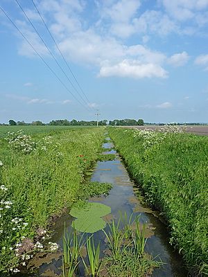
The new drainage work involved making the existing brooks wider and straighter. They also changed the direction of the old Preston Strine to stop seasonal flooding. Because of this, most of the area became farmland in the early 1800s. However, some land was still too boggy for cattle or crops, so it was only used for sheep.
Even today, the villages on the Moors are quite small and spread out. The northern parts of Telford are slowly growing into the area. The name Weald Moors is still used in village names like Eyton upon the Weald Moors and Preston upon the Weald Moors.
Some parts of the Moors have their own local names. These include the Tibberton and Cherrington Moors. Others are the Birch Moors near Adeney, the Rough or Preston Moors north of Preston, the Dayhouse Moor near Rodway, the Longford Moor west of Edgmond, and the Sleap Moor east of Crudgington.
The Shrewsbury Canal, which was part of the Shropshire Union Canal, was built across this area. But today, it is no longer used.
Wildlife of the Weald Moors
The farmland of the Weald Moors is a home for many birds that are now rare in other places. These include the Barn Owl and the Lapwing. In recent years, some areas near Kynnersley have been reflooded. This helps to bring back the fenland habitat for wildlife.
 | Sharif Bey |
 | Hale Woodruff |
 | Richmond Barthé |
 | Purvis Young |


