
Weipa facts for kids
Quick facts for kids WeipaQueensland |
|||||||||
|---|---|---|---|---|---|---|---|---|---|

Weipa
|
|||||||||

Weipa
Location in Queensland
|
|||||||||
| Population | 4,097 (2021 census) | ||||||||
| Established | 1961 | ||||||||
| Postcode(s) | 4874 | ||||||||
| Elevation | 15 m (49 ft) | ||||||||
| Time zone | AEST (UTC+10:00) | ||||||||
| Location | |||||||||
| LGA(s) | Weipa Town | ||||||||
| State electorate(s) | Cook | ||||||||
| Federal Division(s) | Leichhardt | ||||||||
|
|||||||||
Weipa is a mining town located on the coast in Queensland, Australia. It is one of the biggest towns on the Cape York Peninsula. The town exists because of huge amounts of bauxite found along the coast. Bauxite is a rock used to make aluminium. The Port of Weipa mainly ships out bauxite. They also ship live cattle from the port.
In the 2021 census, Weipa had a population of 4,097 people.
Contents
Where is Weipa Located?
Weipa is on the western coast of the Cape York Peninsula. It faces the Gulf of Carpentaria.
Weipa is just south of Duyfken Point. This point was named by Matthew Flinders in 1802. He named it after the ship Duyfken. This ship was led by Dutch explorer Willem Janszoon. Janszoon is thought to be the first European to see the Australian coast. This happened in the Gulf of Carpentaria in 1606. This was 164 years before Lieutenant James Cook sailed up the east coast of Australia.
The town has three main living areas. These are Rocky Point, Trunding, and Nanum. They are all connected. There is also an industrial area called Evans Landing. The town also includes Weipa Airport. This area is separate and has the town's airport.
Weipa's History
First Peoples and Languages
Many different Aboriginal languages were spoken in the Weipa area. These include:
- Yupanguthi
- Kugu Yi'anh
- Kugu Nganchara
- Kugu Muminh
- Thaynakwith
These languages are part of the rich history of the Cape York Peninsula.
The Weipa Mission
In 1895, a missionary named Reverend Nicholas John Hey started a mission. It was at the meeting point of the Embley River and Spring Creek. He called it Weipa. This name is thought to come from an Anhathangayth word meaning "fighting ground."
In 1932, the mission moved about 28 kilometres (17 mi) to Jessica Point. It kept the name Weipa Mission. The community had to move because of malaria. This new site is now called Napranum. It is about 12 kilometres (7.5 mi) south of the current town of Weipa.
At this time, most people were Awngthim. Later, other tribes and groups were moved there. Some were even moved from Old Mapoon. To stop malaria from spreading, the Old Mapoon settlement was burned down in 1963.
Weipa Becomes a Mining Town
In 1955, a geologist named Henry Evans made an important discovery. He found that the red cliffs in the area were huge deposits of bauxite. Bauxite is the rock used to make aluminium. Early Dutch explorers and Matthew Flinders had noticed these red cliffs before.
A company called Comalco started mining in 1960. The government changed the land status. This allowed the company to use large areas of land for mining. In 1962, the people living at Jessica Point agreed to let Comalco rebuild their village. This new community became known as Weipa South.
On 30 March 1985, the Weipa South community elected its own council. The land was then given to the council to manage. In 1990, Weipa South changed its name to Napranum. This means "meeting place of the people."

People in Weipa
In the 2016 census, Weipa had 3,899 people. By 2021 census, the population grew to 4,097 people.
Weipa's Climate
Weipa has a tropical savanna climate. This means it has three clear seasons:
- Wet season: From January to April. It has high humidity, warm nights, and heavy rain. Sometimes there are tropical cyclones.
- Dry season: From May to September. Days are hot and dry, nights are cooler, and there is little rain.
- Build-up season: From October to December. It is very hot and humid. Temperatures often go above 35.0 °C (95.0 °F). There are also heavy rain showers with strong thunderstorms.
Temperatures stay hot all year. The average high temperatures range from 31.1 °C (88.0 °F) in July to 35.9 °C (96.6 °F) in November. Weipa gets about 1,968.5 mm (77.50 in) of rain each year. The most rain in one day was 356.0 millimetres (14.02 in) during Tropical Cyclone Oswald in 2013. The coldest temperature recorded was 9.6 °C (49.3 °F) in August 1990. The hottest was 40.1 °C (104.2 °F) in October 2022.
| Climate data for Weipa (12º37'48"S, 141º52'48"E, 20 m AMSL) (1990-2024 normals, extremes 1959-2024) | |||||||||||||
|---|---|---|---|---|---|---|---|---|---|---|---|---|---|
| Month | Jan | Feb | Mar | Apr | May | Jun | Jul | Aug | Sep | Oct | Nov | Dec | Year |
| Record high °C (°F) | 37.5 (99.5) |
35.7 (96.3) |
35.7 (96.3) |
35.3 (95.5) |
35.5 (95.9) |
35.5 (95.9) |
35.7 (96.3) |
35.9 (96.6) |
38.6 (101.5) |
40.1 (104.2) |
39.6 (103.3) |
39.2 (102.6) |
40.1 (104.2) |
| Mean daily maximum °C (°F) | 32.0 (89.6) |
31.5 (88.7) |
31.9 (89.4) |
32.3 (90.1) |
31.9 (89.4) |
31.2 (88.2) |
31.1 (88.0) |
32.2 (90.0) |
34.5 (94.1) |
35.8 (96.4) |
35.9 (96.6) |
34.0 (93.2) |
32.9 (91.1) |
| Mean daily minimum °C (°F) | 24.3 (75.7) |
24.3 (75.7) |
24.0 (75.2) |
23.0 (73.4) |
21.5 (70.7) |
20.1 (68.2) |
19.1 (66.4) |
18.9 (66.0) |
20.0 (68.0) |
21.9 (71.4) |
23.5 (74.3) |
24.3 (75.7) |
22.1 (71.7) |
| Record low °C (°F) | 20.0 (68.0) |
20.1 (68.2) |
19.1 (66.4) |
14.4 (57.9) |
12.7 (54.9) |
10.2 (50.4) |
9.9 (49.8) |
9.6 (49.3) |
13.9 (57.0) |
13.2 (55.8) |
17.8 (64.0) |
20.1 (68.2) |
9.6 (49.3) |
| Average precipitation mm (inches) | 500.8 (19.72) |
501.4 (19.74) |
404.0 (15.91) |
111.4 (4.39) |
19.8 (0.78) |
3.3 (0.13) |
1.6 (0.06) |
4.5 (0.18) |
1.8 (0.07) |
20.0 (0.79) |
92.4 (3.64) |
291.6 (11.48) |
1,968.5 (77.50) |
| Average precipitation days (≥ 1.0 mm) | 16.1 | 15.6 | 14.8 | 7.3 | 1.9 | 0.4 | 0.4 | 0.5 | 0.4 | 1.4 | 4.9 | 11.5 | 75.2 |
| Average afternoon relative humidity (%) | 73 | 76 | 70 | 59 | 52 | 49 | 44 | 41 | 37 | 39 | 46 | 60 | 54 |
| Average dew point °C (°F) | 24.0 (75.2) |
24.3 (75.7) |
23.4 (74.1) |
21.5 (70.7) |
19.4 (66.9) |
17.8 (64.0) |
15.9 (60.6) |
15.2 (59.4) |
15.5 (59.9) |
17.0 (62.6) |
19.3 (66.7) |
22.4 (72.3) |
19.6 (67.3) |
| Mean monthly sunshine hours | 164.3 | 144.1 | 186.0 | 234.0 | 254.2 | 237.0 | 254.2 | 275.9 | 285.0 | 303.8 | 285.0 | 232.5 | 2,856 |
| Percent possible sunshine | 41 | 41 | 49 | 66 | 71 | 69 | 72 | 76 | 79 | 79 | 75 | 58 | 65 |
| Source: Bureau of Meteorology (1990-2024 normals, extremes 1959-2024) | |||||||||||||
Weipa's Economy

The town of Weipa was mostly built by Comalco. This company is now called Rio Tinto. It is a very large aluminium company. They started shipping bauxite to Japan in 1962. A railway was built to move the bauxite from the mine to the export port.
The Weipa bauxite mine is one of the biggest in the world. In 2006, it was ranked third globally. It could produce 15.5 million tonnes and actually produced 16.1 million tonnes.
Schools in Weipa
Weipa has two schools:
- Western Cape College is a government school for boys and girls. It offers early childhood, primary, and secondary education. It is located in Rocky Point. In 2015, it had 1,073 students and 93 teachers.
- St Joseph's Parish School is a Catholic primary school for boys and girls. It is also in Rocky Point. It opened in 2016 for younger students. It planned to offer all primary levels (Prep to Year 6) by 2018.
Things to Do and Places to Visit
Weipa has many facilities for residents and visitors:
- A visitor's centre
- A swimming pool
- A bowling green
- A golf club
- Tennis and squash courts
- Netball and basketball courts
- Football fields
The Weipa Town Authority runs a public library.
In the Nanum shopping area, you can find:
- A Woolworths supermarket
- A bakery and coffee shop
- A travel agent and clothing shop
- A post office and newsagency
- A butcher shop
- A chemist
- A camping and fishing store
Nearby, there is also a gift shop, furniture store, and a credit union. At Evans Landing, there is a hardware store and car repair shops.
St Joseph's Catholic Church is in Rocky Point.
Sports and Fun
Weipa has many popular sports clubs:
- Carpentaria Golf Club
- Weipa BMX Club
- Weipa Bowls Club
- Weipa Darts Club
- Weipa Squash Club
- Weipa Tennis Club
- Snooker club
- Weipa RLFC (Rugby League Football Club)
- Weipa Cricket Club (plays at Andoom Oval)
Other events include the Weipa Fishing Classic and the Weipa Rodeo Association.
Images for kids
-
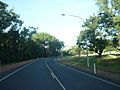
Main road through Weipa township
-
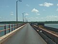
Weipa Mission River bridge
-
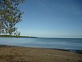
Coastal beach and bay near Wallaby Island
-
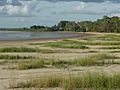
Coastal beach at Nanum suburb
-
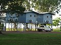
Raised cabins at caravan park near the beach
-
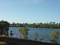
Former mining pit, now a freshwater pond
-
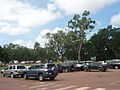
Car park at Woolworths shopping centre, mostly 4WDs
-
Weipa police station
-
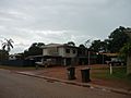
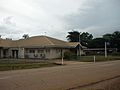
Standard style of housing in Trunding suburb
-
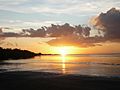
Sunset over the Gulf of Carpentaria


.jpg)
See also
 In Spanish: Weipa para niños
