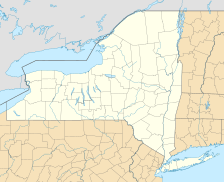
West Kill Mountain, also known as Westkill Mountain, is a tall peak found in Greene County, New York. This mountain gets its name from the West Kill stream, which flows along its northern side. It is an important part of the Devil's Path mountain range within the famous Catskill Mountains.
To the east, West Kill Mountain looks across an 800-foot-deep area called Diamond Notch towards Southwest Hunter Mountain. To the west, it faces North Dome across a place known as Mink Hollow.
About West Kill Mountain
West Kill Mountain is one of the highest peaks in the Catskill Mountains. It stands proudly within the Westkill Mountain Wilderness Area. This area is part of New York's large Catskill State Park. Being in a wilderness area means the land is protected. It is kept as natural as possible for everyone to enjoy.
Where the Water Goes
All the water that falls on West Kill Mountain eventually flows into the Hudson River. The Hudson River then carries this water all the way to New York Bay.
- North Slopes: Rain and snow from the northern parts of the mountain drain into the West Kill stream. This stream then flows into Schoharie Creek, which joins the Mohawk River, and finally reaches the Hudson River.
- Southeast Slopes: Water from the southeast side of the mountain goes into Hollow Tree Brook. This brook then flows into Stony Clove Creek, then Esopus Creek, and finally into the Hudson River.
- Southwest Slopes: The southwest parts of West Kill Mountain send their water into the Broadstreet Hollow stream. This stream also flows into Esopus Creek, which then connects to the Hudson River.


