West Miami, Florida facts for kids
Quick facts for kids
West Miami, Florida
|
||
|---|---|---|
| City of West Miami | ||
|
||
| Motto(s): | ||

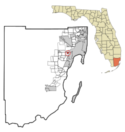
Location in Miami-Dade County and the U.S. state of Florida
|
||

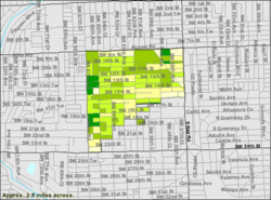
U.S. Census Bureau map showing city limits
|
||
| Country | ||
| State | ||
| County | Miami-Dade | |
| Incorporated | April 7, 1947 | |
| Government | ||
| • Type | Council-Manager | |
| Area | ||
| • Total | 0.71 sq mi (1.84 km2) | |
| • Land | 0.71 sq mi (1.84 km2) | |
| • Water | 0.00 sq mi (0.00 km2) | |
| Elevation | 9 ft (3 m) | |
| Population
(2020)
|
||
| • Total | 7,233 | |
| • Density | 10,201.69/sq mi (3,939.14/km2) | |
| Time zone | UTC-5 (Eastern (EST)) | |
| • Summer (DST) | UTC-4 (EDT) | |
| ZIP codes |
33144, 33155 (Miami)
|
|
| Area code(s) | 305, 786, 645 | |
| FIPS code | 12-76525 | |
| GNIS feature ID | 0293093 | |
West Miami is a small city located in Miami-Dade County, Florida, United States. It is part of the larger Miami metropolitan area in South Florida. In 2020, about 7,233 people lived there. This was an increase from 5,965 people in 2010.
Contents
Geography
West Miami is located about 6 miles (9.7 km) west of downtown Miami. It is at coordinates 25.757691 degrees North and 80.296583 degrees West.
The city has neighbors all around it. To the north, you'll find Miami. To the east, it's bordered by Coral Gables. To the south and west, it's next to Coral Terrace, which is an area not officially part of a city.
According to the United States Census Bureau, West Miami covers a total area of about 0.7 square miles (1.8 km²). All of this area is land, with no water.
Neighboring Communities
West Miami is surrounded by several other places:
- To the north: Flagami (part of Miami)
- To the east: Coral Gables
- To the west and south: Coral Terrace
History
The city of West Miami is quite small, less than three-quarters of a square mile. It is located between two main roads: Tamiami Trail and Coral Way. When the city was first being planned, people suggested names like West Haven and West Gate.
West Miami officially became a town on April 7, 1947. At that time, it had about 700 residents. By the 2020 census, the population had grown to 7,233 people. A large part of the population, 88.54%, identified as Hispanic or Latino. West Miami is surrounded by its much larger neighbors, Coral Gables and Miami.
Population Information
| Historical population | |||
|---|---|---|---|
| Census | Pop. | %± | |
| 1950 | 4,043 | — | |
| 1960 | 5,296 | 31.0% | |
| 1970 | 5,494 | 3.7% | |
| 1980 | 6,076 | 10.6% | |
| 1990 | 5,727 | −5.7% | |
| 2000 | 5,863 | 2.4% | |
| 2010 | 5,965 | 1.7% | |
| 2020 | 7,233 | 21.3% | |
| U.S. Decennial Census | |||
2020 Population Details
In 2020, there were 7,233 people living in West Miami. There were 2,949 households and 2,021 families. Most of the people living in West Miami are of Hispanic or Latino background.
Here's a quick look at the different groups in West Miami in 2020:
- White (not Hispanic): 8.30%
- Black or African American (not Hispanic): 1.33%
- Asian (not Hispanic): 0.69%
- Hispanic or Latino (any race): 88.54%
2010 Population Details
In 2010, West Miami had 5,965 people. There were 2,194 households and 1,502 families.
Here's how West Miami compared to Miami-Dade County and Florida in 2010:
- Total population: West Miami had 5,965 people.
- Population density: West Miami had about 8,417.6 people per square mile.
- Hispanic or Latino: 90.2% of West Miami's population was Hispanic or Latino. This was much higher than the county (65.0%) and the state (22.5%).
- Non-Hispanic White: 9.1% of West Miami's population was non-Hispanic White.
- Black or African-American: 1.3% of West Miami's population was Black or African-American.
City Government
West Miami uses a Council-Manager system. This means there's a Mayor and Commissioners who make decisions. A City Manager handles the day-to-day operations of the city.
- The current Mayor is Eric Diaz-Padron.
- The Vice Mayor is Juan M. Blanes.
- The City Commissioners are Candida Blanca, Luciano L. Suarez, and Ivan Chavez, Jr.
- The City Manager is Edward Silva.
- The City Clerk is Annery Gonzalez.
Public Transportation
You can find information about the local bus routes and schedules for West Miami here: City of West Miami Bus Route & Timetable
Parks
West Miami has four parks where residents can enjoy outdoor activities:
- Edmund P. Cooper Park
- Garden Club Park
- Loraine Park
- West Miami Recreation Center
Education
Schools in West Miami are part of the Miami-Dade County Public Schools district.
- Sylvania Heights Elementary School is located within West Miami.
- Most students in West Miami attend Sylvania Heights Elementary. A small part of the city is zoned for Coral Terrace Elementary School.
- All students in West Miami attend West Miami Middle School (which is not inside the city limits) and then South Miami Senior High School.
Famous People
- Marco Rubio: He is a U.S. senator who once served as a city commissioner for West Miami.
See also
 In Spanish: West Miami para niños
 | Madam C. J. Walker |
 | Janet Emerson Bashen |
 | Annie Turnbo Malone |
 | Maggie L. Walker |


