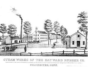
Colchester, Connecticut facts for kids
Quick facts for kids
Colchester, Connecticut
|
|||
|---|---|---|---|
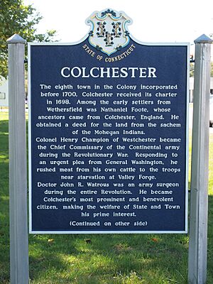
Town of Colchester historical marker
|
|||
|
|||
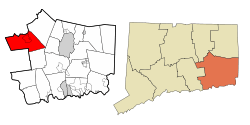 New London County and Connecticut New London County and Connecticut |
|||
| Country | |||
| U.S. state | |||
| County | New London | ||
| Region | Southeastern CT | ||
| Incorporated | 1698 / 1699 | ||
| Government | |||
| • Type | Selectman–town meeting | ||
| Area | |||
| • Total | 49.8 sq mi (129.0 km2) | ||
| • Land | 49.1 sq mi (127.1 km2) | ||
| • Water | 0.7 sq mi (1.9 km2) | ||
| Elevation | 551 ft (168 m) | ||
| Population
(2020)
|
|||
| • Total | 15,555 | ||
| • Density | 312.3/sq mi (120.58/km2) | ||
| Time zone | UTC-5 (Eastern) | ||
| • Summer (DST) | UTC-4 (Eastern) | ||
| ZIP Codes |
06415, 06420
|
||
| Area code(s) | 860/959 | ||
| FIPS code | 09-15910 | ||
| GNIS feature ID | 0213409 | ||
Colchester is a town in New London County, Connecticut, United States. It's located in the Southeastern Connecticut Planning Region. In 2020, about 15,555 people lived here. Colchester made history in 2010. It became the first town in Connecticut to be certified as a Community Wildlife Habitat. This means it's a great place for local wildlife!
Inside Colchester, you'll find smaller areas called Westchester and North Westchester. The main town center is also a special area called a census-designated place. About 4,700 people lived there in 2020.
Before European settlers arrived, the Colchester area was part of the Mohegan tribe's land. Today, some members of the Paugussett tribe live in Colchester. They have a reservation here.
The Colchester Historical Society runs a museum in town. It teaches visitors all about the area's past.
Contents
History of Colchester
Early Beginnings and Town Status
Colchester started on March 31, 1661. Jeremy Adams founded it on a piece of land called "Jerimiah's Farme." This land was a gift to Jeremy from Uncas, the Sachem (leader) of the Mohegan tribe.
For a while, Colchester was mostly a farming area. Jeremy Adams raised cattle there. Even today, Colchester is known as a "Right To Farm Community." This means farming is an important part of its identity. The area wasn't part of a county until 1698.
On October 13, 1698, three men, Michael Taintor II, Samuel Northam, and Nathaniel Foote III, asked to settle the town. They chose Jerimiah's Farme as the main spot. The town's borders were set by rivers and other towns. It was sometimes called the "Plantation of the Twenty-mile River."
On May 11, 1699, the founders asked the court to officially recognize their settlement. They wanted it to be part of the New London colony. On that day, the town was officially named and became part of the colony. Colchester is thought to be named after a town in England. Many early colonists came from Colchester, Essex, England.
Life in the 1700s
Nathaniel Foote and his family were among the first to build a home in Colchester. Their house was finished in 1702. In 1703, the town decided to build a saw and grist mill. These mills helped process wood and grain.
The first schoolmaster started teaching in 1705. A schoolhouse was built by 1711. A cemetery was also built around 1707. Important early residents were buried there. Colchester joined Hartford County in 1708. Later, it rejoined New London County in 1783.
In 1756, Colchester had about 2,300 people. By 1782, the population grew to 3,300. Many men from Colchester fought in the American Revolutionary War. Some of them did not return home.
Colchester became famous for making "bed rugs" in the mid-1700s. These were heavy, embroidered blankets. They kept people warm during cold New England winters. Many women from the Foote family were known for making these beautiful rugs.
The 1800s in Colchester
In 1803, parts of Colchester were used to create a new town called Marlborough. In the early 1800s, people in Colchester voted for their governors. They often supported Trumbull.
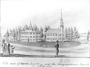
In 1821, land was sold to the Bacon Academy Trustees. This land became part of the school. In 1836, a book called "Connecticut Historical Collections" described Colchester. It mentioned that good quality iron ore was found there. The book also talked about a school for African American children.
In 1850, Nathaniel Hayward donated land for a new town park. The town approved his offer. The park was finished in 1851. It was used for events like circuses and shows.
Colchester Bank
The Colchester Bank started in 1856. The Senate approved its creation. A board of directors was chosen. Isaac Biglow Buell became the bank's president.
The 1900s and Beyond
The Great New England Hurricane of 1938
On September 21 and 22, 1938, a powerful hurricane hit Colchester. Connecticut received a lot of rain and strong winds. The Colchester Town Green looked like a "small lake."
Many large Dutch Elm trees had been planted in 1850. Their roots were not deep enough to hold them in the wet ground. The trees fell on buildings, cars, and power lines. This caused a lot of damage and left many people without power.
The 2000s
In July 2005, CNN's Money Magazine named Colchester the 57th best place to live in the U.S. Every year, the town celebrates this with a festival called "57 Fest." It takes place on the last Saturday of September.
Geography of Colchester
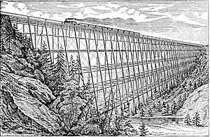
Colchester covers about 49.8 square miles (129 square kilometers). Most of this is land, with a small part being water. Important waterways include the Salmon River and Jeremy River. The Lyman Viaduct crosses Dickinson Creek.
Main Areas
- Colchester center
- Golden Hill Paugussett Reservation
- North Westchester
- Westchester
Climate
Colchester has a climate with big changes between seasons. Summers are warm to hot and often humid. Winters are cold, sometimes very cold. This type of climate is called a humid continental climate.
Activities in Colchester
The Salmon River State Forest is a great place for outdoor fun. You can go fishing, hiking, and hunting there.
Landmarks to See
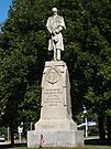
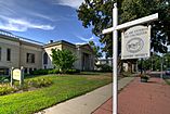
The center of Colchester is a historic district. It is listed on the National Register of Historic Places. This area is called the Colchester Village Historic District. You can walk around the town center. It has a town green with a memorial for veterans. There are also shops and restaurants to visit.
Schools in Colchester
Colchester has four schools for students of all ages:
- Colchester Elementary School (Pre-Kindergarten to Grade 2)
- Jack Jackter Intermediate School (Grades 3–5)
- William J. Johnston Middle School (Grades 6–8)
- Bacon Academy (Grades 9–12)
Colchester's Population
Colchester's population has grown a lot over the years. In 1820, there were 2,152 people. By 2020, the population reached 15,555.
Here are some facts about the people living in Colchester:
- In 2020, about 23.6% of the people were under 18 years old.
- About 16.9% were 65 years or older.
- Roughly 49.2% of the population were female.
- Most people in Colchester are White (92.3%). About 3.0% are of two or more races.
- About 5.0% of the people living in Colchester were born outside the U.S.
- Most homes in Colchester (80%) are owned by the people living in them.
- In 2022, the average household income was about $114,505.
- About 95.9% of adults aged 25 and over have a high school diploma or higher.
- About 45.8% of adults aged 25 and over have a bachelor's degree or higher.
- The average time people spent traveling to work was 32.4 minutes.
Notable People from Colchester
Many interesting people have connections to Colchester:
- John Adams (1772–1863) – He was the principal of Bacon Academy and later founded Phillips Exeter Academy.
- Stephen F. Austin (1793–1836) – Known as the "Father of Texas," he attended Bacon Academy in 1803.
- Jehiel C. Beman (1791–1858) – An important African-American minister and abolitionist, born in Colchester.
- Eliphalet Adams Bulkeley (1803–1872) – A Bacon Academy graduate who founded the Aetna Insurance Company.
- Jonathan Coulton (born 1970) – A singer-songwriter whose first album is named after Colchester's town motto.
- Rick Derringer (born 1947) – A famous rock artist and producer.
- Nathaniel Hayward (1808–1865) – An inventor and business owner.
- Prince Saunders (1775–1839) – He became the attorney general of the Republic of Haiti.
- Lyman Trumbull (1813–1896) – Born in Colchester, he became a powerful U.S. senator for Illinois during the Civil War.
- Ron Wotus (born 1961) – A Bacon Academy graduate who became a coach for the San Francisco Giants baseball team.
- Tokyo's Revenge (born 1998) – A hip hop artist.
Images for kids
See also
 In Spanish: Colchester (Connecticut) para niños


