Western Development Region, Nepal facts for kids
Quick facts for kids Western Development Region (पश्चिमाञ्चल - Paścimāñcala) |
|
| Region | |
|
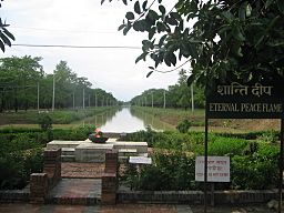
Eternal Peace Flame, Lumbini
|
|
| Country | |
|---|---|
| Zones | Gandaki, Lumbini, Dhawalagiri |
| Headquarters | Pokhara |
| Area | 29,398 km² (11,351 sq mi) |
| Population | 4,926,765 (2011) |
| Density | 168 /km² (435 /sq mi) |
| Timezone | NPT (UTC+5:45) |
| ISO 3166-2 | NP-3 |
The Western Development Region (also called Pashchimānchal Bikās Kshetra in Nepali) was one of the five main areas Nepal was divided into for development. It was located in the west-central part of the country. The main city and administrative center of this region was Pokhara.
Contents
Location and Size
The Western Development Region was bordered by different areas. To its east was the Central Development Region. To the south, it shared a border with India. On its west side was the Mid-Western Development Region. Finally, to the north, it bordered the People's Republic of China.
This region was the second largest among Nepal's development regions. It covered an area of about 29,398 km2 (11,351 sq mi). In 2011, about 4,926,765 people lived there. This meant there were about 167.6 people living in each square kilometer.
Amazing Mountains
Some of the world's highest mountains are found in this region. They are part of the Himalayas mountain range. These giant peaks are located in the Dhawalagiri and Gandaki areas.
Some famous mountains here include:
- Dhaulagiri (8,167 meters tall)
- Manaslu (8,156 meters tall)
- Annapurna (8,091 meters tall)
The most important river in the Western Development Region is the Gandaki. This river eventually flows into the Ganges river.
Major Cities and Towns
The Western Development Region was home to several important cities and towns. These places were centers for trade, culture, and daily life.
Some of the well-known cities and towns in this region included:
- Pokhara (the region's capital)
- Baglung
- Butwall
- Sandhikharka
- Tansen
- Tilaurakot
How the Region Was Divided
The Western Development Region was split into three main parts called Zones. These zones then contained a total of 16 smaller areas called Districts. Each district had its own local administration.
Here is a look at the zones and their districts:
| Zone | Population (2011) |
Area (km²) |
Pop. density (inh/km²) |
Districts | |
|---|---|---|---|---|---|
| Number | Names | ||||
| Dhawalagiri | 542,296 | 8,148 | 66.6 | 4 | Baglung, Mustang, Myagdi, Parbat |
| Gandaki | 1,549,857 | 12,275 | 126.3 | 6 | Gorkha, Kaski, Lamjung, Manang, Syangja, Tanahu |
| Lumbini | 2,834,612 | 8,975 | 315.8 | 6 | Arghakhanchi, Gulmi, Kapilvastu, Nawalparasi, Palpa,Rupandehi |
| Total | 9,656,985 | 27,410 | 352.3 | 16 | |
See Also
 | Toni Morrison |
 | Barack Obama |
 | Martin Luther King Jr. |
 | Ralph Bunche |


