Whitewater, California facts for kids
Quick facts for kids
Whitewater
|
|
|---|---|

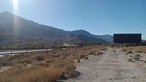
The I-10 passing through Whitewater, California, with Mt. San Jacinto in the background
|
|
| Country | United States |
| State | California |
| County | Riverside |
| Area | |
| • Total | 9.872 sq mi (25.569 km2) |
| • Land | 9.872 sq mi (25.569 km2) |
| • Water | 0 sq mi (0 km2) 0% |
| Elevation | 1,575 ft (480 m) |
| Population
(2020)
|
|
| • Total | 984 |
| • Density | 99.68/sq mi (38.484/km2) |
| Time zone | UTC-8 (Pacific (PST)) |
| • Summer (DST) | UTC-7 (PDT) |
| ZIP codes |
92282
|
| Area code(s) | 760 |
| GNIS feature ID | 2583184 |
Whitewater is a small community in Riverside County, California. It used to be called White Water. It is located right off Interstate 10, about halfway between North Palm Springs and Cabazon. This makes it a convenient stop for travelers going from Palm Springs to Los Angeles.
Whitewater is well-known for the huge San Gorgonio Pass Wind Farm nearby. This is where many wind turbines generate electricity. The area's ZIP Code is 92282, and its phone area code is 760. In 2010, about 859 people lived here. Whitewater is also famous for its trout farm, which is in the canyon of the Whitewater River.
Contents
History of Whitewater
Whitewater is located about 10 miles (16 km) northwest of Palm Springs. It started as a resting and watering spot for people traveling on the Bradshaw Trail in 1862. This trail was an important route between San Bernardino and La Paz in the Arizona Territory.
The Bradshaw Trail was created to help ship goods and allow people to cross the desert. This was especially important during the Colorado River Gold Rush. Whitewater got its name from the White Water Station, a stagecoach stop on this trail. The settlement has remained a useful stop for travelers heading into the Coachella Valley and other desert areas.
Geography and Climate
Whitewater is named after the nearby Whitewater River. The area is famous for its nearly constant wind. This happens because of something called the venturi effect. The wind gets squeezed between the San Bernardino Mountains to the north and the San Jacinto Mountains to the south. This creates perfect conditions for the large wind farm you can see there.
According to the United States Census Bureau, Whitewater covers an area of about 9.9 square miles (25.6 square kilometers). All of this area is land.
Weather in Whitewater
Whitewater has a type of weather called a warm-summer Mediterranean climate. This means it has hot, dry summers and mild, wet winters.
Population and People
The 2010 United States Census counted 859 people living in Whitewater. All of these people lived in homes, not in group living places.
The population included people of all ages. About 26% of the people were under 18 years old. About 9% were between 18 and 24. Around 28% were between 25 and 44, and another 28% were between 45 and 64. About 10% of the population was 65 years old or older. The average age in Whitewater was 37.3 years.
Most homes in Whitewater are owned by the people who live in them. About 75% of the homes were owner-occupied, while 25% were rented.
Education
Children living in Whitewater attend schools that are part of the Banning Unified School District.
See also
 In Spanish: Whitewater (California) para niños
 | Jackie Robinson |
 | Jack Johnson |
 | Althea Gibson |
 | Arthur Ashe |
 | Muhammad Ali |


