1868 Arica earthquake facts for kids

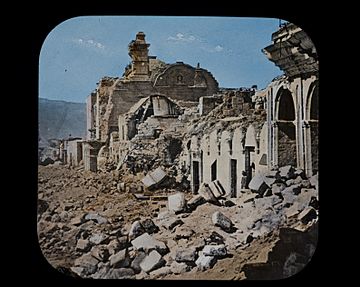
Arequipa's damaged main square
|
|
| Local date | 13 August 1868 |
|---|---|
| Local time | 16:45 |
| Magnitude | 8.5–9.0 Mw (est.) |
| Epicenter | 18°30′S 71°00′W / 18.5°S 71.0°W |
| Areas affected | Peru and northern Chile |
| Max. intensity | XI (Extreme) |
| Casualties | 25,000+ |

The 1868 Arica earthquake was a very powerful earthquake that happened on August 13, 1868. It struck near a city called Arica. At that time, Arica was part of Peru, but today it is part of Chile. The earthquake was so strong, it's estimated to have been between 8.5 and 9.0 on the magnitude scale. This huge earthquake also caused a giant ocean wave, known as a tsunami. The tsunami traveled across the Pacific Ocean, reaching places as far away as Hawaii, Japan, Australia, and New Zealand.
Contents
What Caused the Earthquake?
Earthquakes happen when large pieces of the Earth's crust, called tectonic plates, move and rub against each other. This earthquake happened where the Nazca Plate is sliding underneath the South American Plate. This type of movement is called subduction.
When one plate slides under another, it can get stuck for a while. When it finally breaks free, it causes a sudden, powerful shake. This kind of earthquake is known as a megathrust earthquake. The coasts of Peru and Chile have had many huge megathrust earthquakes because of these moving plates. Two other famous ones are the 1960 Valdivia earthquake and the 2010 Chile earthquake.
How Much Damage Did It Cause?
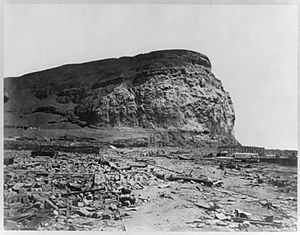
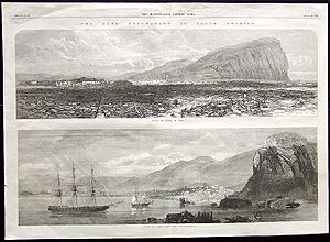
The earthquake and tsunami caused terrible destruction in southern Peru and northern Chile. Many cities and towns were almost completely destroyed. These included Arica, Tacna, Moquegpa, Mollendo, Ilo, Iquique, Torata, and Arequipa.
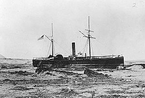
Sadly, more than 25,000 people lost their lives. Many ships in the harbors were also wrecked. For example, three large ships in Arica's port were carried almost 800 meters (about half a mile) inland by the tsunami. These ships included the Peruvian America, the U.S. gunboat Wateree, and the U.S. store ship Fredonia. The Fredonia was completely destroyed.
The tsunami also caused damage far away. In Hawaii, a bridge was washed out. New Zealand experienced its only recorded deadly tsunami from this event. On the Chatham Islands, about 20 people were swept out to sea. On the New Zealand mainland, a Maori village and two houses were washed away, and one person died.
Earthquake and Tsunami Details
The earthquake shaking was felt over a very large area. People felt it as far as 1,400 kilometers (870 miles) to the northwest in Peru and 224 kilometers (139 miles) to the east in Bolivia. Scientists estimate the shaking lasted between five and ten minutes. After the main earthquake, there were about 400 smaller shakes, called aftershocks, recorded in the following days.
The tsunami reached Arica about 52 minutes after the earthquake. The first wave was about 12 meters (39 feet) high. The biggest wave came 73 minutes later, reaching an incredible 16 meters (52 feet) high. While the tsunami was noticed across the Pacific Ocean, most of the severe damage happened along the coasts of southern Peru and northern Chile.
Future Earthquake Risk
Scientists study past earthquakes to understand where future ones might happen. The area around Arica has been identified as a "seismic gap". This means it's a section of a plate boundary where a major earthquake has not happened for a long time. Because of this, experts believe a large earthquake is likely to occur there in the future.
For example, a magnitude 8.6 earthquake was predicted for northern Chile, and it happened in 2014 (the 2014 Iquique earthquake). Scientists have also suggested that an earthquake similar to the 1868 event, possibly a magnitude 8.8, could happen again by the year 2126. If an earthquake like the 1868 one happened today, it would likely cause even more casualties because many more people live in the risk areas now.
See also
 In Spanish: Terremoto de Arica de 1868 para niños
 | William L. Dawson |
 | W. E. B. Du Bois |
 | Harry Belafonte |


