Agrihan facts for kids
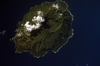
NASA Space Shuttle image of Agrihan
|
|
 |
|
| Geography | |
|---|---|
| Location | Pacific Ocean |
| Coordinates | 18°46′42″N 145°40′17″E / 18.77833°N 145.67139°E |
| Archipelago | Northern Mariana Islands |
| Area | 44.05 km2 (17.01 sq mi) |
| Length | 9 km (5.6 mi) |
| Width | 6 km (3.7 mi) |
| Highest elevation | 965 m (3,166 ft) |
| Highest point | Mount Agrihan |
| Administration | |
|
United States
|
|
| Commonwealth | Northern Mariana Islands |
| Demographics | |
| Population | - uninhabited - (2010) |
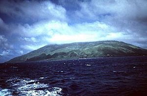
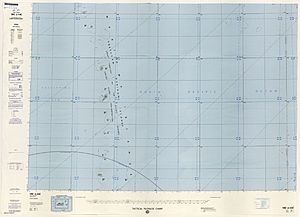
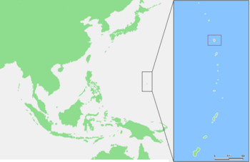
Agrihan (sometimes called Agrigan) is an island in the Northern Mariana Islands. It is located in the Pacific Ocean. This island is currently not lived on by people. Agrihan is about 62 kilometers (38 miles) north of another island called Pagan.
History of Agrihan Island
The first European to find Agrihan was Gonzalo Gómez de Espinosa. This happened on June 11, 1522. He was part of Ferdinand Magellan's journey around the world. Espinosa tried to cross the Pacific Ocean to Mexico. He named the island "Cyco" or "La Griega" (which means "The Greek" in Spanish).
The local Chamorros were not friendly. Espinosa could not drop anchor, but he did take one islander for information. Later, a Spanish missionary named Diego Luis de San Vitores visited Agrihan in 1669. He called it "San Francisco Javier." In 1695, the native people were forced to move to Saipan. Three years later, they were moved again to Guam.
In 1810, people from the Kingdom of Hawaii tried to start a settlement on Agrihan. In the 1870s, the first coconut farms were set up. A German merchant named Adolph Capelle rented the island. He sold copra (dried coconut meat). He used about 20 workers from the Caroline Islands for this.
After Spain sold the Northern Marianas to Germany in 1899, Agrihan became part of German New Guinea. A company called the Pagan Society started more coconut farms. But strong typhoons in 1905 and 1907 destroyed the farms. This caused the company to go out of business.
During World War I, Japan took control of Agrihan. After World War II, the United States took over. The island was part of the Trust Territory of the Pacific Islands. In 1967, 94 people lived on Agrihan. Since 1978, it has been part of the Commonwealth of the Northern Mariana Islands.
In August 1990, people on the island had to leave. This was because a volcano eruption was feared. But by 1992, no eruption had happened. There were still steam vents and hot springs. In 2000, six people came back to live on the island. However, the 2010 census said Agrihan was uninhabited. Even so, some people returned. As of September 2005, nine people were living there again.
On June 1, 2018, an expedition reached the top of the island's highest peak. This was the first time anyone was known to have done this.
Geography of Agrihan
Agrihan is an island covered in thick forests. It is shaped like an oval. The island is about 9 kilometers (5.6 miles) long and 6 kilometers (3.7 miles) wide. Its total area is about 44 square kilometers (17 square miles).
The whole island is a huge stratovolcano. This volcano is called Mount Agrihan. It rises over 4,000 meters (13,000 feet) from the ocean floor. It is the fifth largest volcano in the Marianas volcanic arc. At 976.6 meters (3,204 feet) tall, its top is the highest point in Micronesia.
The volcano has a large caldera at its top. A caldera is a big bowl-shaped hollow. This one is about 1 by 2 kilometers (0.6 by 1.2 miles) wide. It is also about 500 meters (1,600 feet) deep. The bottom of the caldera has old lava flows. It also has two smaller volcano cones. These cones likely formed during an eruption in April 1917. The only flat land on the island is along the southeast coast. There is also some flat land on the north side of the central caldera.
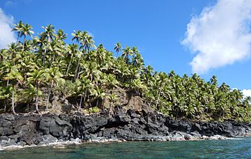
The island has different types of plants. On the higher slopes, you can find swordgrass (Miscanthus floridulus). On the lower slopes and in deep valleys, there are coconut palm trees (Cocos nucifera). You can also find some breadfruit (Artocarpus altilis) and papaya (Carica papaya) trees.
Population of Agrihan
In 1980, the population of Agrihan was 54 people. As mentioned earlier, the island is mostly uninhabited now. However, a small number of people have returned to live there.
See also
 In Spanish: Agrihan para niños
 | Kyle Baker |
 | Joseph Yoakum |
 | Laura Wheeler Waring |
 | Henry Ossawa Tanner |


