Amberley, Queensland facts for kids
Quick facts for kids AmberleyIpswich, Queensland |
|||||||||||||||
|---|---|---|---|---|---|---|---|---|---|---|---|---|---|---|---|

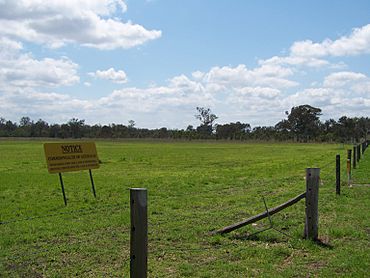
No trespassing on the Amberley Air Base, 2010
|
|||||||||||||||
| Population | 619 (2021 census) | ||||||||||||||
| • Density | 23.72/km2 (61.4/sq mi) | ||||||||||||||
| Postcode(s) | 4306 | ||||||||||||||
| Area | 26.1 km2 (10.1 sq mi) | ||||||||||||||
| Time zone | AEST (UTC+10:00) | ||||||||||||||
| LGA(s) | City of Ipswich | ||||||||||||||
| State electorate(s) |
|
||||||||||||||
| Federal Division(s) | Blair | ||||||||||||||
|
|||||||||||||||
Amberley is a suburb located in the City of Ipswich, Queensland, Australia. It is a small community. In 2021, Amberley had a population of 619 people.
Contents
What is Amberley Like?
Amberley is home to Australia's largest air force base, the RAAF Base Amberley. This base is a very important part of the area. The Bureau of Meteorology, which studies weather, also has a station here.
South of Amberley, you'll find the Fassifern Valley. This is a beautiful valley known for farming. To the west, there is the Jeebropilly coal mine, where coal is dug from the ground. The Haigslea–Amberley Road runs through the area, connecting different places.
Amberley's Past
How Amberley Got Its Name
The name Amberley comes from a town in the United Kingdom called Amberley. In the 1850s, a couple named James and Martha Collett moved here. They named their home "Amberley" because it was their hometown. Before that, the area was known as Three-Mile Creek. This was because it was three miles along the Old Toowoomba Road from Ipswich.
The Story of Amberley School
A school first started in 1861 at Willowbank. It was on a large sheep and cattle farm. The owner, Darby McGrath, later asked the Queensland Government to take over the school. He even gave land for a new school building.
This new school, called Warrill Creek State School, opened on May 22, 1862. It was located where the RAAF Base Amberley is now. In 1888, the school moved to a new spot called Sandridge. However, it was flooded by Warrill Creek in 1893.
In 1903, the school was renamed Amberley State School. It is one of the oldest primary schools in Queensland. During World War II, the air force base became very busy. Because of this, the school closed at the end of 1941. It reopened in 1947.
Later, the noise from the aircraft became a problem for the students. So, a new school was built in the late 1970s. It was on Rosewood Road, further away from the base. On January 1, 2010, the school moved again. It went to Deebing Creek Road in Yamanto and was renamed Amberley District State School.
Early Church in Amberley
In December 1867, a church called the United Methodist Free Church opened in the Three-Mile Creek area. This shows that people were settling and building communities here a long time ago.
Amberley's Weather
Amberley has a humid subtropical climate. This means it has hot and humid summers. The winters are cool and clear. In winter, the temperature can change a lot between day and night. This often leads to frost on some mornings.
The coldest temperature ever recorded in Amberley was -4.9 degrees Celsius. This happened on August 8, 1995, during a very cold period in southern Queensland. Amberley usually gets a lot of sunshine, with over 110 clear days each year.
| Climate data for AMBERLEY AMO | |||||||||||||
|---|---|---|---|---|---|---|---|---|---|---|---|---|---|
| Month | Jan | Feb | Mar | Apr | May | Jun | Jul | Aug | Sep | Oct | Nov | Dec | Year |
| Record high °C (°F) | 44.3 (111.7) |
43.0 (109.4) |
38.9 (102.0) |
36.8 (98.2) |
33.3 (91.9) |
29.2 (84.6) |
29.6 (85.3) |
36.4 (97.5) |
40.1 (104.2) |
41.3 (106.3) |
43.0 (109.4) |
43.8 (110.8) |
44.3 (111.7) |
| Mean daily maximum °C (°F) | 31.2 (88.2) |
30.4 (86.7) |
29.4 (84.9) |
27.2 (81.0) |
24.1 (75.4) |
21.6 (70.9) |
21.2 (70.2) |
22.8 (73.0) |
25.6 (78.1) |
27.8 (82.0) |
29.6 (85.3) |
30.8 (87.4) |
26.8 (80.2) |
| Mean daily minimum °C (°F) | 19.6 (67.3) |
19.5 (67.1) |
17.8 (64.0) |
14.0 (57.2) |
10.0 (50.0) |
7.1 (44.8) |
5.4 (41.7) |
6.2 (43.2) |
9.5 (49.1) |
13.3 (55.9) |
16.3 (61.3) |
18.4 (65.1) |
13.1 (55.6) |
| Record low °C (°F) | 11.6 (52.9) |
11.1 (52.0) |
6.7 (44.1) |
1.0 (33.8) |
−3.1 (26.4) |
−4.3 (24.3) |
−4.8 (23.4) |
−4.9 (23.2) |
−0.2 (31.6) |
2.1 (35.8) |
4.9 (40.8) |
6.8 (44.2) |
−4.9 (23.2) |
| Average precipitation mm (inches) | 116.9 (4.60) |
121.2 (4.77) |
85.5 (3.37) |
54.5 (2.15) |
52.8 (2.08) |
46.9 (1.85) |
37.9 (1.49) |
28.9 (1.14) |
33.6 (1.32) |
73.3 (2.89) |
81.5 (3.21) |
119.4 (4.70) |
864.0 (34.02) |
| Average precipitation days | 10.9 | 11.8 | 11.4 | 7.9 | 7.6 | 6.4 | 6.5 | 5.7 | 6.0 | 8.8 | 9.3 | 10.7 | 103.0 |
| Average relative humidity (%) | 51 | 54 | 52 | 48 | 48 | 46 | 42 | 38 | 38 | 43 | 46 | 49 | 46 |
Education Near Amberley
There are no schools directly within Amberley itself. However, there are several schools nearby for students.
- Primary Schools:
- Amberley District State School is in Yamanto, which is to the east.
- Walloon State School is in Walloon, to the north-west.
- Leichhardt State School is in Leichhardt, to the north-east.
- Secondary Schools:
 | Frances Mary Albrier |
 | Whitney Young |
 | Muhammad Ali |


