Amchitka facts for kids
Quick facts for kids Amchitka Underground Test Site |
|
|---|---|
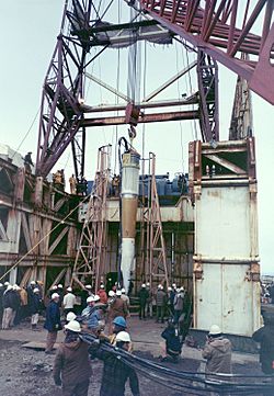
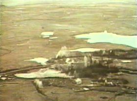
Cannikin warhead being lowered into test shaft
|
|
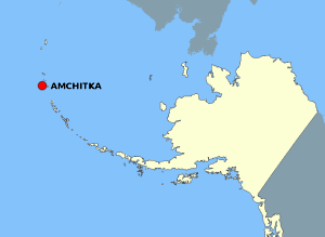
Location of the site
|
|
| Coordinates | 51°32′32″N 178°59′00″E / 51.54222°N 178.98333°E |
| Type | Nuclear testing range |
| Site information | |
| Operator | United States Department of Energy |
| Status | Inactive |
| Site history | |
| In use | 1965–1971 |
| Test information | |
| Nuclear tests | 8 |
| Thermonuclear tests | 3 |
| Remediation | 2001–2025 (DoE estimate) |
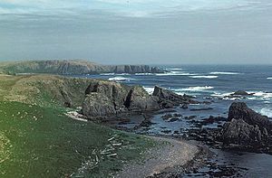
Amchitka is a volcanic island located in the Aleutian Islands of southwest Alaska. It is part of the Alaska Maritime National Wildlife Refuge. The island is about 42 miles (68 km) long and 1 to 4 miles (1.6 to 6.4 km) wide, covering an area of about 116 square miles (300 km2). Amchitka has a cool, wet climate with many storms and often cloudy skies.
People called the Aleut people lived on Amchitka for over 2,500 years. However, no one has lived there permanently since 1832. The United States gained control of the island in 1867. During World War II, the US military used Amchitka as an airfield.
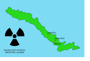
Later, the United States Atomic Energy Commission (AEC) chose Amchitka for underground nuclear testing. Three large tests happened there: Long Shot in 1965, Milrow in 1969, and Cannikin in 1971. Cannikin was the biggest underground nuclear test ever done by the United States. These tests caused a lot of debate, with environmental groups worrying about earthquakes and tsunamis. Amchitka is no longer used for nuclear tests, but scientists still check the island for any leaks of radioactive materials.
Contents
Island Geography and Climate
Amchitka is the southernmost island in the Rat Islands group of the Aleutian Chain. It is surrounded by the Bering Sea to the north and east, and the Pacific Ocean to the south and west.
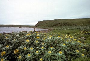
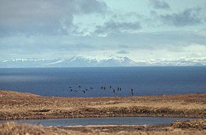
The eastern part of the island is a flat area with small ponds and gentle hills. It has lots of low plants like mosses, ferns, and grasses. The middle of the island is mountainous, and the western end is mostly bare with very few plants.
Amchitka has a maritime climate, which means it's often foggy and windy. The sky is cloudy almost all the time. Even though the ocean keeps temperatures mild, storms happen often. The island is volcanic and sits on a part of the Earth's crust that is very active. This makes it one of the most unstable places in the United States.
Early History of Amchitka
People have lived on Amchitka for at least 2,500 years. The first known inhabitants were the Aleut people. In 1980, human remains believed to be from an Aleut person around 1000 AD were found.
Explorers visited Amchitka in the 1700s and 1800s. In 1783, a group of 16 Japanese sailors were shipwrecked on the island. They lived there for three years with Russian traders and local people. Six of the sailors died during this time.
Amchitka During World War II
In June 1942, during World War II, Japanese forces took over some islands in the western Aleutian chain. The United States wanted to remove them quickly. American leaders decided to build airfields west of Umnak to launch attacks.
The United States Army set up bases on Adak and other locations. After checking Amchitka in late 1942, planners decided an airfield "had to be built" there. This would stop the Japanese from building one themselves.
American forces landed on Amchitka without opposition on January 12, 1943. Despite bad weather and Japanese bombings, they made the airfield ready by February 16. This brought US forces much closer to their target, Kiska. The military built many buildings, roads, and three airstrips on the island. One of these was later rebuilt and used by the United States Atomic Energy Commission in the late 1960s. At its busiest, Amchitka had 15,000 troops.
The Aleutian Islands campaign ended successfully on August 24, 1943. After the war, military facilities on Amchitka were gradually closed. By the end of 1950, the Air Force and Army had left the island.
Nuclear Testing on Amchitka
After the military left in 1950, the United States Department of Defense (DoD) thought about using Amchitka for nuclear tests. However, the island was not suitable at that time.
In the late 1950s, scientists needed to improve how they detected underground nuclear explosions. This was important for telling the difference between nuclear tests and natural earthquakes. The US government started a program called Vela Uniform to study these seismic effects.
Amchitka was then considered for very powerful underground tests. The Partial Nuclear Test Ban Treaty of 1963 stopped atmospheric tests, but underground test preparations continued.
The Long Shot Test
The first major underground test, Long Shot, happened on October 29, 1965. The goal was to learn how nuclear explosions create seismic signals and how to tell them apart from earthquakes.
The test had a yield of 80 kilotons (330 TJ). There was no collapse on the surface. However, small amounts of tritium and krypton were found at the surface later. This information was not made public until 1969.
Milrow and Cannikin Tests
The Milrow test, on October 2, 1969, was done to study the island itself. It was a "calibration shot" to help predict what would happen with even larger explosions. This test helped decide if the planned Cannikin detonation could be done safely.
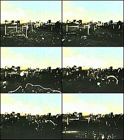
The Milrow blast caused the ground to rise about 5 meters (16 ft) in a large dome shape. It also made the nearby sea foamy and shot mud and water geysers 50 feet (15 m) into the air. A large hole, called a subsidence crater, formed where the ground collapsed into the space created by the explosion.
The Cannikin test was planned to test a powerful warhead for an anti-ballistic missile (ABM) system. This warhead was designed to produce a lot of X-rays and minimal debris.
Concerns and Protests
After the Milrow test, a group called the Don't Make A Wave Committee formed in Canada. This group later became Greenpeace. They were worried that the Cannikin explosion would cause severe earthquakes and tsunamis.
The AEC believed a major earthquake was "very unlikely" unless one was already about to happen. They thought a tsunami was "even more unlikely." However, others disagreed. They worried that the explosion could trigger a chain reaction leading to a large earthquake.
In July 1971, a group tried to stop the test in court, but they were unsuccessful. President Richard Nixon personally approved the test. The Don't Make A Wave Committee tried to sail a boat to the island to protest, but they were stopped.
Cannikin Test Results
The Cannikin test happened on November 6, 1971. It was the largest underground nuclear test in US history, with a yield of about 5 megatons. This was almost 400 times more powerful than the Hiroshima bomb. The ground lifted 20 feet (6 m). A new lake formed where the ground collapsed.
The explosion caused a seismic shock of 7.0 on the Richter scale. This led to rockfalls and turf slides. While the large earthquakes and tsunamis predicted by environmentalists did not happen, several smaller tectonic events did occur in the following weeks. These were thought to be caused by the explosion interacting with natural stresses in the Earth.
After the Tests
The AEC left Amchitka in 1973, but scientists still visit to monitor the island. In 2001, the Department of Energy (DoE) began cleaning up environmental contamination. They stabilized drilling pits and covered them with soil.
Some people have worried that new cracks might be opening underground, allowing radioactive materials to leak into the ocean. A 1996 study by Greenpeace claimed that Cannikin was leaking plutonium and americium. However, studies in 2004 and 2006 found very small levels of plutonium that were not considered harmful.
The Department of Energy continues to monitor the site. This monitoring is expected to continue until 2025. After that, the island is planned to become a protected wildlife preserve with limited access.
| Name | Date (GMT) | Location | Yield | Type |
|---|---|---|---|---|
| Long Shot | 21:00, October 29, 1965 | 51°26′12″N 179°10′47″E / 51.43655°N 179.17976°E | 80 kt (330 TJ) | 2,343 ft (714 m) shaft |
| Milrow | 22:06, October 2, 1969 | 51°24′56″N 179°10′48″E / 51.41559°N 179.17992°E | ~ 1 Mt (4.2 PJ) | 4,002 ft (1,220 m) shaft |
| Cannikin | 22:00, November 6, 1971 | 51°28′11″N 179°06′12″E / 51.46961°N 179.10335°E | < 5 Mt (21 PJ) | 6,104 ft (1,860 m) shaft |
See also
 In Spanish: Isla Amchitka para niños
 | Chris Smalls |
 | Fred Hampton |
 | Ralph Abernathy |


