Angel Island (California) facts for kids
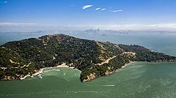
Aerial view of Angel Island in 2019
|
|
| Geography | |
|---|---|
| Location | San Francisco Bay |
| Coordinates | 37°52′N 122°26′W / 37.86°N 122.43°W |
| Area | 1.2 sq mi (3.1 km2) |
| Highest elevation | 788.76 ft (240.414 m) |
| Highest point | Mount Caroline Livermore |
| Administration | |
|
United States
|
|
| State | California |
| County | Marin County City and County of San Francisco |
| Demographics | |
| Population | 12 |
| Pop. density | 3.87 /km2 (10.02 /sq mi) |
| Reference #: | 529 |
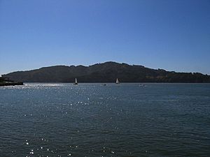
Angel Island is a special island located in San Francisco Bay. The whole island is part of Angel Island State Park, which is managed by California State Parks.
Over time, people have used the island for many different things. Native American tribes used it for hunting and gathering food. Later, European ships got water and wood from there. Mexicans used it for ranching. The United States military built bases there. It was also a place where people arriving in the U.S. were checked for health reasons or for immigration.
The Angel Island Immigration Station is on the northeast side of the island. It is a very important historical place. About one million immigrants, mostly from Asia, were inspected and sometimes held there.
Contents
Exploring Angel Island
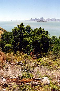
Angel Island is the second largest island in San Francisco Bay. Only Alameda is bigger. On a clear day, you can see far away cities like Sonoma and Napa from the north side. From the south side, you can see San Jose.
The highest point on the island is Mount Caroline Livermore. It is almost in the middle of the island and stands 788 feet (240 meters) tall. Most of the island is in Marin County, near the city of Tiburon. A small part on the eastern side belongs to the City and County of San Francisco.
The island is separated from the mainland by a narrow stretch of water called Raccoon Strait. This water is about 90 feet deep.
How Angel Island Was Formed
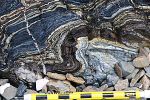
Angel Island was created during the last Ice Age. Back then, the ocean was much lower. The island's rocks are part of a large group called the Franciscan Complex. These rocks were formed from ocean sediments and volcanic material. They changed under high pressure and low temperatures deep underground.
The island has steep hills that spread out from Mount Caroline Livermore. You can find different kinds of rocks there. For example, there's a type of rock called serpentinite in the old quarry. On Kayak Beach, you can see sandstones and other rocks. The island's shape also shows signs of old landslides.
Island History
About ten thousand years ago, Angel Island was connected to the mainland. But as the last ice age ended, sea levels rose and cut it off. For about two thousand years, the Coast Miwok Native Americans used the island for fishing and hunting. You can find similar signs of Native American life on the nearby Tiburon Peninsula.
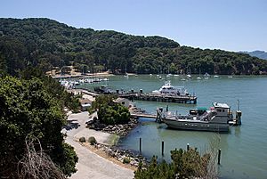
In 1775, a Spanish ship named San Carlos was the first European vessel to enter San Francisco Bay. Its commander, Juan de Ayala, anchored near Angel Island and gave it its modern name, Isla de los Ángeles, which means "Island of the Angels." The bay where he anchored is now called Ayala Cove.
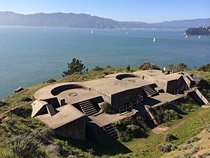
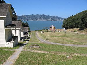
In the 1800s, like many places in California, Angel Island was used for raising cattle. During the American Civil War in 1863, the U.S. Army worried about attacks on San Francisco. They built artillery batteries on the island. The Army also set up a camp there, which is now known as Camp Reynolds. This camp later became a base for soldiers fighting against Native American peoples in the West.
Fort McDowell
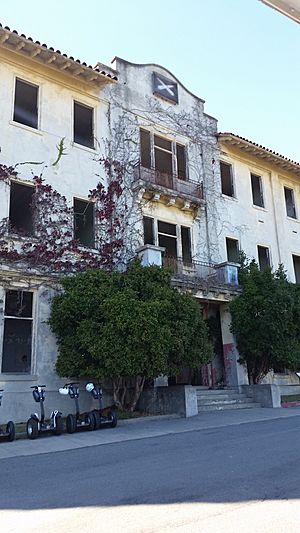
In the late 1800s, the Army named the entire island "Fort McDowell." They built more facilities there. A health inspection station opened in Ayala Cove in 1891. During the Spanish–American War, the island was a place where soldiers returned home. It continued to be a transit station for troops, including those going to and from World War I.
During World War II, the military needed many more troops in the Pacific. The facilities on Angel Island were expanded. The Army ferry General Frank M. Coxe transported soldiers to and from the island. Fort McDowell was also used to hold Japanese, German, and Italian immigrants from Hawaii during the war. They were later moved to other camps. Japanese and German prisoners of war were also held on the island.
The Army closed the military post in 1947. In 1954, a Nike missile station was built on the island. The missile launch pads were built on the southeast side. The top of Mount Ida (now Mount Caroline Livermore) was flattened for a radar station. The missiles were removed in 1962, and the military left the island for good. The missile launch pad is still there, but the station on Mount Caroline Livermore was removed, and the mountaintop was restored.
Immigration Station
From 1910 to 1940, the Angel Island Immigration Station was a major entry point for about 1 million Asian immigrants coming to the U.S. Because of laws like the Chinese Exclusion Act of 1882, many Chinese immigrants spent years on the island waiting for permission to enter. While they waited, many carved poetry into the walls of their barracks. Station officers tried to cover the poetry, but it would often reappear.
In 1940, a fire destroyed the main administration building. After that, immigration processing moved to San Francisco.
In 1964, the Chinese American community worked to have the immigration station recognized as a State Landmark. Today, the Angel Island Immigration Station is a National Historic Landmark. It was restored and reopened in 2009. School groups can visit by appointment.
Angel Island State Park
In 1955, California State Parks began buying land around Ayala Cove to create Angel Island State Park. More land was added later. In 1962, the entire island became a state park.
There is one active United States Coast Guard lighthouse on the island at Point Blunt.
Nature and Wildlife
Angel Island has different types of plant life. There are grasslands and coastal scrub on the sunny, windy slopes. There are also evergreen forests with trees like Coast Live Oak, bay, and madrone, especially on the eastern and northern parts of the island.
It is believed that the Coast Miwok people used controlled fires to help the grasslands grow. This provided more food for deer and small animals.
A special type of mole, called the Angel Island Mole, lives only on Angel Island.
The military planted many Bluegum Eucalyptus trees on the island. These trees spread a lot. In the 1980s, California State Parks decided to remove most of them to help native plants grow back and reduce fire risk. Most eucalyptus trees were removed between 1990 and 1997, and native plants were planted in their place. Some eucalyptus trees were kept for historical reasons.
Other non-native plants are also being removed to help restore the island's original plant communities. The military also planted other trees like Monterey Pine, Cork Oak, and Canary Island Date Palm around the old bases.
Mule deer were brought to the island by the Army in 1915 for hunting. Since there were no predators, the deer population grew very large and ate too much of the island's plants. Now, the deer population is managed each year by California State Parks.
In 2002, the top of Mount Caroline Livermore was reshaped to look more like it did before the Nike missile station was built. It even became 16 feet taller! The old access road was removed, and a new winding trail was built.
2008 Fire
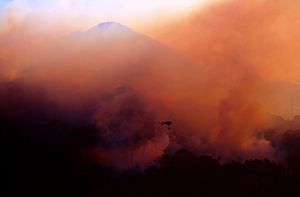
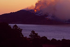
On October 12, 2008, a large fire started on Angel Island. It quickly spread across a third of the island. Firefighters came from the mainland, and helicopters dropped water and fire retardants. They worked hard to protect the historical buildings. The fire was fully put out by October 14. About 380 acres of the island's 740 acres were burned. No buildings were lost, except for one old water tank.
In some areas, the fire burned quickly through the undergrowth but left the trees mostly unharmed. The fire burned some Monterey Pine trees that the U.S. Army had planted. These areas will be restored with native evergreen trees.
There have been other fires on the island, including one in 2005 that burned 25 acres, and a smaller one in 2004.
How to Visit Angel Island
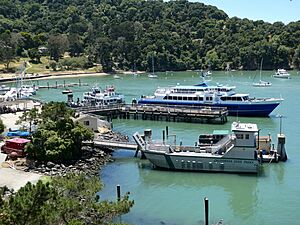
You can only get to Angel Island by boat at Ayala Cove Ferry Terminal. There are ferries that go to the island from San Francisco and Tiburon. The Angel Island-Tiburon Ferry runs daily from Tiburon. Golden Gate Ferry also has service from San Francisco. During the cooler months (October to March), ferries run less often. Your ferry ticket usually includes park admission. You can also bring your own private boat.
You can bring bicycles on the ferry or rent them on the island during certain seasons. You can use bikes on the island's main roads. Electric scooters and Segways can also be rented. However, roller skates, roller blades, skateboards, and personal Segways are not allowed.
Dogs (except service dogs) are not allowed on the island.
You cannot have wood fires on the island. Charcoal fires are allowed, but you need to bring your own charcoal.
There are 11 campsites on the island, including one for people with disabilities. There are also group sites for kayakers. Some areas of the island are closed at night for safety.
While metal detectors are allowed, digging or disturbing the ground in the park is not permitted.
Island Power
Angel Island gets its electricity from PG&E through two underwater cables from Tiburon. One of these cables is old and not working well. Instead of replacing them, PG&E is looking into using the island for a special project. This project would use distributed energy resources to create a small, independent power system for the island.
See also
 In Spanish: Isla de los Ángeles para niños


