Atiu facts for kids
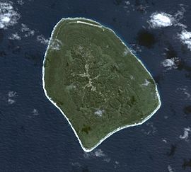
Satellite Image of Atiu
|
|
| Geography | |
|---|---|
| Location | Central-Southern Pacific Ocean |
| Coordinates | 19°59′S 158°07′W / 19.983°S 158.117°W |
| Archipelago | Cook Islands |
| Area | 26.9 km2 (10.4 sq mi) |
| Administration | |
| Demographics | |
| Population | 434 (2016) |
| Ethnic groups | Polynesian |
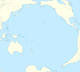
Atiu, also known as Enuamanu, means land of the birds. It is an island in the Cook Islands group, located in the central-southern Pacific Ocean. Atiu is part of the Nga-pu-Toru islands. It is about 214 kilometers (133 miles) northeast of Rarotonga. The number of people living on Atiu has become much smaller over the last 50 years.
Contents
Geography of Atiu
Atiu is a volcanic island that has been lifted up. It is surrounded by a coral reef. From this reef, cliffs made of old, fossilized coral rise about 30 meters (100 feet) high. These coral cliffs are called makatea.
The makatea forms a ring around the island. This ring is about 0.5 kilometers (0.3 miles) wide. Inside this ring, the land dips down about 30 meters (100 feet). This dip creates fertile land. The land then slowly rises again to a flat-topped hill in the center. This hill is about 70 meters (230 feet) high.
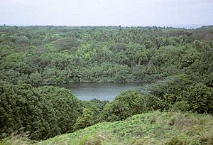
The low, wet areas have taro farms, marshes, and a lake called Lake Tiroto. This rich land also grows bananas, citrus fruits, papayas, breadfruit, and coconuts.
The island has a reef around it that is about 90 meters (300 feet) wide. The makatea cliffs are full of caves. Some of these caves were used long ago for burials.
History of Atiu
People from Polynesia are thought to have lived on Atiu since at least 900 or 1000 AD. Old stories say that Atiu was named after the first man on the island. Other stories talk about different settlers. These include Te Ariki-Mou-Taua, Mariri, and Nuku-kere-i-manu. The famous navigator Ruatapu also visited the island.
In the mid-1700s, the island became united. After that, Atiu took control of its nearby islands, Mauke and Mitiaro.
The first European to visit Atiu was Captain Cook. He saw the island on March 31, 1777. He made some contact with the people over the next few days.
In early 1823, a missionary named J.M. Orsmond left two teachers from Bora Bora on the island. Later that year, John Williams from the London Missionary Society arrived. He helped the island's leader, Rongomatane Ngaakaara Ariki, become a Christian. Because of this, all the people on the island moved to one main village in the center. After becoming Christian, Atiu's power over its neighbors became less.
In the 1860s, Ngamaru Rongotini Ariki, who was a chief of Atiu, Mauke, and Mitiaro, married Makea Takau Ariki, a chief from Rarotonga. Because of this marriage, Atiu became part of the Kingdom of Rarotonga in 1871. In 1888, it became a British protectorate. This was part of the Cook Islands Federation. In 1901, New Zealand took control of Atiu.
After this, Atiu exported oranges, coffee, and copra (dried coconut meat). But it was hard to ship these goods, and exports stopped in the 1950s. The citrus fruit business started again in the 1960s but then slowed down in the 1970s.
Many people started moving to Rarotonga in the 1950s because there were not many jobs on Atiu. A money problem in 1995 and 1996, and changes to government jobs, caused even more people to leave the island.
People of Atiu
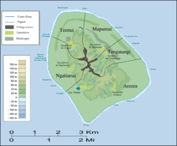
Most people live on the central hill of Atiu. On March 12, 2003, there were 571 people living on Atiu. They lived in five villages that spread out from the island's center. These villages have grown together since 1823. They follow the old tapere (land division) system from before Europeans arrived. The villages are:
- Teenui Village (Te-Kuru-Kava-Nui)
- Mapumai Village (Mapumai-Nui-O-Ruavari)
- Ngatiarua Village (Mokoero-Nui-O-Tautipa)
- Areora Village (Areora-Nui-Te-Are-O-Tangaroa)
- Tengatangi Village (Taturoa-I-Te-Puta-Marama)
Each of the five villages on Atiu has a meeting house. These houses are very important to the people. They are kept in good condition, and villagers are proud of them. In these houses, they hold village meetings and community events. They also welcome and feed visitors and sell local products. Learning courses are held here. If a large group of visitors comes from overseas, they can even stay in these houses.
| Historical population | ||
|---|---|---|
| Year | Pop. | ±% |
| 1906 | 918 | — |
| 1916 | 759 | −17.3% |
| 1926 | 933 | +22.9% |
| 1936 | 1,086 | +16.4% |
| 1951 | 1,270 | +16.9% |
| 1961 | 1,266 | −0.3% |
| 1966 | 1,327 | +4.8% |
| 1976 | 1,312 | −1.1% |
| 1986 | 957 | −27.1% |
| 1996 | 956 | −0.1% |
| 2001 | 623 | −34.8% |
| 2006 | 570 | −8.5% |
| 2011 | 480 | −15.8% |
| 2016 | 434 | −9.6% |
| Source: | ||
The small island of Takutea is also considered part of Atiu for government purposes. Takutea is not lived on and is a special place for birds.
Culture of Atiu
The people of Atiu call themselves Toke-enua no Enuamanu. This means "worms of Enuamanu." They say this because they were born on Atiu and hope to be buried there.
Long ago, there was a custom on Atiu. It was like a custom of the New Zealand Māori. When a baby was born, its placenta was buried under a newly planted tree. This is where the Atiuan saying comes from: "We come from the land and go back to the land."
Most people (96%) on Atiu say they are Cook Islanders. Many people belong to the Cook Islands Christian Church (49.6%). Others are Roman Catholic (21.3%) or Seventh-day Adventist (13.9%).
A local custom is the tumunu, or bush drink party. Making this drink was brought to the island by whalers. However, drinking it was not allowed by missionaries. It stayed against the rules until the 1980s. This led to people secretly making the drink in the jungle. At first, the tumunu was a secret group. Now, it is offered as a fun experience for tourists.
Economy of Atiu
The government helps Atiu's economy a lot. Half of the people who work on the island are employed by the government.
After the citrus fruit business failed and many people moved away, there are only a few shops, a lodge, and one motel on the island. Some tourists visit Atiu. It is the second most visited outer island after Aitutaki. A new plant nursery opened in 2020.
Atiu is connected to the other Cook Islands by Enua Airport. It also has a wharf at Taunganui Harbour.
Before 2018, the island got its power from diesel generators. Since 2018, it has been powered by a solar and battery power station.
Coffee Farming on Atiu
Atiu has a long history of growing coffee. Missionaries started growing it for business in the early 1800s. By 1865, the Cook Islands were sending out 30,000 pounds of coffee each year. The island's chiefs, called ariki, controlled the land where coffee was grown. They also received most of the money from it. The regular people often got little or no pay for their hard work.
In the late 1890s, coffee plants on Rarotonga got a disease. This caused coffee production to drop. So, more coffee had to come from the outer islands like Atiu, Mauke, and Mangaia. World War I and World War II caused coffee exports to drop even more and then stop completely.
In the 1950s, a new way of working together, called the co-operative movement, helped coffee farming start again. On Atiu, new coffee farms were set up. This was done with help from New Zealand and the Cook Islands Agriculture Department. The raw coffee was sent to New Zealand to be processed and sold.
By 1983, the coffee business had failed again. The government stepped back and left the farms to their owners. Farmers stopped growing coffee for sale. They only grew it for themselves. This was because they did not earn much money from selling their coffee to a company in Rarotonga. The coffee farms became overgrown with plants.
Growing coffee for business started again around 1984. This happened when a German economist named Juergen Manske-Eimke started Atiu Coffee Factory Ltd. In 2012, the Atiu Coffee Factory managed 39 hectares (96 acres) of land. It produced 4.5 tonnes (9,900 pounds) of roasted coffee beans. In 2015, the coffee factory closed. A new company, Atiu Island Coffee, took it over.
Nature and Wildlife
Plant Life
The plants on Atiu can be found in five different natural areas. The pa tai (coast) and Rautuitui (upland makatea) areas have many coconut trees and Pandanus tectorius plants. There are also groups of Barringtonia asiatica, Elaeocarpus tonganus, and Hernandia moerenhoutiana.
The Puna (swampy lowlands) are used to grow taro. These areas also have grasses and forests in the drier parts. The Rautuanue (slopes) and maunga (mountain) areas have many Platycerium and Casuarina trees. Pineapple and yams are also grown here.
In 2017, the Moko‘ero Nui Nature Reserve was created on the west side of the island. This reserve protects 120 hectares (296 acres) of coastal forest.
Animal Life
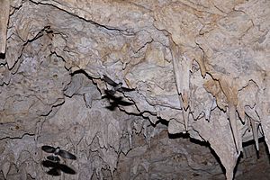
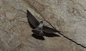
Birds that live only on Atiu include the Pacific imperial pigeon, chattering kingfisher, and lilac-crowned fruit dove. The Atiu swiftlet or kopeka (Aerodramus sawtelli) is a special bird. It uses echo-location to find its way. This bird is found only on Atiu. It builds its nests inside Anatakitaki Cave.
Old bone remains show that other birds once lived on Atiu. These include the Polynesian ground dove, Polynesian imperial pigeon, and Kuhl's lorikeet (Rimatara lorikeet, Vini kuhlii). But these birds are no longer found on the island.
Atiu does not have black rats. Because of this, it was chosen as a place to bring back the Rarotonga monarch in 2001. The Kuhl's lorikeet was also brought back in 2007. The lorikeet population has grown well, with over 400 birds now living there.
The common myna bird was brought to Atiu in 1915. This was done to try and control a type of insect that harmed coconut trees. But the myna bird became a big problem itself. In 2009, a plan was started to remove these birds. This involved trapping, poisoning, and shooting them. The myna bird was completely removed from the island by 2014. However, this led to a lot of stick insects appearing in 2016.
The island has been named an Important Bird Area (IBA) by BirdLife International. This means it is a very important place for birds.
See also
 In Spanish: Atiu para niños
 | Selma Burke |
 | Pauline Powell Burns |
 | Frederick J. Brown |
 | Robert Blackburn |


