Austell, Georgia facts for kids
Quick facts for kids
Austell, Georgia
|
|
|---|---|

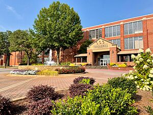
City of Austell Threadmill Complex
|
|

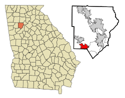
Location in Cobb County and the state of Georgia
|
|
| Country | United States |
| State | Georgia |
| Counties | Cobb |
| Area | |
| • Total | 5.96 sq mi (15.44 km2) |
| • Land | 5.95 sq mi (15.40 km2) |
| • Water | 0.02 sq mi (0.04 km2) |
| Elevation | 928 ft (283 m) |
| Population
(2020)
|
|
| • Total | 7,713 |
| • Density | 1,297.39/sq mi (500.95/km2) |
| Time zone | UTC−5 (Eastern (EST)) |
| • Summer (DST) | UTC−4 (EDT) |
| ZIP Codes |
30106, 30168
|
| Area codes |
|
| FIPS code | 13-04252 |
| GNIS feature ID | 0354416 |
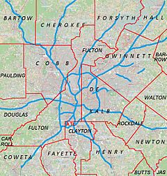
Austell is a city in Cobb and Douglas counties in the U.S. state of Georgia. It is part of the larger Atlanta metropolitan area. In 2020, about 7,713 people lived in Austell.
Contents
History of Austell
The area where Austell is now was once a popular spot for hunters and trappers. They visited because of the natural salt licks. People also believed the local waters had special healing powers. This led to a town called Salt Springs being founded.
As more people moved in, a man named G. O. Mozely gave up some of his land. He divided it into streets, helping the small settlement grow. The spring was later called Lithia Springs because its water contained lithium carbonate. The nearby city of Lithia Springs was started in 1882.
In 1888, the water from Lithia Spring was bottled and sold. It was called Bowden Lithia Spring Water. Today, you can still buy this water under the name Lithia Spring Water.
The Georgia Pacific Railway chose Austell as an important train station. It was a key point where major railway lines split off. One line went to Birmingham and the other to Chattanooga.
Austell officially became a city in 1885. It was named after General Alfred Austell (1814–1881). He was honored for his efforts to bring big railway lines to the Southern United States. General Austell also started the Atlanta National Bank. This bank later became part of Wachovia and then Wells Fargo.
In 2009, Sweetwater Creek flooded. This flood caused damage to many homes and businesses in the Austell area.
Exploring Austell's Geography
Austell is located on the southern edge of Cobb County. A small part of the city also reaches into Douglas County. To the south, it borders Lithia Springs. To the east, it borders Mableton. The city of Powder Springs is about 4 miles (6.4 km) to the northwest.
U.S. Route 78 goes through Austell. This road leads east about 15 miles (24 km) to downtown Atlanta. It also goes west about 8 miles (13 km) to Douglasville.
The United States Census Bureau says Austell covers about 5.96 square miles (15.44 square kilometers). Most of this area is land, with only a tiny bit (0.24%) being water.
Land and Water Features
Sweetwater Creek flows through Austell. This creek is a branch of the Chattahoochee River. It passes north and then east of the city center. The land in Austell is mostly flat, without many large hills.
Austell's Climate
Austell has a humid subtropical climate. This means it has hot, humid summers. Winters are mild, but can sometimes be cold. The city experiences all four seasons.
Summers are hot and humid. In July, the average daily temperature is about 89°F (32°C). It's common for temperatures to go above 90°F (32°C) in summer. Winters are mild and can be windy. There are some warm, sunny days and sometimes snow. In January, the average high is 50°F (10°C) and the low is 30°F (-1°C). Very cold temperatures below 0°F (-18°C) are rare.
| Climate data for Austell, Georgia | |||||||||||||
|---|---|---|---|---|---|---|---|---|---|---|---|---|---|
| Month | Jan | Feb | Mar | Apr | May | Jun | Jul | Aug | Sep | Oct | Nov | Dec | Year |
| Record high °F (°C) | 80 (27) |
80 (27) |
89 (32) |
93 (34) |
96 (36) |
101 (38) |
104 (40) |
104 (40) |
99 (37) |
92 (33) |
86 (30) |
80 (27) |
104 (40) |
| Mean daily maximum °F (°C) | 50 (10) |
55 (13) |
64 (18) |
72 (22) |
79 (26) |
86 (30) |
89 (32) |
88 (31) |
83 (28) |
73 (23) |
63 (17) |
54 (12) |
71 (22) |
| Mean daily minimum °F (°C) | 30 (−1) |
34 (1) |
38 (3) |
45 (7) |
54 (12) |
62 (17) |
66 (19) |
65 (18) |
59 (15) |
46 (8) |
38 (3) |
31 (−1) |
47 (8) |
| Record low °F (°C) | −12 (−24) |
−2 (−19) |
7 (−14) |
21 (−6) |
32 (0) |
40 (4) |
50 (10) |
48 (9) |
30 (−1) |
22 (−6) |
9 (−13) |
−4 (−20) |
−12 (−24) |
| Source: The Weather Channel | |||||||||||||
People of Austell: Demographics
| Historical population | |||
|---|---|---|---|
| Census | Pop. | %± | |
| 1890 | 582 | — | |
| 1900 | 648 | 11.3% | |
| 1910 | 755 | 16.5% | |
| 1920 | 758 | 0.4% | |
| 1930 | 963 | 27.0% | |
| 1940 | 1,229 | 27.6% | |
| 1950 | 1,413 | 15.0% | |
| 1960 | 1,867 | 32.1% | |
| 1970 | 2,632 | 41.0% | |
| 1980 | 3,939 | 49.7% | |
| 1990 | 4,173 | 5.9% | |
| 2000 | 5,359 | 28.4% | |
| 2010 | 6,581 | 22.8% | |
| 2020 | 7,713 | 17.2% | |
| U.S. Decennial Census 1850-1870 1870-1880 1890-1910 1920-1930 1940 1950 1960 1970 1980 1990 2000 2010 2020 |
|||
What the 2020 Census Shows
The 2020 United States census counted 7,713 people living in Austell. There were 2,691 households and 1,794 families.
This table shows the different groups of people living in Austell over the years:
| Race / Ethnicity (NH = Non-Hispanic) | Pop 2000 | Pop 2010 | Pop 2020 | % 2000 | % 2010 | % 2020 |
|---|---|---|---|---|---|---|
| White alone (NH) | 3,314 | 1,932 | 1,444 | 61.84% | 29.36% | 18.72% |
| Black or African American alone (NH) | 1,314 | 3,593 | 4,500 | 24.52% | 54.60% | 58.34% |
| Native American or Alaska Native alone (NH) | 18 | 13 | 26 | 0.34% | 0.20% | 0.34% |
| Asian alone (NH) | 43 | 96 | 106 | 0.80% | 1.46% | 1.37% |
| Native Hawaiian or Pacific Islander alone (NH) | 0 | 9 | 2 | 0.00% | 0.14% | 0.03% |
| Other race alone (NH) | 12 | 22 | 53 | 0.22% | 0.33% | 0.69% |
| Mixed race or Multiracial (NH) | 65 | 134 | 278 | 1.21% | 2.04% | 3.60% |
| Hispanic or Latino (any race) | 593 | 782 | 1,304 | 11.07% | 11.88% | 16.91% |
| Total | 5,359 | 6,581 | 7,713 | 100.00% | 100.00% | 100.00% |
In 2020, most of Austell's population (6,541 people) lived in Cobb County. A smaller number (40 people) lived in Douglas County.
Austell's Economy
In its early days, Austell's economy depended a lot on the train station. People and goods were moved by rail. Many residents also used the trains to travel to Atlanta for jobs. Today, people no longer travel by train to or from Austell.
Other industries in Austell include recycling paper and plastics. These recycled materials are even sent as far away as China.
Arts and Culture in Austell
Annual Events and Celebrations
The city of Austell has an annual July 4 fireworks celebration. It's a fun event for everyone.
A local church, Beacon of Light Christian Church, hosts a free block party every Easter Sunday. It's a community event for all ages.
Interesting Places to Visit
Six Flags Over Georgia is a huge amusement park. It's a popular tourist spot located about 7 miles (11 km) southeast of downtown Austell. Even though it's outside the city limits, it has an Austell mailing address.
The Collar Community Center is near downtown. It's used for community groups and local gatherings. The South Cobb Recreation Center is a large facility. It has a gym, rooms for many uses, a kitchen, and offices. It can hold up to 939 people.
The Cenacle Coffee and Bistro opened in 2015. It's a welcoming place where visitors and locals feel at home. Located in the heart of Austell, The Cenacle offers a varied menu. It also has unique spaces like the Garden of Hope. The Cenacle helps the community in many ways. During the pandemic, they gave free meals twice a week to those who needed them. They often host local events and support community programs. The Cenacle also has a food truck and offers catering. It's a big part of Austell's friendly community spirit.
Sports and Activities
During summer, softball games are very popular. City leagues have 30 games with 450 players. The Sweetwater Valley Youth Association supports cheerleading and 32 teams of over 500 young people.
There are five lighted fields for baseball and softball fans. Collar Park and Washington Street Park both have tennis courts for playing.
Parks and Outdoor Fun
The Austell Parks and Recreation Department takes care of five recreation centers and seven parks. These parks include Berry Park, Collar Park, Legion Park, Pine Street, Stephens, and Washington Street Park. Together, they cover about 36.2 acres (14.6 hectares) of land.
Education in Austell
Public schools in the Cobb County part of Austell are managed by the Cobb County School District. These schools include Austell Primary School, Austell Elementary School, Garrett Middle School, and South Cobb High School.
For the Douglas County part of Austell, public education is handled by the Douglas County School System.
There are also private schools in the city:
- Cumberland Christian Academy
- Good Shepherd Learning Center
- Sunbrook Academy at Barnes Mill
- The Goddard School (located north of Austell)
Media and News
People in Austell can read several local newspapers. These include the South Cobb Patch, The Atlanta Journal-Constitution, and the Fulton County Daily Report.
Transportation in Austell
Austell is located about 4 miles (6.4 km) north of Interstate 20. It is also where two Norfolk Southern railway lines separate. One line goes to Birmingham, and the other goes to Chattanooga.
See also
 In Spanish: Austell (Georgia) para niños
 | Georgia Louise Harris Brown |
 | Julian Abele |
 | Norma Merrick Sklarek |
 | William Sidney Pittman |


