Avalon, New Jersey facts for kids
Quick facts for kids
Avalon, New Jersey
|
||
|---|---|---|
|
Borough
|
||
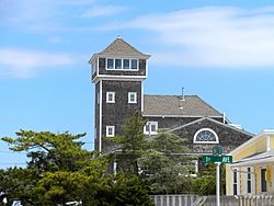
Former Avalon Lighthouse
|
||
|
|
||
| Motto(s):
"Cooler by a Mile"
|
||
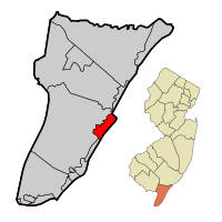
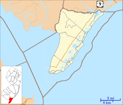
Location of Avalon in Cape May County highlighted in red (left). Inset map: Location of Cape May County in New Jersey highlighted in orange (right).
|
||
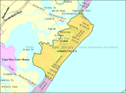
Census Bureau map of Avalon, New Jersey
|
||
| Country | ||
| State | ||
| County | ||
| Formed | 1723 as part of Middle Township | |
| Incorporated | April 18, 1892 | |
| Named for | Avalon of Arthurian legend | |
| Government | ||
| • Type | Faulkner Act (mayor–council) | |
| • Body | Borough Council | |
| Area | ||
| • Total | 5.06 sq mi (13.09 km2) | |
| • Land | 4.27 sq mi (11.06 km2) | |
| • Water | 0.79 sq mi (2.04 km2) 15.53% | |
| Area rank | 275th of 565 in state 7th of 16 in county |
|
| Elevation | 10 ft (3 m) | |
| Population
(2020)
|
||
| • Total | 1,243 | |
| • Estimate
(2023)
|
1,218 | |
| • Rank | 523rd of 565 in state 12th of 16 in county |
|
| • Density | 291.1/sq mi (112.4/km2) | |
| • Density rank | 476th of 565 in state 12th of 16 in county |
|
| Time zone | UTC−05:00 (Eastern (EST)) | |
| • Summer (DST) | UTC−04:00 (Eastern (EDT)) | |
| ZIP Code |
08202
|
|
| Area codes | 609 Exchanges: 263, 368, 967 | |
| FIPS code | 3400902320 | |
| GNIS feature ID | 0885146 | |
Avalon is a small town, called a borough, in Cape May County, New Jersey. It is located on Seven Mile Island. In 2020, about 1,243 people lived there. However, during the summer, the population can grow to as many as 45,000 visitors!
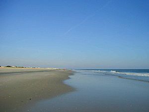
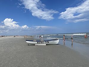
Avalon is known as a popular beach resort in South Jersey. Its motto is "Cooler by a Mile." This is because it sticks out into the Atlantic Ocean about a mile farther than other nearby islands. Another reason for the motto is that Avalon is four miles long, which is one mile longer than its neighbor, Stone Harbor.
Contents
History of Avalon
How Avalon Was Formed
About 14,000 years ago, the barrier islands of Cape May County were created. They likely formed from sand spits and lines of sand dunes. This area was once a thick juniper forest where Lenni Lenape Native Americans lived.
In 1722, a man named Aaron Leaming bought the land for 79 pounds. It was known as Seven Mile Beach and included what is now Avalon and Stone Harbor. The Leaming family owned this land for about 100 years.
Pirates and Early Uses
Some old stories say that pirates buried their treasures on Seven Mile Island. It's also said that Henry Hudson might have anchored his ship offshore. The island was used for raising cattle and for its many trees. Over time, the Leamings sold the land, and it changed hands many times.
In 1887, the Seven Mile Beach company was started. By 1893, Avalon was advertised as a resort town. As more people came, homes and businesses were built. The original juniper forest was cut down, and the sandy hills were flattened. Today, it's rare to see hills or native juniper trees in Avalon.
Becoming a Borough
Avalon officially became a borough on April 18, 1892. This happened after people voted for it. The borough was re-established a few times in the 1890s. More land from Middle Township was added in 1910. In 1941, some parts of Avalon were given to Stone Harbor. The town is named after Avalon from the stories of King Arthur.
The Commonwealth Shipwreck
On January 4, 1890, a ship called the Commonwealth sank. This ship was traveling from New York City to Philadelphia with a cargo of molasses, coffee, and other goods. In bad weather, it got stuck in Townsend's Inlet. The crew was saved, and most of the cargo was rescued. However, the ship broke apart after a week. Some of its remaining cargo washed ashore and was collected by the early residents of Avalon.
Changes in Transportation
In the early 1900s, the Leaming Railroad bridge was built. This allowed trains to come into town, bringing more visitors from nearby Philadelphia, Pennsylvania. Around 1944, the train lines merged, and train travel to the island ended.
Today, most people travel to Avalon by car or boat. However, buses also run regularly to and from the shore towns.
Geography of Avalon
Avalon covers about 5.06 square miles (13.09 square kilometers). Most of this is land, but about 15.53% is water.
A small area called Peermont is also located within the borough. Avalon shares borders with other towns in Cape May County, including Dennis Township, Middle Township, Sea Isle City, and Stone Harbor. It also borders the Atlantic Ocean.
Population of Avalon
| Historical population | |||
|---|---|---|---|
| Census | Pop. | %± | |
| 1900 | 93 | — | |
| 1910 | 230 | 147.3% | |
| 1920 | 197 | −14.3% | |
| 1930 | 343 | 74.1% | |
| 1940 | 313 | −8.7% | |
| 1950 | 428 | 36.7% | |
| 1960 | 695 | 62.4% | |
| 1970 | 1,283 | 84.6% | |
| 1980 | 2,162 | 68.5% | |
| 1990 | 1,809 | −16.3% | |
| 2000 | 2,143 | 18.5% | |
| 2010 | 1,334 | −37.8% | |
| 2020 | 1,243 | −6.8% | |
| 2023 (est.) | 1,218 | −8.7% | |
| Population sources: 1900–2000 1900–1920 1900–1910 1910–1930 1940–2000 2010 2020 |
|||
In 2010, there were 1,334 people living in Avalon. This number went down to 1,243 people by 2020. Even though the year-round population is small, many people visit Avalon during the summer months.
The average age of people living in Avalon in 2010 was about 61.8 years old. Many residents are 65 years or older.
Education in Avalon
The Avalon School District serves students from first to eighth grade. As of the 2022–23 school year, the district had 83 students and 12.2 teachers. This means there were about 6.8 students for every teacher.
Since the 2011–12 school year, students in kindergarten through fourth grade from both Avalon and Stone Harbor go to school in Stone Harbor. All students in grades 5-8 attend Avalon Elementary School in Avalon.
For high school, students in grades nine through twelve go to Middle Township High School. This high school is in Cape May Court House. Students from Dennis Township, Stone Harbor, and Woodbine also attend this high school.
Students can also choose to go to Cape May County Technical High School. This school offers different programs for students from all over the county. There is also a Catholic school, Bishop McHugh Regional School, in Ocean View, which serves students from kindergarten to eighth grade.
Transportation in Avalon
Roads and Highways
As of 2010, Avalon had about 41.61 miles of roads. Most of these roads are maintained by the town itself.
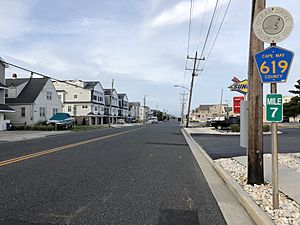
There are no major highways like Interstates or U.S. Routes that go through Avalon. The most important roads are county routes. These include County Route 601 (Avalon Boulevard), which connects to the Garden State Parkway, and County Route 619, which is part of Ocean Drive.
Public Transportation
Avalon also has a trolley service that runs during the summer months. This trolley travels along the seven-mile-long island. There are also NJ Transit bus stops in Avalon. These buses can take you to Philadelphia or to the Port Authority Bus Terminal in Midtown Manhattan, New York City.
Climate in Avalon
Avalon has a humid subtropical climate. This means it has hot, humid summers and mild winters.
| Climate data for Avalon (39.1004, -74.7186), Elevation 7 ft (2 m), 1991–2020 normals, extremes 1981–2022 | |||||||||||||
|---|---|---|---|---|---|---|---|---|---|---|---|---|---|
| Month | Jan | Feb | Mar | Apr | May | Jun | Jul | Aug | Sep | Oct | Nov | Dec | Year |
| Record high °F (°C) | 70.7 (21.5) |
73.6 (23.1) |
87.4 (30.8) |
88.9 (31.6) |
91.0 (32.8) |
96.1 (35.6) |
97.4 (36.3) |
96.1 (35.6) |
97.4 (36.3) |
91.3 (32.9) |
79.9 (26.6) |
74.5 (23.6) |
97.4 (36.3) |
| Mean daily maximum °F (°C) | 42.9 (6.1) |
44.3 (6.8) |
50.3 (10.2) |
60.3 (15.7) |
69.6 (20.9) |
78.6 (25.9) |
83.9 (28.8) |
82.6 (28.1) |
77.2 (25.1) |
66.9 (19.4) |
56.2 (13.4) |
47.8 (8.8) |
63.5 (17.5) |
| Mean daily minimum °F (°C) | 27.8 (−2.3) |
28.9 (−1.7) |
35.2 (1.8) |
44.8 (7.1) |
54.1 (12.3) |
63.5 (17.5) |
69.3 (20.7) |
68.1 (20.1) |
62.0 (16.7) |
50.5 (10.3) |
40.3 (4.6) |
32.7 (0.4) |
48.2 (9.0) |
| Record low °F (°C) | −3.8 (−19.9) |
2.0 (−16.7) |
10.3 (−12.1) |
21.0 (−6.1) |
36.2 (2.3) |
45.3 (7.4) |
51.2 (10.7) |
47.0 (8.3) |
40.5 (4.7) |
30.8 (−0.7) |
17.3 (−8.2) |
3.3 (−15.9) |
−3.8 (−19.9) |
| Average precipitation inches (mm) | 3.40 (86) |
2.97 (75) |
4.40 (112) |
3.50 (89) |
3.45 (88) |
3.62 (92) |
4.21 (107) |
4.45 (113) |
3.77 (96) |
4.27 (108) |
3.34 (85) |
4.24 (108) |
45.63 (1,159) |
| Average snowfall inches (cm) | 6.0 (15) |
4.0 (10) |
2.1 (5.3) |
0.1 (0.25) |
0.0 (0.0) |
0.0 (0.0) |
0.0 (0.0) |
0.0 (0.0) |
0.0 (0.0) |
0.0 (0.0) |
0.0 (0.0) |
2.0 (5.1) |
14.2 (36) |
| Average dew point °F (°C) | 25.7 (−3.5) |
26.5 (−3.1) |
31.9 (−0.1) |
41.1 (5.1) |
52.1 (11.2) |
62.1 (16.7) |
67.2 (19.6) |
66.7 (19.3) |
61.0 (16.1) |
49.9 (9.9) |
38.8 (3.8) |
31.4 (−0.3) |
46.3 (7.9) |
| Source 1: PRISM | |||||||||||||
| Source 2: NOHRSC (Snow, 2008/2009 - 2022/2023 normals) | |||||||||||||
The Nor'easter of 1962
In March 1962, a very strong storm called a Nor'easter hit the U.S. East Coast. This storm caused huge ocean waves. Much of Avalon experienced serious flooding and lost a lot of its coastline. The island was underwater for four to five days. Homes were damaged depending on how they were built and where they were located.
Protecting Avalon from Storms
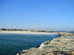
Since 1962, there have been many strong storms. However, new rock walls, called jetties, have been built at Townsends Inlet. These jetties have mostly protected the homes near the inlet.
But the beaches and properties facing the ocean, especially from 8th to 12th Streets, have had a harder time. They have tried different ways to stop the island from shrinking. These include extending the 8th Street rock jetty, building an artificial reef, and adding more sand to the beaches (called beach replenishment). So far, these efforts have helped stop the island from getting smaller in this area, but they cost a lot of money. Sometimes, the road leading north from Avalon to Townsends Inlet has to close because of flooding during storms.
Notable People from Avalon
Many famous people have lived in or are connected to Avalon, including:
- Geno Auriemma (born 1954), a well-known college basketball coach for the University of Connecticut Huskies women's basketball team.
- Paul Holmgren (born 1955), a former General Manager and current president of the Philadelphia Flyers ice hockey team.
- Tim Kerr (born 1960), a former ice hockey player for the Philadelphia Flyers.
- Ed McMahon (1923–2009), a famous television show host.
- Joe Paterno (1926–2012), a legendary college football coach for Penn State.
- Stephen Sharer (born 1992), a popular YouTube personality.
See also
 In Spanish: Avalon (Nueva Jersey) para niños
 | Leon Lynch |
 | Milton P. Webster |
 | Ferdinand Smith |


