Banner Creek Summit facts for kids
Quick facts for kids Banner Creek Summit |
|
|---|---|
| Elevation | 7,037 ft (2,145 m) |
| Traversed by | |
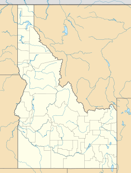
| Location | Boise County / Custer County, Idaho, U.S. |
| Range | Salmon River Mountains |
| Coordinates | 44°18′26″N 115°14′00″W / 44.307222°N 115.233333°W |
| Topo map | USGS Banner Summit |
Banner Creek Summit is a special place in the mountains of central Idaho. It's a mountain pass, which is like a low spot or a gap between mountains. This makes it easier for roads to cross from one side to another.
The summit is very high up, at about 7,037 feet (or 2,145 meters) above sea level. It's located on Idaho State Highway 21, which is also known as the Ponderosa Pine Scenic Byway.
Contents
Banner Creek Summit: A Mountain Pass
Banner Creek Summit sits right on the border between two counties in Idaho: Custer County and Boise County. It also marks the edge of two large national forests: the Challis National Forest and the Boise National Forest.
This pass is found just northwest of the beautiful Sawtooth Range. It's a key spot for travelers and nature lovers.
Where is Banner Creek Summit?
If you're driving on State Highway 21, Banner Creek Summit is about halfway between the towns of Stanley and Lowman. It's a scenic drive through the mountains.
The highway follows Banner Creek on the north side of the summit. This creek flows into the Middle Fork of the Salmon River. On the south side, the highway follows Canyon Creek, which is part of the South Fork of the Payette River.
Rivers and Waterways
Banner Creek Summit is important because it marks a "divide" between two major river systems. This means that rainwater and snowmelt that falls on one side of the summit will flow into the Salmon River. Water that falls on the other side will flow into the Payette River.
This is like a natural boundary for water. It shows how mountains can direct where water goes across the landscape.
Traveling in Winter
During the winter months, the section of State Highway 21 that goes over Banner Creek Summit is usually closed. This is because the area gets a lot of snowfall. Also, not many cars travel this road in winter.
Closing the road helps keep people safe from heavy snow and icy conditions. It also saves money on snow removal when there isn't much traffic.
 | Dorothy Vaughan |
 | Charles Henry Turner |
 | Hildrus Poindexter |
 | Henry Cecil McBay |


