Basin, Montana facts for kids
Quick facts for kids
Basin, Montana
|
|
|---|---|
Basin Street
|
|
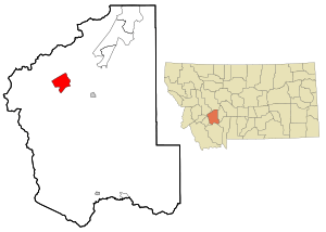
Location of Basin, Montana
|
|
| Country | United States |
| State | Montana |
| County | Jefferson |
| Area | |
| • Total | 12.71 sq mi (32.92 km2) |
| • Land | 12.71 sq mi (32.92 km2) |
| • Water | 0.00 sq mi (0.00 km2) 0% |
| Elevation | 5,364 ft (1,635 m) |
| Population
(2020)
|
|
| • Total | 199 |
| • Density | 15.66/sq mi (6.04/km2) |
| Time zone | UTC−7 (MST) |
| • Summer (DST) | UTC−6 (MDT) |
| ZIP code |
59631
|
| Area code(s) | 406 |
| FIPS code | 30-04150 |
| GNIS feature ID | 0800393 |
Basin is a small community in Jefferson County, Montana, United States. It's called a census-designated place (CDP), which means it's a special area the government uses to collect population data. Basin is located in a narrow canyon, about 10 miles (16 km) southeast of the Continental Divide. It sits along Interstate 15, roughly halfway between the cities of Butte and Helena.
Basin Creek flows through the town and joins the Boulder River on the south side. In 2020, about 199 people lived in Basin. Long ago, archaeologists found signs that people lived near here as far back as 10,000 years ago.
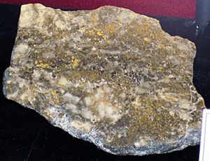
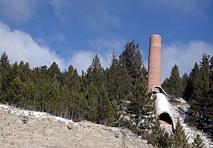
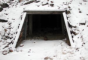
Basin is built on top of a large rock formation called the Boulder Batholith. This rock holds many valuable minerals. Because of this, Basin became a busy place for gold and silver mining. At its peak in the early 1900s, about 1,500 people lived here. But as the mines ran out of minerals, the town's population slowly got smaller. Today, you can still see old mining equipment and the remains of buildings used for processing ore.
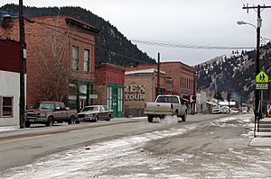
Basin's main street has historic buildings from its mining days. These buildings now house a fire station, a post office, restaurants, a bar, art shops, and other small businesses. The community has a small elementary school and its own water system. Local volunteers help run some services, but the county government handles things like law enforcement. From 1993 to 2011, Basin was home to the Montana Artists Refuge, a place where artists could live and work.
Contents
Where is Basin Located?
Basin is in Jefferson County, Montana. It's part of the wider Helena area. The town is high up, at 5,364 feet (1,635 meters) above sea level. It's located along Interstate 15, about 27 miles (43 km) north of Butte and 35 miles (56 km) south of Helena.
The town is mostly surrounded by the Beaverhead-Deerlodge National Forest. Basin Creek flows south through the town and meets the Boulder River. The interstate highway is the main road connecting Basin to other towns. The Continental Divide is about 10 miles (16 km) upstream on Basin Creek. The entire area of Basin is land, covering about 12.8 square miles (33.2 square kilometers).
What is the Boulder Batholith?
Around 81 to 74 million years ago, hot, melted rock called magma rose to the Earth's surface in this area. It cooled and formed a huge body of rock called the Boulder Batholith. This rock is about 10 miles (16 km) thick and 100 miles (160 km) wide, stretching from Helena to Butte. This batholith is where many valuable metal ores found in Montana are located.
As the granite rock cooled, it cracked. Hot liquids then flowed into these cracks, forming veins filled with gold and other metals. Millions of years later, weather broke down these rocks. This caused gold from the veins to wash into the gravels of Basin Creek, Cataract Creek, and the Boulder River.
A Brief History of Basin
Who Lived Here First?
Scientists believe the first people in Montana came from Asia over a land bridge about 12,000 years ago. These early people, called Paleo-Indians or Clovis people, traveled along the edges of melting glaciers. Evidence of these ancient people, including tools, has been found near Clancy, about 20 miles (32 km) north of Basin. These artifacts are about 10,000 years old.
Around 2,000 years ago, new groups of people, called the Late Hunters, arrived. They hunted bison (buffalo) in the grassy valleys. Tribes like the Kootenai, Flathead (Salish), and Pend d'Oreilles lived in or visited this area. Later, the Crow and Shoshone tribes came. By the mid-1700s, the Blackfeet became very powerful in Montana. They relied heavily on bison.
By the 1870s, around the time white miners started looking for gold near Basin, most Native American tribes had been moved to reservations. These reservations were far from Basin.
How Basin Started as a Mining Camp
Basin began as a mining camp in the 1800s. Gold was found in Cataract Creek, just downstream from where Basin is now, as early as 1862. Prospectors built cabins and started placer mining, which means they washed gold from the gravels in the creeks. Over time, buildings from the Cataract camp were moved to Basin, and that camp was left behind.
By the 1870s, miners found the main lode veins (the original rock formations with gold) in both Cataract and Basin Creeks. Important mines like the Eva May, Uncle Sam, Grey Eagle, and Comet opened. By 1880, Basin became the main place for supplies for all the mines and miners in the area.
Basin's Mining Boom and Decline
Two mines, the Katy and the Hope, were very important to Basin's success. In 1894, the Basin and Bay State Mining Company tried to expand these mines. However, floods and fires caused them to close by 1896. Even with these problems and several town fires, Basin continued to grow.
In 1905, a new company took over the mines. By then, Basin had grown to 1,500 people. It had hotels, stores, a bank, a newspaper, and many saloons. Two railroads, the Northern Pacific and the Great Northern, served the town, carrying both people and goods. There was even a large building meant to be a smelter, which would process the ore, but it was never fully used.
Mining continued at the Hope-Katy mine complex. Mills crushed the ore and separated the valuable minerals. Water was brought in by special channels called Flumes to power the mills and supply the town. Steam engines provided power for the mine equipment, and a water wheel generated electricity for streetlights.
Basin also had places for fun, like a dance hall, a baseball field, and a playground. There were churches and meeting halls for groups like the Masons. Businesses included a hardware store, a bakery, a brewery, and a dairy.
In 1909, a new company used the old mill buildings to process zinc ore using a new method called froth flotation. This plant closed in 1912.
The most successful mining of the Hope-Katy vein started in 1919. The Jib Consolidated Mining Company expanded the mine tunnels greatly. By 1924, this company became the biggest gold producer in Montana. That year, the Jib mines produced a lot of gold, silver, copper, and lead. But in 1925, the mines changed hands, and production went down. This was the last big mining boom for Basin. Since then, only small-scale mining has continued.
Basin in Recent Times
For about 50 years, the Merry Widow Health Mine in Basin has attracted people who believe that limited exposure to radioactive mine water and radon can help with health problems like arthritis. This practice is debated because high levels of radiation can be harmful.
In 1975, Basin built a modern water and sewage system. By 1990, the new Interstate 15 highway was completed through town.
In 1999, the Environmental Protection Agency added the Basin mining area to a special list called Superfund because of mining waste problems. The waste contained harmful metals like arsenic, copper, cadmium, and lead. Cleanup efforts in the area were completed by 2004, making the area safer.
Weather in Basin
The warmest months in the Basin area are usually July and August. December and January are the coldest. May and June are the wettest months, with about 4 inches (100 mm) of rain. Weather records were kept in Basin from 1949 to 1970, mostly for rain and snow.
| Climate data for Boulder, Montana (1949–2015) | |||||||||||||
|---|---|---|---|---|---|---|---|---|---|---|---|---|---|
| Month | Jan | Feb | Mar | Apr | May | Jun | Jul | Aug | Sep | Oct | Nov | Dec | Year |
| Mean daily maximum °F (°C) | 34 (1) |
39 (4) |
45 (7) |
55 (13) |
64 (18) |
73 (23) |
83 (28) |
82 (28) |
71 (22) |
59 (15) |
43 (6) |
35 (2) |
57 (14) |
| Mean daily minimum °F (°C) | 10 (−12) |
14 (−10) |
19 (−7) |
27 (−3) |
35 (2) |
43 (6) |
48 (9) |
46 (8) |
37 (3) |
28 (−2) |
18 (−8) |
11 (−12) |
28 (−2) |
| Source: National Centers for Environmental Information | |||||||||||||
| Climate data for Basin, Montana (1949–1970) | |||||||||||||
|---|---|---|---|---|---|---|---|---|---|---|---|---|---|
| Month | Jan | Feb | Mar | Apr | May | Jun | Jul | Aug | Sep | Oct | Nov | Dec | Year |
| Average precipitation inches (mm) | 1.00 (25) |
0.58 (15) |
0.76 (19) |
1.00 (25) |
1.78 (45) |
2.46 (62) |
1.36 (35) |
1.27 (32) |
1.03 (26) |
0.80 (20) |
0.75 (19) |
0.77 (20) |
13.56 (343) |
| Average snowfall inches (cm) | 10.68 (27.1) |
8.05 (20.4) |
10.23 (26.0) |
7.15 (18.2) |
0.71 (1.8) |
0.25 (0.64) |
0.12 (0.30) |
0 (0) |
0.89 (2.3) |
2.57 (6.5) |
7.55 (19.2) |
8.68 (22.0) |
56.88 (144.44) |
| Source: National Centers for Environmental Information | |||||||||||||
People of Basin
| Historical population | |||
|---|---|---|---|
| Census | Pop. | %± | |
| 1900 | 600 | — | |
| 1910 | 650 | 8.3% | |
| 1920 | 420 | −35.4% | |
| 1930 | 355 | −15.5% | |
| 1940 | 315 | −11.3% | |
| 1950 | 300 | −4.8% | |
| 1960 | 280 | −6.7% | |
| 1970 | 230 | −17.9% | |
| 1980 | 175 | −23.9% | |
| 1990 | 200 | 14.3% | |
| 2000 | 255 | 27.5% | |
| 2010 | 212 | −16.9% | |
| 2020 | 199 | −6.1% | |
| Census sources 1900−1990; 2000−2020 | |||
In 2000, there were 255 people living in Basin. The population density was about 20 people per square mile (8 per km2). Most residents (about 95%) were White, and about 2% were Native American. About 2% of the population identified as Hispanic or Latino. By 2020, the population had decreased to 199 people.
In 2000, about 29% of homes had children under 18. About 51% were married couples. The average household had 2.26 people. The median age was 38 years old. About 27% of the population was under 18, and 8% were 65 or older.
The median income for a household in 2000 was $22,500. For families, it was about $30,000. About 23% of families and 33% of the total population lived below the poverty line. By 2020, the median household income had increased to $49,000.
Arts and Culture in Basin
From 1993 to 2011, Basin was home to the Montana Artists Refuge. This was a place where professional artists could live and work. It was set up in old historic buildings, like a former bank and a dry goods store.
The refuge held yearly art events, including the American Indian Artists Symposium and the Basin City Jazz Art Experience. These events took place at the Basin Community Hall. Many different kinds of artists, such as potters, painters, musicians, dancers, and writers, came to Basin for residencies. The Montana Artists Refuge closed in October 2011.
See also
 In Spanish: Basin (Montana) para niños
 | Sharif Bey |
 | Hale Woodruff |
 | Richmond Barthé |
 | Purvis Young |


