Billinge Hill facts for kids
Quick facts for kids Billinge Hill |
|
|---|---|

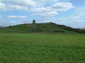
Billinge Hill with its summit tower
|
|
| Highest point | |
| Elevation | 179 m (587 ft) |
| Prominence | 155 m (509 ft) |
| Parent peak | Winter Hill |
| Listing | Marilyn |
| Geography | |
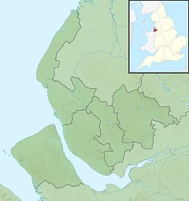
| Location | Billinge, Merseyside, England |
| OS grid | SD525014 |
| Topo map | OS Landranger 108 |
Billinge Hill, also known as Billinge Lump, is the highest point in the Metropolitan Borough of St Helens in North West England. It is also the highest spot in Merseyside. This hill is located in Billinge, within the historic county of Lancashire. It is one of 176 hills in England known as a Marilyn.
What is Billinge Hill?
Billinge Hill is a special type of hill called a "Marilyn." To be a Marilyn, a hill must be at least 150 meters (about 492 feet) high. It also needs to rise at least 150 meters above the lowest point connecting it to any higher peak. This measurement is called "prominence." Billinge Hill meets both of these requirements.
The Beacon Tower
At the very top of Billinge Hill, there is a beacon tower. This tower was built in the 1700s. It was originally a summerhouse for a large estate called Winstanley Hall. The tower was used for special celebrations in the year 2000.
Many people gather at the summit to watch fireworks. You can see displays from towns like Wigan and St Helens. You can also see fireworks from the local village of Rainford. The tower used to have a lot of graffiti, but it has been cleaned. Metal panels now cover the inside of the beacon.
Amazing Views from the Top

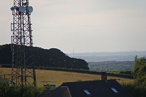
Near Billinge Hill, to the north-west, are several large transmitter masts. These masts use the hill's height to send signals far away. The views from Billinge Hill are very wide.
If the weather is clear, you can see the mountains of Snowdonia in Wales. To the north-east, you can spot Winter Hill. Looking east, you can see the city of Manchester and the Derbyshire Peak District.
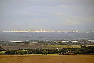
On a clear day, you might even see Blackpool Tower, which is over thirty miles away. You can also see the town of St. Helens and the Widnes-Runcorn bridge. Sometimes, you can even see the large telescope at Jodrell Bank to the south-east.

A Look Back in Time
Billinge Hill was once used by the Royal Observer Corps. This group helped monitor the country during wartime. There was a special underground bunker located about 60 yards west of the beacon.
The beacon itself was used to watch for aircraft during and after the war. The bunker was designed to track important events during a conflict. It would have helped monitor the effects of wartime events over Lancashire. The bunker opened in January 1960 and closed in October 1968.
 | Janet Taylor Pickett |
 | Synthia Saint James |
 | Howardena Pindell |
 | Faith Ringgold |


