Merseyside facts for kids
Quick facts for kids
Merseyside
|
|||||||||||||||||||||||||||||||
|---|---|---|---|---|---|---|---|---|---|---|---|---|---|---|---|---|---|---|---|---|---|---|---|---|---|---|---|---|---|---|---|
|
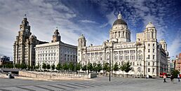
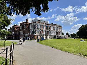
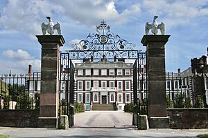
Pictures of Merseyside: Pier Head in Liverpool, Another Place statues at Crosby Beach, and the Roman pavilion in Birkenhead Park.
|
|||||||||||||||||||||||||||||||
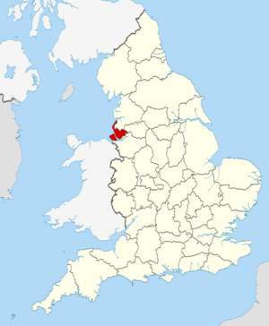
Location of Merseyside within England
|
|||||||||||||||||||||||||||||||
| Sovereign state | United Kingdom | ||||||||||||||||||||||||||||||
| Constituent country | England | ||||||||||||||||||||||||||||||
| Region | North West England | ||||||||||||||||||||||||||||||
| Established | 1 April 1974 | ||||||||||||||||||||||||||||||
| Established by | Local Government Act 1972 | ||||||||||||||||||||||||||||||
| Time zone | UTC±00:00 (Greenwich Mean Time) | ||||||||||||||||||||||||||||||
| • Summer (DST) | UTC+01:00 (British Summer Time) | ||||||||||||||||||||||||||||||
| Members of Parliament | 15 MPs | ||||||||||||||||||||||||||||||
| Police | Merseyside Police | ||||||||||||||||||||||||||||||
| Largest city | Liverpool | ||||||||||||||||||||||||||||||
|
|||||||||||||||||||||||||||||||
Merseyside (pronounced MUR-zee-syde) is a county in North West England. It's known as both a "ceremonial county" (for royal events) and a "metropolitan county" (for local government). It shares borders with Lancashire to the north, Greater Manchester to the east, and Cheshire to the south. To the southwest, it faces Flintshire in Wales across the Dee Estuary, and to the west is the Irish Sea. The biggest city in Merseyside is Liverpool.
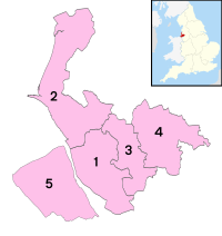
Merseyside is a very built-up area. It covers about 645 square kilometers (249 square miles) and has a population of around 1.42 million people. After Liverpool (with over 550,000 residents), the largest towns are Birkenhead, St Helens, and Southport. For local government, Merseyside is split into five main areas called "metropolitan boroughs": Knowsley, St Helens, Sefton, Wirral, and Liverpool. These boroughs work together as the Liverpool City Region, led by an elected mayor.
Before the Industrial Revolution, the area that is now Merseyside was mostly countryside. But then, Liverpool and Birkenhead grew quickly because of their location on the Mersey Estuary. Liverpool became a huge port, important for trade and supplying cotton. Birkenhead became a center for building ships. During this time, many new things were invented, like the world's first inter-city railway (between Liverpool and Manchester) and the first public park paid for by the government (Birkenhead Park). Merseyside was officially created in 1974. Before that, the Wirral Peninsula was part of Cheshire, and the rest of the county was part of Lancashire.
Merseyside is famous for its sports, music, and culture. The "Merseybeat" music style started here, and many famous bands, including the Beatles, came from this area. The county has several football clubs, including Everton and Liverpool, which play in the top league. Golf courses like Royal Liverpool and Royal Birkdale have hosted major championships. The Grand National horse race, one of Europe's biggest, also takes place here. Merseyside is also home to National Museums Liverpool, which includes nine museums and art galleries.
Contents
History of Merseyside
Merseyside was formed on April 1, 1974. Before this, the areas that make up Merseyside were part of the counties of Lancashire and Cheshire. Some large towns like Birkenhead, Wallasey, Liverpool, Bootle, and St Helens were also independent "county boroughs."
The idea for Merseyside began in the 1960s. The government wanted to reorganize local areas to make them work better. Different plans were suggested for how the new county should look. Eventually, the Local Government Act 1972 decided the final shape of Merseyside.
From 1974 to 1986, Merseyside had a two-level government system. The five local boroughs shared power with the Merseyside County Council. However, in 1986, the government decided to remove the county council. This meant that the five boroughs became more independent, managing their own areas.
Geography of Merseyside
Merseyside is split into two parts by the River Mersey estuary. The Wirral Peninsula is on the west side of the river. The rest of the county is on the east side. The eastern part of Merseyside borders Lancashire to the north and Greater Manchester to the east. Both parts of the county border Cheshire to the south.
The two parts of Merseyside are connected by two Mersey Tunnels for cars. There's also the Wirral line of Merseyrail for trains and the famous Mersey Ferry for passengers.
Green Spaces
Merseyside has many "green belt" areas. These are protected areas of open land that stop towns and cities from growing too much. They are found around the Liverpool urban area and across the Mersey in the Wirral. There are also green spaces near Southport. All the boroughs in Merseyside have some of these important green areas.
Population of Merseyside
Merseyside is home to many people. The population has changed over the years.
| Year | Population |
|---|---|
| 1971 | 1,655,800 |
| 1981 | 1,522,200 |
| 1991 | 1,449,700 |
| 2001 | 1,362,026 |
| 2011 | 1,381,189 |
| 2021 | 1,423,000 |
Economy of Merseyside
Merseyside has a strong economy. Different areas within the county contribute to its overall wealth. The table below shows the economic output (GVA and GDP) for each borough in 2021. GVA stands for Gross Value Added, which measures the value of goods and services produced. GDP stands for Gross Domestic Product.
| District | GVA (£ billions) |
GVA per person (£) |
GDP (£ billions) |
GDP per person (£) |
|---|---|---|---|---|
| Knowsley | £4.0 | £25,927 | £4.6 | £29,407 |
| Liverpool | £14.3 | £29,489 | £15.9 | £32,841 |
| St Helens | £2.8 | £15,448 | £3.4 | £18,803 |
| Sefton | £4.6 | £16,275 | £5.4 | £19,418 |
| Wirral | £5.6 | £17,527 | £6.6 | £20,688 |
| Merseyside (Total) | £31.3 | £22,000 | £36.0 | £25,281 |
Transport in Merseyside
Merseyside has a good transport network, including roads, railways, and sea links.
Roads
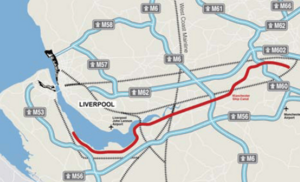
Merseyside is served by several major roads called motorways. These include the M58 to the north, M56 to the south, and the M6 and M62 to the east. The M53 is to the west. The M57 acts as a ring road around Liverpool.
The River Mersey can be crossed using the Queensway Tunnel and Kingsway Tunnel, which connect Liverpool to Birkenhead and Wallasey. There are also bridges like the Silver Jubilee Bridge and Mersey Gateway Bridge that link Runcorn and Widnes. The Mersey Gateway Bridge opened in 2017 to improve travel in the area.
Railways
Liverpool Lime Street is the main train station for long-distance journeys. It connects Merseyside to cities across the UK. Over 10 million passengers used it in 2021–2022.
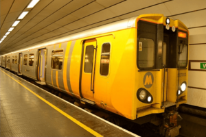
Merseyrail is the local train system for the county. It has 66 stations on two lines: the Northern Line and the Wirral Line. These lines meet in Liverpool City Centre. Liverpool Central is the busiest station on the Merseyrail network. The network also reaches towns outside Merseyside, like Ormskirk and Chester.
Sea Travel
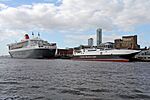
Liverpool Cruise Terminal is where large passenger cruise ships depart from. Cruises from here go to places like Iceland, France, Spain, and Norway. There are plans to build a second cruise terminal.
Ferries
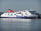
The Pier Head in Liverpool is a departure point for ferries to the Isle of Man during summer. The Twelve Quays ferry port in Birkenhead handles winter ferries to the Isle of Man and services to Belfast, Northern Ireland.
The Mersey Ferry has been running since the 1200s! It connects the Wirral Peninsula to Liverpool City Centre at Seacombe, Woodside, and Pier Head.
Commercial Shipping
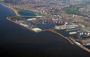
The Port of Liverpool handles most of the commercial ships. The Birkenhead Docks also handle some cargo. The Port of Liverpool is a major container port. It handles over 33 million tonnes of cargo each year and connects to more than 100 places around the world. A second large container terminal, Liverpool2 at Seaforth Dock, opened in 2016. This doubled the port's ability to handle huge ships.
Air Travel
Liverpool John Lennon Airport is Merseyside's international airport. It is located in Speke, southeast of Liverpool city center. In 2020, 5 million people flew from here. Flights are mainly operated by easyJet and Ryanair, serving over 70 destinations, including places in the Near East and North Africa. The airport plans to grow and handle more than 12 million passengers by 2030.
Sports in Merseyside
Merseyside is a big sports hub. It has several professional football clubs, including Everton F.C., Liverpool F.C., and Tranmere Rovers F.C.. There are also many non-league clubs like Marine A.F.C. and Southport F.C..
Golf is very popular here, with famous courses like Royal Liverpool Golf Club and Royal Birkdale Golf Club. The historic Aigburth Cricket Ground hosts cricket matches.
For motor racing, the Aintree Motor Racing Circuit used to host the British Grand Prix. Today, Aintree Racecourse is famous for the Grand National horse race. Haydock Park Racecourse is another important horse racing venue. The Totally Wicked Stadium hosts Rugby League games. Hoylake is a great place for sailing and sand yachting. There's even a ski slope at The Oval (Wirral).
Places to Visit in Merseyside
Liverpool
- Albert Dock
- Anfield (Liverpool F.C. Stadium)
- The Beatles Story Museum
- The Cavern Club
- Chinatown, Liverpool
- Croxteth Hall
- Everton Stadium
- Goodison Park (Everton F.C. Stadium)
- International Slavery Museum
- Liverpool Cathedral (Anglican)
- Liverpool Empire Theatre
- Liverpool John Lennon Airport
- Liverpool Town Hall
- Liverpool Metropolitan Cathedral (Roman Catholic)
- Merseyside Maritime Museum
- Mersey Tunnels – Queensway and Kingsway
- Museum of Liverpool
- Pier Head
- Royal Liver Building
- Sefton Park
- Speke Hall (National Trust)
- St George's Hall
- Tate Liverpool (art gallery)
- Walker Art Gallery
- World Museum Liverpool
Knowsley
- Knowsley Hall
- Knowsley Safari Park
St Helens
- The Dream (sculpture)
- Haydock Park Racecourse
- Totally Wicked Stadium (St Helens Stadium)
- North West Museum of Road Transport
- World of Glass
Sefton
- Aintree Racecourse – Home of the Grand National
- Atkinson Art Gallery and Library
- British Lawnmower Museum, Southport
- Crosby Beach – Home to Another Place (sculpture) by Antony Gormley
- Formby
- Hesketh Park, Southport
- Lord Street, Southport
- Pleasureland Southport
- Royal Birkdale Golf Club
- Seaforth Dock
- Southport Botanic Gardens
- Southport Flower Show
- Southport Pier
Wirral
- Bidston Hill and Bidston Windmill
- Birkenhead Park
- Birkenhead Priory
- Fort Perch Rock
- Hamilton Square
- Hilbre Island
- Lady Lever Art Gallery
- Leasowe Castle and Leasowe Lighthouse
- Port Sunlight
- Prenton Park (Tranmere Rovers F.C. Stadium)
- Royal Liverpool Golf Club
- Williamson Art Gallery and Museum
- Wirral Country Park
See also
 In Spanish: Merseyside para niños
 | Stephanie Wilson |
 | Charles Bolden |
 | Ronald McNair |
 | Frederick D. Gregory |


