St Helens, Merseyside facts for kids
Quick facts for kids St Helens |
|
|---|---|
| Town | |
|
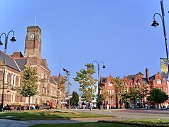
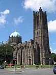
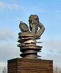
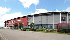
A montage of Victoria Square with the town hall and Gamble Institute; St Mary's Lowe House Catholic Church; the Anderton Shearer Monument and, at the bottom, the Totally Wicked stadium |
|
| Population | 137,332 (2021 Census) |
| OS grid reference | SJ505955 |
| • London | 174 mi (280 km) SE |
| Metropolitan borough |
|
| Metropolitan county | |
| Region | |
| Country | England |
| Sovereign state | United Kingdom |
| Post town | ST. HELENS |
| Postcode district | WA9, WA10, WA11 |
| Dialling code | 01744 |
| Police | Merseyside |
| Fire | Merseyside |
| Ambulance | North West |
| EU Parliament | North West England |
| UK Parliament |
|
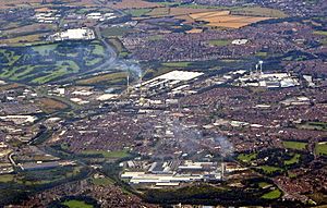
St Helens is a town in Merseyside, England. It has a population of 137,332 people. St Helens is the main town of the Metropolitan Borough of St Helens. It is also the second largest town in the Liverpool City Region.
The town is about 6 miles (10 km) north of the River Mersey. It is in the historic county of Lancashire. St Helens started as a small village in the area of Windle. By the mid-1700s, it grew into a larger town. In 1868, it officially became a borough. Later, in 1974, it became part of the new county of Merseyside.
St Helens was once famous for its heavy industries. These included coal mining, glassmaking, chemicals, and copper smelting. During the Industrial Revolution, these industries helped the town grow a lot. Today, the glass producer Pilkington is one of the few large industrial employers left.
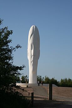
The town is well-known for its Rugby League team, the Saints. They have won the World Club Challenge three times. St Helens also has interesting museums like the North West Museum of Road Transport and the World of Glass. You can also see cool art, like the Dream sculpture.
Contents
History of St Helens
Early Settlements
Long ago, the area of Lancashire where St Helens is now was home to the Brigantes. This was a Celtic tribe. The Romans later took control of this land. The name "Eccleston" in St Helens might come from words meaning "church." This suggests there was a place of worship here a long time ago.
The first recorded settlements were in the 11th century. These were listed in the Domesday Book. The lands of Sutton, Windle, and Parr were part of larger areas. People likely lived here even before these records.
How St Helens Grew
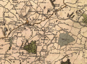
St Helens didn't become a town until the mid-1700s. It grew quickly during the Industrial Revolution. Between 1629 and 1839, it changed from a small group of houses around a chapel to a big town. This town included four main areas: Windle, Eccleston, Parr, and Sutton.
The Domesday Book from 1086 mentions several manors (large estates). But it doesn't specifically name "St Elyn." The area of Windle was first recorded in 1201. Bold was recorded in 1212, and Parr in 1246. The Ecclestone family owned the Eccleston area from around 1100.
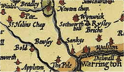
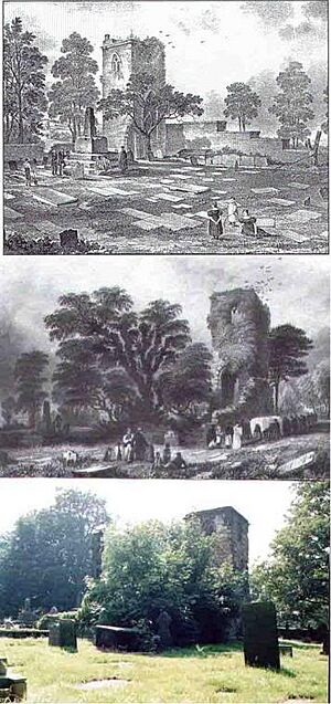
The name "St Helens" comes from a small chapel. This chapel was dedicated to St Elyn. The earliest mention of it is from 1552. It was located where four townships met: Eccleston, Parr, Sutton, and Windle. It was also at a crossroads, connecting towns like Liverpool and Manchester.
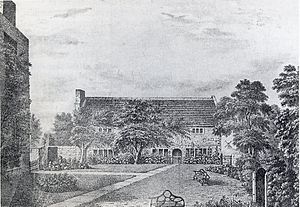
Because it was a busy area, a village likely existed there for centuries. By 1629, there were many houses, farms, and manors nearby. The original chapel was rebuilt around 1618. In 1678, a building was used as a meeting place for the Quakers. This building, the Quaker Friends' Meeting House, is still standing today.
By 1746, St Helens was growing. It was mentioned in Parliament because of plans to extend a road from Liverpool. By 1844, St Helens was described as a "very thriving town." It included the four townships of Sutton, Parr, Windle, and Eccleston.
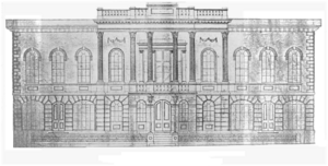
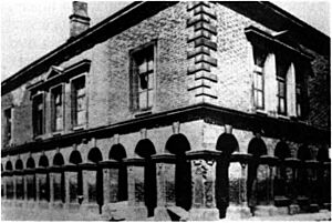
The population of the St Helens area was about 12,500 in 1801. By 1861, it had grown to over 37,000 people. The first Town Hall was built in 1839. It was used for courts, meetings, and public events.
On February 2, 1868, Queen Victoria officially made St Helens a Municipal Borough. This meant it had its own local government. In 1887, it became a County Borough, with even more responsibilities.
In 1974, St Helens became part of the new county of Merseyside. The modern area of St Helens includes towns and villages that weren't originally part of the town.
Industrial Growth
Before the mid-1700s, local industries were small. People wove linen at home, and there were small mines for clay, peat, and coal. Coal was key to St Helens' growth. It led to other industries like copper smelting and glassmaking.
St Helens sits on the South Lancashire Coalfield. The town's old motto was "Ex Terra Lucem" (From the Ground, Light). This showed how important coal was. In the 1970s, local coal mines still employed up to 5,000 men.
Coal was discovered in 1556. The clay and pottery industries also lasted until the early 1900s. Most of the land was used for farming until the 18th century. But then, coal mining took over. Early mining was difficult, with shallow pits that often flooded.
Coal helped the town grow by creating new businesses. It also increased the need for better transport. Coal was sent to Liverpool to power ships and steel works. Raw materials were also brought into St Helens for processing.
The Sankey Canal opened in 1757. It linked St Helens to the River Mersey and Liverpool. This canal helped transport coal from mines to Liverpool. It also brought raw materials to St Helens. This transport revolution brought many industries and jobs to the area.
Glassmaking began in Sutton around 1688. This was because of the local coal, good sand, and salt from nearby Cheshire. The "British Cast Plate Glass Company" started in Ravenhead in 1786. This made the region a leader in glass production.
The invention of the steam engine by James Watt also helped. It allowed mines to dig deeper for more coal. This increased the demand for coal, which St Helens supplied. Wealthy industrialists like John Mackay and the Pilkingtons moved to the area.
Copper smelting was another major industry. The Parys mining company set up near the Sankey Canal. They brought copper ore from Wales to St Helens. Here, coal was used to fire the furnaces.
However, this boom didn't last forever. The American War of Independence (1775–1783) hurt the coal industry. Many smaller businesses failed. But the industry recovered with new partnerships. The demand for chemicals like alkali from the glass industry also led to new businesses.
The Liverpool and Manchester Railway opened in 1830. It passed through the south of St Helens. This further helped the town's economy as an industrial center.
Coal Mining Decline
The last coal mines near St Helens closed between 1947 and 1991. Sutton Manor Colliery, the last one in the immediate area, closed on May 24, 1991. The government said that deep coal mining was no longer profitable.
Miners' unions opposed these closures. But after the Miners' Strike of 1984–85, many towns like St Helens lost their main employers. Some believed that Sutton Manor and Bold Collieries still had 40 years of coal left when they closed. The very last colliery in the wider St Helens area, Parkside, closed in 1993.
Economy
The glass industry is not as big as it once was. But Pilkington Brothers, founded in 1826, still makes all of the UK's flat glass. It employs over a thousand people in St Helens.
In 1994, a new road was built to connect the M62 motorway to the town center. This also led to new shops and businesses in the Ravenhead area.
Shopping in St Helens
The main shopping area is around the parish church of St Helens. There used to be an open market here. Now, the Church Square shopping center surrounds the church. Church Street is the main high street. Another shopping center, The Hardshaw Centre, is also nearby.
St Helens has several supermarkets, including Asda and Tesco. There are also two large retail parks. The Ravenhead Retail Park has many big stores, restaurants, and cafes. A very large Tesco Extra store opened here in 2011.
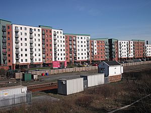
Old industrial land is being redeveloped into hotels, shops, and homes. This is part of a plan to improve the town.
Town Improvements
Since 2000, St Helens has focused on urban regeneration. This means improving the town with help from local groups, businesses, and government funding. The goal is to make St Helens a great place to live, work, and visit.
The "Brand New St Helens" project started in 2007. It showed what had been achieved and planned future developments. These included new college buildings and improvements to schools.
In 2009, St Helens joined the Liverpool City Region. This helps the town work with nearby areas on things like economic growth, transport, and tourism. Local projects like "Re:new St Helens" aim to improve neighborhoods. They work with residents, the council, and police to make changes. These projects have helped improve parks like The Duckeries and Gaskell Park.
Important Buildings
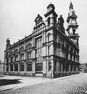
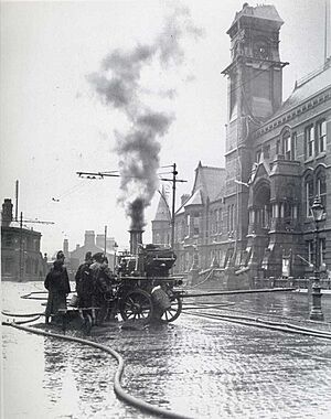
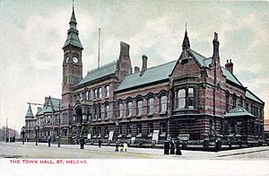
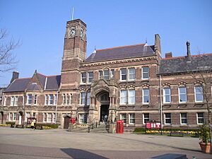
The St Helens Town Hall was built in 1876. It replaced an older one that was damaged by fire. Its clock tower lost its steeple in another fire in 1913.
Next to the Town Hall is the Gamble Institute. Built in 1896, it was named after Sir David Gamble, the first mayor. Today, it's the central library and holds other town offices.
Other notable buildings include:
- The Friends' Meeting House, Church Street. This stone building has been used by Quakers for over 300 years since 1678. It's a Grade II listed building.
- The Beecham Clock Tower, Westfield Street. This was the main office for the Beecham pharmaceutical company. It's now part of St Helens College.
- St Mary's Lowe House Catholic Church, North Road. Opened in 1929, this church has a unique Romanesque and Gothic style. It has a 130-foot (40 m) tower and a large carillon (bells played with a keyboard).
- The Roman Catholic Church of St Anne and Blessed Dominic, Monastery Road, Sutton. This is a special place for Catholics. Blessed Dominic Barberi and Father Ignatius Spencer are buried here.
Geography
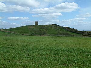
The St Helens Borough covers about 30 square miles (78 km2). It has gentle hills mostly used for farming. The highest point in the borough is Billinge Hill, about 4.5 miles (7 km) north of the town center. From here, you can see Manchester and Liverpool on a clear day.
Carr Mill Dam is the largest body of inland water in Merseyside. It's used for powerboating and fishing. St Helens is about 160 feet (49 m) above sea level.
The Burgies are two large mounds. They were created from waste from glass manufacturing. Now, they are covered with grass and trees.
On November 23, 1981, a tornado hit St Helens town center. It caused some damage.
Location of St Helens
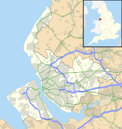
St Helens is located 12 miles (19 km) east of Liverpool and 23 miles (37 km) from Manchester. It shares borders with towns like Prescot, Skelmersdale, Warrington, Widnes, and Wigan. It has good road and rail links. This central location is often highlighted in local promotions.
Transport
Road Travel
St Helens has good motorway connections. The M58 and M62 run to the north and south. The M57 and M6 run to the east and west. The M6 is a few miles east of the town center. The M62 is a couple of miles south.
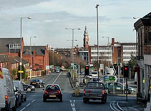
The A580 East Lancashire Road runs north of the town center. It's a dual-carriageway that connects Manchester to the Liverpool Docks. It was built between 1929 and 1934.
The St Helens Linkway opened in 1994. This dual-carriageway connects the town center directly to the M62. In 2020, yellow flowers in a heart shape were planted on the Linkway to remember those who died during the coronavirus pandemic.
In 2010, St Helens was called the "UK's most car-friendly town." This was based on things like petrol prices and parking costs.
Bus Services
Bus services connect St Helens to Wigan, Liverpool, Widnes, and Warrington. The town has a central bus station.
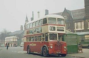
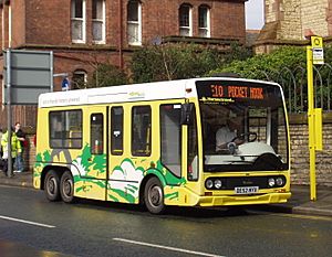
From 1890, St Helens Corporation Transport ran public bus and trolleybus services. After 1974, Merseytravel took over. Today, Arriva operates most bus routes. Smaller companies also run some routes. There used to be free electric minibuses in the town center, but these were stopped in 2014.
Train Travel
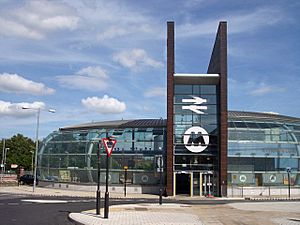
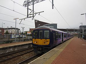
St Helens Central station serves the town center. Other stations like Thatto Heath and Eccleston Park are on the line to Wigan. The Liverpool to Manchester line serves stations like Rainhill and St Helens Junction. These stations were built when the line opened in 1830.
A major upgrade of St Helens Central station was finished in 2007. It cost £6.2 million. The building uses copper, honoring the town's industrial past.
In 2015, the train lines to Manchester and Wigan were electrified. This means electric trains now run on these routes.
Waterways
St Helens is not on the coast. But it has easy access to the ports of Liverpool and Mostyn. The Sankey Canal is no longer used for transporting goods. Parts of it have been drained.
Air Travel
The closest airport is Liverpool John Lennon Airport. It's about 12 miles (19 km) southwest of St Helens. You can get there by bus or by car via the M62.
Manchester Airport is about 25 miles (40 km) away. You can reach it by car via the M62 or by train from St Helens Junction station.
Past Transport Links
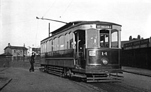
St Helens used to have a big tram and trolleybus system. Trams ran from 1880 to 1936. Trolleybus services started in 1927 and stopped in 1958. The original tram tracks were removed during the war for steel. Today, you can still see some old tram tracks in the Transport Museum.
Governance
How St Helens is Governed
St Helens first became responsible for its wider area in 1836. This was part of a law that gave more control to local parishes. The original Town Hall was built in 1839. It served as a court, meeting place, and administrative center.
In 1868, St Helens became a borough. A new Town Hall was built between 1872 and 1876 after the old one was damaged by fire. In 1889, St Helens became a "county borough." This gave it more power over a larger area.
On April 1, 1974, St Helens became the main town of the Metropolitan Borough of St Helens. This was part of a new law. The St Helens Borough Council now runs all local services in the area.
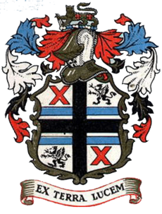
Old Coat of Arms
The old coat of arms for St Helens was given in 1876. It had a white background. The black cross came from the Eccleston family. The "X" shapes were from the Gerards of Windleshaw. The griffins were from the Bold family. Blue bars were from the Parr family. The lion was from the Walmsleys, and the two fleurs-de-lys (flower symbols) honored Sir David Gamble, the first mayor.
This coat of arms is no longer used since 1974. The current council's coat of arms uses parts of this old design.
Town Motto
The old motto was in Latin: "Ex Terra Lucem". This means "From the Ground, Light." It referred to the town's coal resources, which produce light when burned. It also referred to the glass industry, which lets light pass through.
In 1974, the motto changed to "PROSPERITAS IN EXCELSIS" ("Success in the highest"). However, after the 2012 Summer Olympics opening ceremony, the creative writer, Frank Cottrell Boyce, said the St Helens motto inspired the Olympic cauldron. This made people want to bring back "Ex Terra Lucem."
A public vote was held in 2013. The council decided to change back to the original motto, "Ex Terra Lucem." The Coat of Arms stayed the same.
Political Representation
St Helens is represented by two Members of Parliament (MPs) in the UK Parliament. These are for the St Helens South and Whiston and St Helens North areas. Each area sends one MP to Parliament.
In 2015, Conor McGinn (St Helens North) and Marie Rimmer (St Helens South and Whiston) were elected as MPs for the Labour Party. They both kept their seats in the 2019 election. In 2024, David Baines was elected for St Helens North. St Helens is known as a strong Labour area.
Local Council
St Helens is run by the St Helens Metropolitan Borough Council. The Labour Party has mostly been in charge of the council. After the 2022 local elections, the council was made up of:
| Party | Councillors |
|
| Labour Party | 29 | |
| Liberal Democrats | 4 | |
| Conservative Party | 2 | |
| Independents | 7 | |
| Green | 6 | |
Several parish councils also serve St Helens. They help with local duties like street lighting and managing parks.
Demographics
Christianity is the main religion in St Helens. In 2001, about 87% of the population identified as Christian. This made St Helens one of the most Christian towns in Britain at that time.
There are very few ethnic minorities in St Helens. In 2001, 98.84% of the population was White British. The largest ethnic minority group in 2006 was the gypsy and traveler community.
Education
Primary Schools
The Borough of St Helens has many primary schools. It has one nursery school, one infant school, one junior school, and 52 primary schools. There is also one independent school for ages 3–16. Students in St Helens often do better than the national average in Key Stage 1 and 2 tests.
Schools for Special Needs
There are three schools in St Helens for children with special educational needs: Penkford, Mill Green, and Lansbury Bridge.
Secondary Schools
St Helens has nine public secondary schools and one independent school:
- Cowley International College
- De La Salle School
- Hope Academy
- Outwood Academy Haydock
- Rainford High School
- Rainhill High School
- St Augustine of Canterbury Catholic Academy
- St Cuthbert's Catholic High School
- The Sutton Academy
- Tower College
Further Education
After secondary school, students can go to several places for further education. These include:
- Cowley International College
- Rainford High Technology College
- Rainhill High School and Sixth Form Centre
- The Sutton Academy
- Hope Academy
- Carmel College (a sixth form college)
- St Helens College (a college with many courses)
Carmel College is a top college and is linked with the University of Liverpool. St Helens College has a new campus and offers many higher education courses. It also has a University Centre. Many local students go to universities in nearby cities like Liverpool and Manchester. St Helen's Chamber also helps students find apprenticeships.
Media
The local weekly newspaper is the St Helens Star. It comes out every Thursday and is free.
Local news and TV shows are provided by BBC North West and ITV Granada. You can listen to local radio stations like BBC Radio Merseyside and Greatest Hits Radio Wigan & St Helens. There's also an online community radio station called Relax Radio.
Culture and Leisure
Museums to Visit
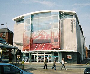
The World of Glass Museum opened in 2000. It includes the Pilkington Glass Museum and the St Helens Local Museum.
The North West Museum of Road Transport is another museum in town. The Smithy Heritage Centre in Eccleston is a small museum about a local blacksmith.
Parks and Green Spaces
St Helens has several large parks and open spaces. These include Taylor Park, which is a historic park opened in 1893. Victoria Park is also near the town center.
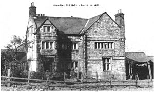
Sherdley Park is a modern park in Sutton. It used to host the St Helens Festival, a big free event.
Parr has Gaskell Park and The Duckeries (or Ashtons Green). It also shares a border with "The Moss" (Colliers Moss) and the "Flash" (fishing ponds). There's a nature walk along the Sankey Valley Country Park.
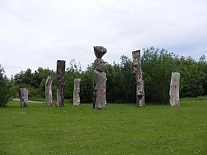
A 20-meter (66 ft) tall sculpture called Dream is located on an old coal mine site in Sutton Manor.
Gaskell Park, Taylor Park, The Duckeries, and King George V Park have all received Green Flag Awards for being well-managed green spaces.
Theatres in St Helens
The Citadel Theatre
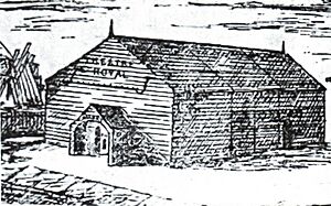
The first Theatre Royal was a wooden building on Bridge Street, opened in 1847. It was later replaced. The Milk Street theatre was bought by the Salvation Army and became the SA Citadel. In 1988, it reopened as The Citadel Arts Centre. It was renovated in 2000. In 2019, it was announced that the Citadel Arts Centre would close.
The Theatre Royal
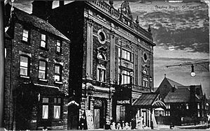
The Theatre Royal on Corporation Street opened in 1889. It was badly damaged by fire in 1901. It was rebuilt by famous theatre architect Frank Matcham. His design was very fancy, with ornate balconies. In the 1960s, the theatre was changed inside. It was refurbished again in 2001.
Today, the theatre hosts touring shows and an annual pantomime. Local groups and schools also perform there.
Sport
Rugby League
Professional Rugby League
St Helens is home to St Helens R.F.C., often called 'Saints'. They play in the British Super League. The club started in 1873. They were one of the first teams in the Rugby Football League in 1895. They used to play at Knowsley Road but moved to the modern Langtree Park stadium in 2012. Saints have a big rivalry with the Wigan Warriors. They are one of the most successful teams in the Super League era.
Amateur Rugby League
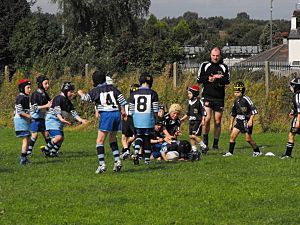
The town has many amateur rugby league teams for both adults and young players. Some well-known teams are Blackbrook A.R.L.F.C., Bold Miners, and Thatto Heath Crusaders. Many of these teams play in local and national competitions. The St Helens R.F.C. Under 18s and 16s teams help train future Saints players.
Rugby Union
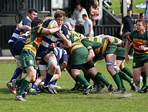
St Helens also has amateur rugby union teams. Liverpool St Helens F.C. is the most famous union team. They claim to be "the oldest open rugby club in the world," started in 1857.
Other local clubs have their own teams, like West Park St Helens and Ruskin Park R.F.C.
Football (Soccer)
St Helens Town FC is an amateur football club. They play in the Liverpool County Premier League. They won the FA Vase in 1987, beating Warrington Town 3-2 at Wembley Stadium.
F.C. St Helens and Pilkington F.C. also play in the North West Counties Football League.
The town used to have its own amateur football league, the St Helens & District Football Combination.
St Helens W.F.C was a successful women's football club. They reached the Women's FA Cup final four times in the 1980s, winning in 1980. Famous players like Sheila Parker played for the club. The club closed in 2006.
Cricket
St Helens has several amateur cricket teams. St Helens Recreation Cricket Club, formed in 1847, is the most senior club now. They play in the Liverpool and District Cricket Competition. Other towns like Sutton and Haydock also have their own cricket clubs.
Other Sports
St Helens used to have an American football team, the St Helens Cardinals. They won the UKAFL Championship in 1987. In 2019, the Cardinals reformed to play in the British Gridiron League.
Greyhound racing took place at two venues in St Helens from 1932 to 2001.
Youth Organizations
Scouts
The Scout movement has been active in St Helens since 1907. The first official Scout Troop opened at the YMCA in 1908. This happened after Robert Baden-Powell, the founder of Scouting, visited St Helens.
In 2007, the District celebrated 100 years of Scouting in the town. The District has its headquarters in Sutton Leach. It owns a special Scout Hut and land for all members to use.
Current Scout Groups
- 1st St Helens (YMCA)
- 1st Knowsley (Earl of Derby's Own)
- Whiston and Huyton
- 2nd St Helens (Eccleston Park)
- 4th St Helens (St Anne's)
- 5th St Helens (Rainhill Open)
- 6th St Helens (Parr)
- 8th St Helens (Sutton Parish)
- 10th St Helens (Rainford)
- 11th St Helens (Toll Bar)
- 13th Knowsley (Huyton Parish Church)
- 15th St Helens (St Andrews)
- 16th St Helens (St Thomas's)
- 18th St Helens (Haydock)
- 21st St Helens (Newton-Le-Willows)
- 23rd St Helens (Eccleston)
- 25th St Helens (Billinge)
- 26th St Helens (Blackbrook)
Cadet Forces
All three military cadet forces have a presence in St Helens:
- 969 (St Helens) Squadron is the local group of the Royal Air Force Air Cadets.
- Merseyside Army Cadet Force has a troop based at Jubilee Barracks.
- The Sea Cadet Corps has Training Ship Scimitar at Mill Street Barracks.
Notable People
Many famous people come from St Helens. These include:
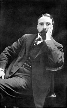
- Thomas Beecham, a famous conductor.
- Dave Watts, a politician.
- Conor McGinn and Marie Rimmer, current Members of Parliament.
- Many famous rugby league players from the St Helens R.F.C. team.
International Links
St Helens is twinned with:
- Chalon-sur-Saône, France
- Stuttgart, Germany
|
See also
 In Spanish: Saint Helens (Merseyside) para niños
 | Precious Adams |
 | Lauren Anderson |
 | Janet Collins |


