Birkdale, Queensland facts for kids
Quick facts for kids BirkdaleRedland City, Queensland |
|||||||||||||||
|---|---|---|---|---|---|---|---|---|---|---|---|---|---|---|---|
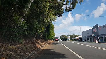
Birkdale Road, 2018
|
|||||||||||||||
| Population | 14,816 (2021 census) | ||||||||||||||
| • Density | 1,235/km2 (3,200/sq mi) | ||||||||||||||
| Postcode(s) | 4159 | ||||||||||||||
| Area | 12.0 km2 (4.6 sq mi) | ||||||||||||||
| Time zone | AEST (UTC+10:00) | ||||||||||||||
| Location |
|
||||||||||||||
| LGA(s) | City of Redland | ||||||||||||||
| State electorate(s) |
|
||||||||||||||
| Federal Division(s) | Bowman | ||||||||||||||
|
|||||||||||||||
Birkdale is a coastal town located in the City of Redland, Queensland, Australia. It's a place where the land meets the sea! In 2021, about 14,816 people called Birkdale home.
Contents
What's Birkdale Like?
Birkdale stretches from Tingalpa Creek in the west, which is the border with Brisbane City, all the way to Wellington Point in the east. To its north are Thorneside and Waterloo Bay, and to its south are Capalaba and Alexandra Hills.
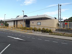
The Cleveland railway line runs through Birkdale, making it easy to travel. The Birkdale railway station is right in the town, connecting it to Brisbane and Cleveland.
Birkdale has some cool features, like a canal-style housing area called Aquatic Paradise. There's also a big shopping area nearby and a retirement village called Wellington Manor.
You might also find the Redlands Waste Transfer Station here. It's a place where residents can take their waste for free, especially to recycle things like green waste and cardboard. This helps keep the environment clean!
Get ready for some exciting news! The Redland Whitewater Centre is being built in the Birkdale Community Precinct. This centre will be used for white-water canoeing events during the 2032 Summer Olympics. How cool is that?
A Look Back at Birkdale's History
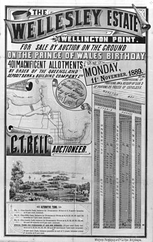
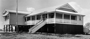
The name Birkdale comes from Birkdale House. This was the home of an early settler and grape farmer named James Baron. When the railway station was built in 1889, they decided to name it after his house.
Another important early landowner in the area was William Thorne.
Birkdale State School first opened its doors on 27 November 1916. It started with just 28 students!
In the 1920s, raising chickens for eggs and meat was a very important industry in Birkdale.
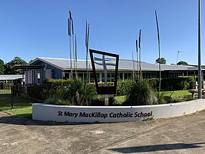
Later, Mary MacKillop Catholic Primary School opened on 20 April 1997. Birkdale South State School also opened on 25 January 1982.
Who Lives in Birkdale?
In 2021, Birkdale had a population of 14,816 people.
A few years earlier, in 2016, there were 14,497 people living here. About 50.8% were female and 49.2% were male. The average age was 39 years old, which is a little older than the national average of 37.
Most people in Birkdale, about 75.2%, were born in Australia. Other countries where people came from included England (5.8%), New Zealand (4.9%), South Africa (1.3%), and the Netherlands (1.2%). Most people (90%) spoke only English at home.
Important Places in Birkdale
There's one special place in Birkdale that is listed for its historical importance. It's the School of Arts Hall, located at 101 Birkdale Road. This building has a rich history!
Learning in Birkdale
Birkdale has several primary schools for younger students:
- Birkdale State School is a government primary school for students from Prep to Year 6. It's located at 74 Agnes Street. In 2018, about 629 students attended this school. It also has a special education program for students who need extra support.
- Birkdale South State School is another government primary school for Prep to Year 6 students. You can find it at 451 Old Cleveland Road East. In 2018, this school had about 583 students. The area around the school used to be small farms but is now mostly homes. This school also offers a special education program.
- St Mary MacKillop Primary School is a Catholic primary school for Prep to Year 6 students. It's located at 10 Hardy Road. In 2018, around 576 students were enrolled here.
Birkdale itself doesn't have any secondary schools. Older students usually go to high schools in nearby areas. These include Wellington Point State High School in Wellington Point or Alexandra Hills State High School in Alexandra Hills.
Getting Around Birkdale
The Birkdale railway station is a key way to travel. It offers regular train services that connect Birkdale to Brisbane and Cleveland.
Sports and Fun in Birkdale
Birkdale is home to several sports clubs where you can get active:
- Birkdale Mud Crabs Cricket Club
- Bayside Ravens Gridiron Club
- Redlands Rugby Union Club
There's also a youth group for young people:
- Birkdale Scout Group
Parks and Green Spaces
Birkdale has many parks and green areas where you can relax and play:
- Aquatic Paradise Park
- Bailey Road Park
- Birkdale Bushland Refuge
- Birkdale Fodder Forest
- Bynd Road Park
- Byng Road Park
- Creek Road Park
- Howeston Golf Course
- Judy Holt Sportsfield
- Mary Street Park
- Pine Forest Park
- Pitstachio Court Park
- Quarry Road Park
- Tarradarrapin Wetlands
- The Frederick Radunza Reserve
- Three Paddocks Park
- Tingalpa Creek Reserve
- Valantine Park
- William Taylor Park
Birkdale's Weather
Birkdale has a humid subtropical climate. This means it has hot, humid summers and mild winters. From November to March, thunderstorms are common. Sometimes, these storms can be quite strong, bringing large hail, heavy rain, and strong winds.
| Climate data for Redlands | |||||||||||||
|---|---|---|---|---|---|---|---|---|---|---|---|---|---|
| Month | Jan | Feb | Mar | Apr | May | Jun | Jul | Aug | Sep | Oct | Nov | Dec | Year |
| Record high °C (°F) | 37.5 (99.5) |
38.2 (100.8) |
35.6 (96.1) |
32.7 (90.9) |
29.3 (84.7) |
25.9 (78.6) |
27.4 (81.3) |
31.6 (88.9) |
33.4 (92.1) |
35.1 (95.2) |
36.6 (97.9) |
36.6 (97.9) |
38.2 (100.8) |
| Mean daily maximum °C (°F) | 28.9 (84.0) |
28.6 (83.5) |
27.7 (81.9) |
25.9 (78.6) |
23.3 (73.9) |
21.0 (69.8) |
20.5 (68.9) |
21.5 (70.7) |
23.6 (74.5) |
25.3 (77.5) |
26.8 (80.2) |
28.2 (82.8) |
25.1 (77.2) |
| Mean daily minimum °C (°F) | 19.9 (67.8) |
20.0 (68.0) |
18.6 (65.5) |
15.7 (60.3) |
12.5 (54.5) |
9.7 (49.5) |
8.2 (46.8) |
8.3 (46.9) |
11.0 (51.8) |
14.2 (57.6) |
16.7 (62.1) |
18.7 (65.7) |
14.5 (58.1) |
| Record low °C (°F) | 9.5 (49.1) |
13.0 (55.4) |
10.9 (51.6) |
5.0 (41.0) |
2.3 (36.1) |
1.0 (33.8) |
0.0 (32.0) |
0.1 (32.2) |
2.6 (36.7) |
4.2 (39.6) |
5.7 (42.3) |
9.2 (48.6) |
0.0 (32.0) |
| Average precipitation mm (inches) | 154.3 (6.07) |
161.5 (6.36) |
163.2 (6.43) |
105.7 (4.16) |
113.2 (4.46) |
87.6 (3.45) |
61.8 (2.43) |
52.4 (2.06) |
39.1 (1.54) |
84.0 (3.31) |
104.5 (4.11) |
143.7 (5.66) |
1,269.1 (49.96) |
| Average precipitation days | 11.5 | 12.9 | 12.8 | 11.3 | 10.2 | 8.1 | 7.2 | 6.2 | 7.0 | 9.1 | 10.2 | 10.7 | 117.2 |
| Source: Bureau of Meteorology | |||||||||||||
Famous People from Birkdale
Birkdale has been home to some well-known individuals:
- Peter Airley (1865-1950): A school teacher, politician, and writer.
- Wally Lewis (born 1959): A famous Rugby League player and sports presenter, often called "The King" in rugby league.
- Mirusia Louwerse (born 1985): A talented opera singer.
- George Randall (1843-1930): A person who made sweets, helped people move to Australia, and grew fruit.
 | James Van Der Zee |
 | Alma Thomas |
 | Ellis Wilson |
 | Margaret Taylor-Burroughs |


