Capalaba, Queensland facts for kids
Quick facts for kids CapalabaRedland City, Queensland |
|||||||||||||||
|---|---|---|---|---|---|---|---|---|---|---|---|---|---|---|---|
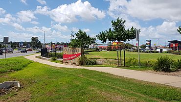
Intersection opposite Capalaba Park, 2018
|
|||||||||||||||
| Postcode(s) | 4157 | ||||||||||||||
| Area | 18.7 km2 (7.2 sq mi) | ||||||||||||||
| Time zone | AEST (UTC+10:00) | ||||||||||||||
| Location |
|
||||||||||||||
| LGA(s) | Redland City | ||||||||||||||
| State electorate(s) | Capalaba | ||||||||||||||
| Federal Division(s) | Bowman | ||||||||||||||
|
|||||||||||||||
Capalaba is a lively area located in the City of Redland, Queensland, Australia. It's a busy place with lots of shops and businesses. In 2021, about 18,002 people called Capalaba home.
Contents
Exploring Capalaba's Location
Capalaba is a big suburb with many shopping centers. It has two large malls and a main bus station. You'll also find light industrial areas here. These are surrounded by natural bushland and homes. It's the second most populated suburb in the Redlands area.
Capalaba is bordered by other suburbs like Alexandra Hills and Birkdale. It also touches parts of Brisbane, like Burbank and Chandler.
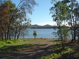
The Tingalpa Creek forms a natural boundary. It separates Capalaba in Redland City from the City of Brisbane. This makes Capalaba a key entry point to the coastal Redlands region for people coming from Brisbane. The Leslie Harrison Dam is also located on Tingalpa Creek.
Capalaba's Past: A Quick Look
The name Capalaba comes from the Indigenous Yugarabul language. It means "ringtail possum," which is a small animal that lives in the area.
European settlers started arriving in the 1850s. They were mostly farmers, lumberjacks, and people who ran sawmills.
The town was first surveyed in 1863 and called Tingalpa. But in 1927, its name was changed to Capalaba. The original town was on the west side of Tingalpa Creek. This area is now part of Chandler.
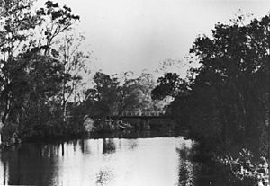
There was a crossing point on the creek called The Rocks Crossing. It was part of the main road from Brisbane to Cleveland. Later, in 1874, a bridge was built over the creek.
Early Schools and Growth
In the early days, the community had three small settlements. People wanted a school, but they couldn't agree on where to build it. A temporary school opened in 1874 in a wooden shed.
Finally, in 1880, Capalaba State School opened. It started with 22 students. However, student numbers dropped when the sawmills closed. Also, a new railway line in 1889 meant Capalaba was no longer on the main route to Cleveland. This made the local economy slow down.
The school even closed for a short time in 1922. But local people pushed for it to reopen, and it did in 1924. During the Great Depression in the 1930s, more people moved to Capalaba. They were looking for cheaper homes. This helped the school get enough students to stay open.
In 2005, Capalaba State School joined with Capalaba State High School. They formed the Capalaba State College.
Changing Names and New Ideas
The town was officially called Tingalpa for a while. But this caused confusion because there was another area with the same name. So, in 1927, the town's name was officially changed to Capalaba. This was the name people were already using.
In 1955, Queensland's very first drive-in movie theatre opened in Capalaba. It was a popular spot! But in 1979, it closed to make way for the new Capalaba Park Shopping Centre. The drive-in moved to a new location in 1980 but closed for good in 1997.
Modern Development
The Leslie Harrison Dam was finished in 1968. It provided a lot of fresh water for the Redland Shire. This led to a lot of new homes, shops, and businesses being built in the 1970s.
As the area grew, Capalaba was split into two suburbs. Capalaba stayed in Redland Shire (east of the creek). The area to the west of the creek became Capalaba West. This part was in the City of Brisbane. In 2010, Capalaba West became part of the Brisbane suburb of Chandler.
Capalaba Park Shopping Centre opened in 1981. It was built on the site of the first drive-in theatre. The shopping center has grown over the years.
Who Lives in Capalaba?
In 2021, Capalaba had a population of 18,002 people.
In 2016, about 17,333 people lived in Capalaba. Almost half were female (50.4%) and half were male (49.6%). The average age was 37 years old.
Most people (74.4%) living in Capalaba were born in Australia. Other countries of birth included New Zealand (6.6%), England (4.4%), and South Africa (1.0%).
Most people (87.7%) speak English at home. Other languages spoken include Mandarin Chinese, Hindi, and Tagalog.
Special Places in Capalaba
Capalaba has some places that are important to its history:
- The Rocks Crossing: This was an old crossing point over Tingalpa Creek, off Old Cleveland Road.
- Tallowwood Tree: A very old tree (over 400 years old) on the Indigiscapes' Tallowood View Trail at 17 Runnymede Road.
Learning in Capalaba
Capalaba has several schools for young people:
- Coolnwynpin State School: This is a government primary school for students from Prep to Year 6. It's located at 6 Telaska Court.
- St Luke's Catholic Parish School: This is a Catholic primary school for students from Prep to Year 6. You can find it at 45 Degen Road.
- Capalaba State College: This is a government school that covers both primary and secondary education, from Early Childhood to Year 12. It's on School Road.
- Turning Point Positive Learning Centre: This school helps students from Year 5 to 10 who need extra support. It aims to help them return to a regular classroom or learn job skills.
Things to Do and See in Capalaba
Capalaba is a great place for shopping and community activities:
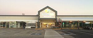
- Capalaba Park Shopping Centre: A large shopping mall located where Redland Bay Road, Moreton Bay Road, and Mount Cotton Road meet.
- Capalaba Central Shopping Centre: Another big shopping center at 38-62 Moreton Bay Road. It has an Event Cinemas movie theatre.
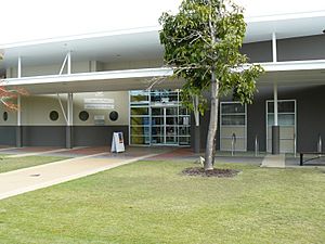
- Capalaba Library: The Capalaba Library is run by the Redland City Council. It's at 14 Noleen Street and has a council service center next to it.
- Redlands IndigiScapes Centre: This is a special place at 17 Runnymede Road where you can learn about the environment.
- Capalaba Uniting Church: A church located at 30 Ney Road.
Capalaba also has many parks where you can play and relax. Some of these include:
- Bowen Street Park
- Capalaba Regional Park
- Chatsworth Circuit Park
- Coolnwynpin Nature Refuge
- Maridale Park
- Sam Sciacca Sportsfield
Events in Capalaba
The College Markets are held every Sunday morning on School Road. These markets are a great place to find local goods and enjoy the community atmosphere.
Getting Around Capalaba
The Capalaba bus station is a major transport hub. It connects Capalaba to many parts of the Redlands and Eastern Brisbane. You can catch buses to places like Garden City bus station and Carindale bus station. There are also routes that go to the Brisbane central business district.
Major roads like Old Cleveland Road and Mount Gravatt-Capalaba Road also pass through Capalaba. These roads connect the suburb to the City of Brisbane and the Gateway Motorway.
Sports in Capalaba
Capalaba has several sports clubs for those who love to be active:
- Capalaba Sports Club
- Capalaba District Junior Rugby League Football Club (known as the Capalaba Warriors)
- Capalaba Football Club (formerly the Capalaba Bulldogs), who play in the National Premier Leagues Queensland
 | James B. Knighten |
 | Azellia White |
 | Willa Brown |


