Burbank, Queensland facts for kids
Quick facts for kids BurbankBrisbane, Queensland |
|||||||||||||||
|---|---|---|---|---|---|---|---|---|---|---|---|---|---|---|---|

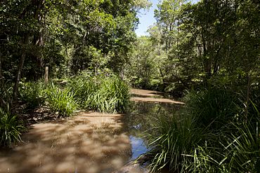
Waterway in Brisbane Koala Bushlands, 2012
|
|||||||||||||||
| Population | 1,051 (2021 census) | ||||||||||||||
| • Density | 34.69/km2 (89.8/sq mi) | ||||||||||||||
| Postcode(s) | 4156 | ||||||||||||||
| Area | 30.3 km2 (11.7 sq mi) | ||||||||||||||
| Time zone | AEST (UTC+10:00) | ||||||||||||||
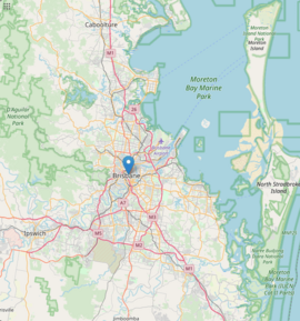
| Location | 18.6 km (12 mi) SE of Brisbane CBD | ||||||||||||||
| LGA(s) | City of Brisbane (Chandler Ward) |
||||||||||||||
| State electorate(s) | Mansfield | ||||||||||||||
| Federal Division(s) | Bonner | ||||||||||||||
|
|||||||||||||||
Burbank is a green and spacious suburb located in the City of Brisbane, Queensland, Australia. It's known for its large blocks of land and natural areas. In 2021, Burbank was home to 1,051 people.
Contents
Exploring Burbank's Landscape

Burbank is an outer suburb of Brisbane. It shares borders with the City of Redland to the east and the City of Logan to the south. The suburb's eastern edge is defined by Tingalpa Creek. Because of this creek, Burbank was once known as Upper Tingalpa until 1976.
The main road that runs through Burbank is Mount Gravatt-Capalaba Road. You'll find a mix of working farms and hobby farms here. There are also businesses that grow palm trees and turf (grass). Burbank has several churches and temples, and there's also a Jewish school. There are no shops within the suburb itself, and public transport options are limited.
A big part of Burbank's landscape is shaped by the Leslie Harrison Dam. This dam was built in the late 1960s and creates the Tingalpa Reservoir on Tingalpa Creek. The dam used to provide water for people in Redland City. Now, it's connected to a larger water supply network for the region. To protect the water quality, the number of houses in the area around the dam is kept low.
Burbank's Past and Present
Burbank was originally called Upper Tingalpa. The suburb got its current name from Alfred Harry Burbank. He was a surveyor and farmer who lived in the area from 1890 to 1908. His son, Frank Burbank, was a local horse breeder and timber-getter who stayed in the area until the 1950s. Burbank was officially named on June 1, 1976.
A private school called Sinai College opened its doors in Burbank on January 29, 1990.
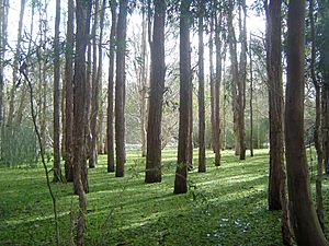
Since 1990, the Brisbane City Council has been buying undeveloped land in Burbank. This is part of a plan to create more nature reserves. One important area is the Brisbane Koala Bushlands. This park helps protect koalas and has special visitor facilities and boardwalks on Ford Road. Another park, JC Trotter Memorial Park, is next to the Tingalpa Reservoir. These parks are important because they protect koala habitats and help koalas move safely through the area. Experts believe that 3,000 to 5,000 koalas live in southeast Brisbane.
In 2008, a private property in Burbank became the first to be protected as a conservation area. This was part of an agreement with the Brisbane City Council. The goal is to restore 40% of Brisbane's land to natural habitat by 2026.
Who Lives in Burbank?
Burbank has not been divided into many small housing blocks. This helps keep the number of people living there low. In 2009, Burbank had one of the highest average house prices in Australia.
In 2008, information from the Australian census showed something interesting. Burbank had the most households with three cars in Brisbane, at 40%. Also, people who live in Burbank tend to stay there for a long time. In 2010, residents had lived in the suburb for an average of 13 years. This was one of the longest average stays in Brisbane.
In 2016, Burbank had a population of 1,050 people. By 2021, the population had slightly increased to 1,051 people.
Learning in Burbank
Sinai College is a private primary school in Burbank. It teaches students from Prep to Year 6. The school is located at 20 Moxon Road (27°33′21″S 153°08′41″E / 27.5558°S 153.1448°E). In 2018, it had 30 students and 5 teachers.
There are no government schools directly in Burbank. However, there are several public primary schools nearby. These include Mackenzie State Primary School in Mackenzie and Rochedale State School in Rochedale. For high school, students can attend Mansfield State High School in Mansfield or Rochedale State High School in Rochedale.
Parks and Green Spaces
Burbank is home to many parks and green areas for residents to enjoy. Here are some of them:
- Alperton Road Park (27°34′21″S 153°09′22″E / 27.5724°S 153.1560°E)
- Ford Road Park (27°35′25″S 153°09′14″E / 27.5902°S 153.1539°E)
- J.C. Trotter Memorial Park (27°33′09″S 153°10′18″E / 27.5525°S 153.1716°E)
- Leacroft Road Park (27°34′14″S 153°10′22″E / 27.5705°S 153.1729°E)
- Longton Court Park (no.100) (27°35′21″S 153°10′10″E / 27.5891°S 153.1694°E)
- Mt Petrie Recreation Reserve (27°32′50″S 153°08′12″E / 27.5472°S 153.1366°E)
- Prout Road (485) Park (27°31′57″S 153°09′30″E / 27.5325°S 153.1582°E)
- Prout Road Park (27°32′11″S 153°08′51″E / 27.5365°S 153.1476°E)
- Suzette Street Park (27°33′26″S 153°10′43″E / 27.5572°S 153.1786°E)
- Upfield Street Park (27°33′25″S 153°09′04″E / 27.5569°S 153.1511°E)
 | Percy Lavon Julian |
 | Katherine Johnson |
 | George Washington Carver |
 | Annie Easley |


