
Bishop Monkton Ings facts for kids
| Site of Special Scientific Interest | |
.JPG)
Woodland carr in Bishop Monkton Ings
|
|
| Area of Search | North Yorkshire |
|---|---|
| Coordinates | 54°05′16″N 1°28′27″W / 54.0878°N 1.4741°W |
| Interest | Biological |
| Area | 37.788 hectares (0.378 km2; 0.146 sq mi) |
| Notification | 1 October 1986 |
| Location map | Magic Map (Defra) |
Bishop Monkton Ings is a special nature area in North Yorkshire, England. It's known as a Site of Special Scientific Interest (SSSI). This means it's a protected place because of its unique plants, animals, or geology.
This area is mostly made up of marshy grasslands. It also has some broadleaved woodlands and fen areas. Fens are like wet, spongy lands, often with reeds. Two small rivers flow through the site. This mix of wet habitats creates a home for many different kinds of plants, including the interesting marsh lousewort.
Contents
What is an Ings?
.JPG)
The word "ings" comes from an old language called Norse. It means a water meadow or a marshy area. This word came into the English language a long time ago. You can find it in many place names, especially in areas like Yorkshire, Cumbria, and Lincolnshire.
Long ago, in 1807, parts of this land were sold. At that time, it was described as a meadow. Later, in 1862, a farmer named George Heath was using some of the land. It was called "Ings Close" and had a small area of willow trees. By 1883, the land was known as "Ings Field." It was described as rich grassland with a drain running through it.
Why is Bishop Monkton Ings Special?
.JPG)
Bishop Monkton Ings is a large Site of Special Scientific Interest (SSSI). It covers about 37.788 hectares (which is about 93 acres). It's located south of Ripon in North Yorkshire.
You can visit the site by walking along a public footpath called Ings Lane. This path starts from Bishop Monkton village. The path can be quite muddy, and it's also part of the Ripon Rowel Walk. There are no roads for cars or special facilities for visitors at the site.
Two small rivers, Holbeck and Ings Drain, flow through the area. The site has different types of habitats. These include deciduous woodlands, which are forests where trees lose their leaves in autumn. It also has marshy grasslands that often flood in winter. These areas are full of different plant species. There are also fen areas along the rivers.
The site was officially named an SSSI on 1 October 1986. It was chosen because it has so many different kinds of wetland habitats. Wetlands like this used to be common, but many have been lost. They are often drained for farming or building. Protecting Bishop Monkton Ings helps save this important natural environment.
Plants and Animals at Bishop Monkton Ings
Note: Unless we say otherwise, the pictures of plants and animals in this article are just examples. They might not have been taken at this exact location.
Amazing Plants
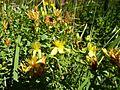
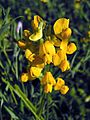
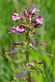
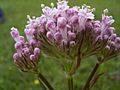
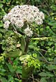
The marshy grasslands here get flooded in winter. This helps many different plants to grow. You can find plants like greater bird's foot trefoil and square stalked St John's wort. Other flowers include meadow vetchling, tufted vetch, and ragged robin. You might also see great burnet, wild angelica, and common valerian. More common plants are marsh marigold and meadowsweet. Different types of rushes and lesser pond sedge also grow here.
-
Square stalked St John's wort
-
Meadow vetchling
-
Ragged robin


_-_geograph.org.uk_-_1143992.jpg)
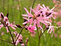
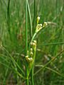
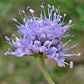
Near the natural springs, the water has special minerals from the ground. These minerals help certain plants to thrive. Here you can find marsh lousewort and marsh valerian. Other plants include carnation sedge, glaucous sedge, and common sedge. You might also spot brown sedge and black bogrush. The most common plant in these areas is the blunt-flowered rush.
-
Marsh lousewort
-
Marsh valerian
-
Carnation sedge
-
Glaucous sedge
-
Black bogrush
-
Blunt-flowered rush


_02.JPG)


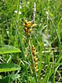
In the southern part of the site, there's higher ground with different soil. Here, you'll find plants like bugle and great burnet. Other flowers include sneezewort, devil's bit scabious, and pignut. Creeping buttercup also grows here. These flowers grow among grasses such as tufted hair grass, Yorkshire fog, and sweet vernal grass.
-
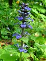
Bugle
-
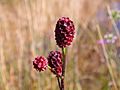
Great burnet
-
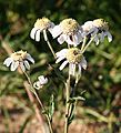
Sneezewort
-
Devil's bit scabious


.jpg)


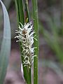
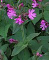
There are three areas of deciduous woodland at the site. In the dampest spots under the trees, you'll find wild angelica and meadowsweet. On slightly higher, drier ground, plants like wood avens, red campion, and dog's mercury grow. Guelder rose is also common here. The trees in these woodlands include bay willow, crack willow, ash, and alder.
-
Wild angelica
-
Red campion
-
Dog's mercury
-
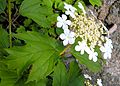
Guelder rose


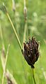
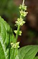
The fen areas along the rivers are also very important habitats. Here, you can see reed canary grass and reed sweet grass. The tall reed Phragmites australis also grows in these wet places.
-
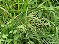
Reed sweet grass


.JPG)
Wildlife
The fen areas are also home to various birds. Common snipe and curlew are two types of wading birds that build their nests and raise their young here. You might also spot tracks of animals like Roe deer in the muddy areas.
-
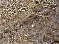
Roe deer tracks, at Bishop Monkton Ings


.JPG)
Looking After the Site
To keep the grassland healthy and full of different plants, the site needs to be grazed. This means that animals like cattle, ponies, or hill sheep eat some of the grass each year. This grazing usually happens from late spring to early autumn. It helps stop tall grasses and dead plants from taking over. If these grow too much, they can block sunlight and stop smaller, weaker plants from growing.
It's also important to keep the existing drains working well. Some areas of scrub (small bushes) and hedges should also be kept. Changes to the drainage system are strongly discouraged. Using fertilizers, herbicides (weed killers), or pesticides (insect killers) is also not allowed. These chemicals would harm the natural balance and variety of plants and animals living at Bishop Monkton Ings.
Images for kids
-
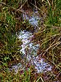
The bog water here has a natural oily sheen
.JPG)
