Black Mountains (Nevada) facts for kids
Quick facts for kids Black Mountains |
|
|---|---|
| Highest point | |
| Peak | Hamblin Mountain |
| Elevation | 3,310 ft (1,010 m) |
| Geography | |
| Country | United States |
| State | Nevada |
| County | Clark |
| Range coordinates | 36°12′55.930″N 114°28′31.917″W / 36.21553611°N 114.47553250°W |
| Topo map | USGS Middle Point |
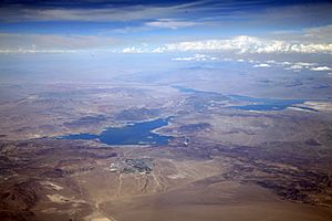
The Black Mountains are a group of tough, dry, and rocky mountains in Nevada. They were formed a very long time ago from volcanoes. These mountains reach heights of up to 3,310 feet (about 1,009 meters).
You can find the Black Mountains on the north side of Lake Mead. They are near the southwest part of the Overton Arm of the lake. This area is about 25 miles (40 km) south of a town called Overton, Nevada.
Most of the Black Mountains are inside the Lake Mead National Recreation Area. There's a small valley called Bitter Spring Valley next to them. This valley is southeast of the dry Muddy Mountains.
The mountains have many deep canyons and dry riverbeds. These flow southeast into the Overton Arm of Lake Mead. The rocks in the range contain soft deposits of manganese.
History of the Black Mountains
A famous old trade route, the Old Spanish National Historic Trail, once passed through this area. This part of the trail was called the Armijo Route. It followed the valleys that are now covered by Lake Mead.
The trail went down the Colorado River from the Virgin River. It avoided a tricky area called Boulder Canyon. This canyon is southwest of the Black Mountains. Here, the Nevada Black Mountains are separated from the Black Mountains in Arizona.
The trail then headed west towards Las Vegas Wash. It entered the mountains, going southwest of Pyramid Peak. Then it went to Pinto Valley. After that, it went around the south side of Hamblin Mountain. North of this path were Pinto Ridge and Razorback Ridge. The trail also passed by Cottonwood Spring.
North of these ridges is a wide, dry valley called Bitter Springs Valley. This valley is next to the Muddy Mountains. The trail followed the southern part of the mountain range on its western side. It circled around Hamblin Mountain and went down Callville Wash. Today, the southwestern end of the Black Mountains is at Callville Bay. In the past, the trail led to the lowlands along the Colorado River. This path continued towards Las Vegas Wash.
How to Visit the Black Mountains
You can get to the northwest and north parts of the Black Mountains by car. There's a paved road called North Shore Road. It starts from Nevada State Route 564 in Henderson, Nevada. Henderson is about 30 miles (48 km) to the south-southwest.

 | Isaac Myers |
 | D. Hamilton Jackson |
 | A. Philip Randolph |


