Blanding, Utah facts for kids
Quick facts for kids
Blanding, Utah
|
|
|---|---|

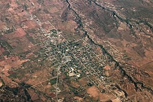
Aerial view of Blanding
|
|
| Motto(s):
Basecamp to Adventure
|
|

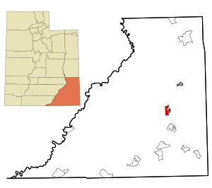
Location in San Juan County and the state of Utah.
|
|
| Country | United States |
| State | Utah |
| County | San Juan |
| Founded | 1905 |
| Founded by | Walter C. Lyman |
| Named for | Amelia Blanding Bicknell |
| Area | |
| • Total | 13.22 sq mi (34.23 km2) |
| • Land | 13.18 sq mi (34.13 km2) |
| • Water | 0.04 sq mi (0.11 km2) |
| Elevation | 6,099 ft (1,859 m) |
| Population
(2020)
|
|
| • Total | 3,394 |
| • Density | 275.73/sq mi (106.46/km2) |
| Time zone | UTC-7 (MST) |
| • Summer (DST) | UTC-6 (MDT) |
| ZIP code |
84511
|
| Area code | 435 |
| FIPS code | 49-06370 |
| GNIS feature ID | 2409863 |
Blanding (pronounced BLAN-ding) is a city located in San Juan County, Utah, United States. In 2020, about 3,394 people lived there, making it the largest city in San Juan County.
Blanding was first settled in the late 1800s by Mormon pioneers. Many of these settlers came from the famous Hole-In-The-Rock journey. The city's economy relies on things like mining, farming, local businesses, and tourism.
Blanding is close to the Navajo and White Mesa Ute Native American lands. Many people in Blanding have family connections to these cultures. The city is also a great starting point for exploring many natural and historical sites. These include The Dinosaur Museum, Natural Bridges National Monument, Monument Valley, and the Four Corners area. You can also visit Glen Canyon National Recreation Area (Lake Powell), Cedar Mesa wilderness, the San Juan River (including Goosenecks State Park), and the Needles district of Canyonlands National Park. It's about an hour south of Moab and Arches National Park.
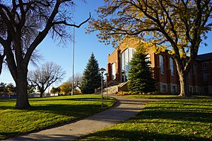
Blanding is also home to one of the regional campuses of Utah State University.
Contents
Discovering Blanding's Past
How Blanding Got Its Name
Blanding was originally called Grayson. It was named after Nellie Grayson Lyman, who was the wife of an early settler named Joseph Lyman.
In 1914, the town's name changed. A rich person from the eastern U.S., Thomas W. Bicknell, offered a thousand books to any town that would take his name. Grayson competed with another Utah town, Thurber (which became Bicknell). Grayson decided to rename itself Blanding after Bicknell's wife's maiden name, Amelia Blanding Bicknell. Both towns then received 500 books each.
Who Lives in Blanding?
Blanding's Growing Population
Blanding has grown quite a bit since it was first settled. Here's how its population has changed over the years:
| Historical population | |||
|---|---|---|---|
| Census | Pop. | %± | |
| 1910 | 385 | — | |
| 1920 | 1,072 | 178.4% | |
| 1930 | 1,001 | −6.6% | |
| 1940 | 1,438 | 43.7% | |
| 1950 | 1,177 | −18.2% | |
| 1960 | 1,805 | 53.4% | |
| 1970 | 2,250 | 24.7% | |
| 1980 | 3,118 | 38.6% | |
| 1990 | 3,162 | 1.4% | |
| 2000 | 3,162 | 0.0% | |
| 2010 | 3,375 | 6.7% | |
| 2020 | 3,394 | 0.6% | |
| U.S. Decennial Census | |||
A Look at Blanding's Community
In 2010, there were 3,375 people living in Blanding. About 1,013 households called the city home. Many of these households were families.
The people living in Blanding come from different backgrounds. About 66% of the population was White, and nearly 30% were Native American. A small percentage of people were from other racial groups or had mixed heritage. About 4% of the population was of Hispanic or Latino background.
Many households in Blanding had children under 18 living with them. The average household had about three people. The average family had almost four people. The median age in Blanding was about 26.6 years old. This means half the people were younger than 26.6, and half were older.
Learning in Blanding
Schools and Higher Education
The San Juan School District manages the public schools in Blanding. Students attend:
- Blanding Elementary School
- Albert R. Lyman Middle School
- San Juan High School
For those who want to continue their education after high school, Utah State University has a campus right in Blanding.
Where is Blanding Located?
Blanding's Place on the Map
Blanding is found in the Four Corners area of the Colorado Plateau. This is where the borders of Utah, Colorado, Arizona, and New Mexico meet.
The city covers a total area of about 2.4 square miles (6.1 square kilometers). All of this area is land.
See also
 In Spanish: Blanding (Utah) para niños


