
Boothbay Harbor, Maine facts for kids
Quick facts for kids
Boothbay Harbor
|
||
|---|---|---|

Boothbay Harbor aerial photo
|
||
|
||

Location in Lincoln County and the state of Maine
|
||
| Country | United States | |
| State | Maine | |
| County | Lincoln | |
| Incorporated | 1889 | |
| Area | ||
| • Total | 9.22 sq mi (23.87 km2) | |
| • Land | 5.70 sq mi (14.76 km2) | |
| • Water | 3.52 sq mi (9.11 km2) | |
| Elevation | 40 ft (10 m) | |
| Population
(2020)
|
||
| • Total | 2,027 | |
| • Density | 380/sq mi (146.7/km2) | |
| Time zone | UTC-5 (Eastern (EST)) | |
| • Summer (DST) | UTC-4 (EDT) | |
| ZIP Codes |
04538 (Boothbay Harbor)
04575 (West Boothbay Harbor) 04549 (Isle of Springs) |
|
| Area code(s) | 207 | |
| FIPS code | 23-015-06120 | |
| GNIS feature ID | 0582359 | |

Boothbay Harbor is a small town in Lincoln County, Maine, in the United States. In 2020, about 2,027 people lived there. It includes several areas like Mount Pisgah, Sprucewold, and the villages of Bayville and West Boothbay Harbor. The Isle of Springs is also part of the town.
Boothbay Harbor is a very popular place for yachting and tourism, especially during the summer. It is surrounded by the larger town of Boothbay.
Contents
History of Boothbay Harbor
The native Abenaki people called this area Winnegance. The first Europeans arrived in 1623. They were English fishermen who set up a small outpost called Cape Newagen. In 1666, an Englishman named Henry Curtis bought land from the Abenaki leader Mowhotiwormet.
Early Conflicts and Abandonment
The English settlers were forced to leave twice. The first time was in 1676 during King Philip's War. They returned after the war. Then, in 1689, during King William's War, they were driven out again. Winnegance was left empty for 40 years.
New Beginnings and Growth
In 1730, a new settlement was started by Colonel David Dunbar. He named it Townsend after Lord Charles Townshend. In 1764, Townsend became an official town called Boothbay. Even with attacks during the French and Indian Wars and robberies during the American Revolutionary War, the settlement grew. Its large, safe harbor was a big reason for its success.
During the Penobscot Expedition in 1779, Boothbay Harbor was a meeting point for the American navy. This was before their difficult battle with the British at Castine.
Becoming Boothbay Harbor
In 1842, the area known as Townsend (now Southport) separated from Boothbay. It became its own town called Southport. The harbor continued to grow as a fishing hub. In bad weather, hundreds of boats, like Friendship Sloops, could find shelter there.
By 1881, the area had many businesses. These included a fishery, a fish oil company, and an ice company. There were also places to repair boats and a factory that canned lobsters. On February 16, 1889, this community officially became the town of Boothbay Harbor.
During World War II and into the 1950s, the Frank L. Sample shipyard in Boothbay Harbor built minesweepers for the United States Navy. Part of the 1956 movie Carousel was filmed here. Today, Boothbay Harbor is a popular tourist spot. Visitors enjoy the state aquarium, art galleries, restaurants, and boat tours for whale watching.
Geography of Boothbay Harbor
Boothbay Harbor is located in southern Lincoln County. It sits at the end of a peninsula that reaches into the Gulf of Maine. This gulf is part of the Atlantic Ocean. The Sheepscot River is to the west, and Linekin Bay is to the east.
The main part of town is at the north end of Boothbay Harbor. This harbor connects to Linekin Bay in the south. Townsend Gut, a narrow waterway, separates Boothbay Harbor from Southport Island to the southwest. The town shares borders with Boothbay to the north and east. To the south is Southport, and across the Sheepscot River to the west are Westport and Georgetown.
The island community of Isle of Springs is in the western part of the town. West Boothbay Harbor is in the west-central area. Bayville is near the eastern border, close to East Boothbay.
State routes 27 and 96 pass through the town. Route 27 goes south into Southport and north about 13 miles (21 km) to Wiscasset. Route 96 goes east about 2 miles (3.2 km) to East Boothbay village. It ends about 5 miles (8.0 km) away at Ocean Point.
The town covers about 9.22 square miles (23.87 km2) in total. About 5.70 square miles (14.76 km2) is land, and 3.52 square miles (9.11 km2) is water. This means about 38% of the town's area is water.
Climate
| Climate data for Boothbay Harbor (Newcastle Weather Station) | |||||||||||||
|---|---|---|---|---|---|---|---|---|---|---|---|---|---|
| Month | Jan | Feb | Mar | Apr | May | Jun | Jul | Aug | Sep | Oct | Nov | Dec | Year |
| Mean daily maximum °F (°C) | 29.7 (−1.3) |
33.1 (0.6) |
41.5 (5.3) |
53.2 (11.8) |
65.3 (18.5) |
73.2 (22.9) |
78.6 (25.9) |
76.9 (24.9) |
67.8 (19.9) |
56.8 (13.8) |
45.3 (7.4) |
34.4 (1.3) |
54.6 (12.6) |
| Mean daily minimum °F (°C) | 12.1 (−11.1) |
15.4 (−9.2) |
24.5 (−4.2) |
34.0 (1.1) |
44.0 (6.7) |
52.5 (11.4) |
58.3 (14.6) |
57.3 (14.1) |
49.5 (9.7) |
39.4 (4.1) |
30.5 (−0.8) |
18.5 (−7.5) |
36.3 (2.4) |
| Average precipitation inches (mm) | 4.35 (110) |
3.22 (82) |
4.42 (112) |
4.24 (108) |
4.00 (102) |
3.58 (91) |
3.11 (79) |
2.75 (70) |
3.83 (97) |
4.10 (104) |
4.70 (119) |
4.63 (118) |
46.93 (1,192) |
| Source: NOAA | |||||||||||||
Population and People
| Historical population | |||
|---|---|---|---|
| Census | Pop. | %± | |
| 1890 | 1,699 | — | |
| 1900 | 1,926 | 13.4% | |
| 1910 | 2,021 | 4.9% | |
| 1920 | 2,025 | 0.2% | |
| 1930 | 2,076 | 2.5% | |
| 1940 | 2,121 | 2.2% | |
| 1950 | 2,290 | 8.0% | |
| 1960 | 2,252 | −1.7% | |
| 1970 | 2,320 | 3.0% | |
| 1980 | 2,207 | −4.9% | |
| 1990 | 2,347 | 6.3% | |
| 2000 | 2,334 | −0.6% | |
| 2010 | 2,165 | −7.2% | |
| 2020 | 2,027 | −6.4% | |
| U.S. Decennial Census | |||
In 2010, there were 2,165 people living in Boothbay Harbor. There were 1,084 households, and 550 families. About 15% of households had children under 18. The average age in town was 55.8 years old. About 11.6% of residents were under 18.
In 2000, the population was 2,334 people. There were 1,097 households. About 21.9% of households had children under 18. The average age was 48 years.
Local Media
The local newspaper for the Boothbay area is the Boothbay Register. Another newspaper, the Lincoln County News, also circulates here. For daily news, people read the Portland Press Herald.
Places to Visit
- Auld-McCobb House
- Bayville
- Boothbay Harbor Memorial Library
- Boothbay Region High School
- Opera House at Boothbay Harbor
- Sprucewold Lodge
- West Boothbay Harbor
Notable People
Many interesting people have connections to Boothbay Harbor:
- Nancy Hemenway Barton, an artist
- Arthur Bradford, a writer and filmmaker
- Lansing Campbell, an illustrator
- Charles H. Chapman, a jazz musician
- Mabel Conkling, a sculptor
- Ralph Fuller, a cartoonist
- Raymond A. Hare, an American diplomat
- Elle Logan, a rower
- Terry Morrison, a politician
- George Lincoln Rockwell, an activist
- George Lovejoy Rockwell, a vaudeville performer
- Anning Smith Prall, a politician
- Tim Sample, a humorist
- Stanley R. Tupper, a politician
- Michael van der Veen, an attorney
- Arthur Valpey, an American football player and coach
- Clarence Wilkinson, a politician
- Jay Zeamer Jr., a US Army Air Forces pilot and Medal of Honor recipient
Images for kids
-
Boothbay Harbor c. 1910
-
Boothbay Harbor, Maine in 2024
-

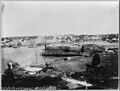
Boothbay Harbor in 1938
-
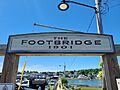
Footbridge at Boothbay Harbor, Maine
-
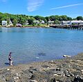
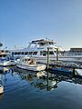
Boothbay Harbor, Maine
-
Ferries in Boothbay Harbor, Maine


.jpg)


See also
 In Spanish: Boothbay Harbor (Maine) para niños
