
Bridgeport, Pennsylvania facts for kids
Quick facts for kids
Bridgeport, Pennsylvania
|
|||
|---|---|---|---|

Bridgeport Borough Hall
|
|||
|
|||

Location of Bridgeport in Montgomery County, Pennsylvania.
|
|||

Bridgeport, Pennsylvania
Location in Pennsylvania

Bridgeport, Pennsylvania
Location in the United States
|
|||
| Country | United States | ||
| State | Pennsylvania | ||
| County | Montgomery | ||
| Government | |||
| • Type | Council-Manager | ||
| Area | |||
| • Total | 0.71 sq mi (1.85 km2) | ||
| • Land | 0.66 sq mi (1.71 km2) | ||
| • Water | 0.05 sq mi (0.14 km2) | ||
| Elevation | 108 ft (33 m) | ||
| Population
(2020)
|
|||
| • Total | 5,015 | ||
| • Density | 7,610.02/sq mi (2,937.67/km2) | ||
| Time zone | UTC-5 (EST) | ||
| • Summer (DST) | UTC-4 (EDT) | ||
| ZIP Code |
19405
|
||
| Area code(s) | 610 and 484 | ||
| FIPS code | 42-08568 | ||
| Website | https://www.bridgeportborough.org/ | ||


Bridgeport is a small town, called a borough, in Montgomery County, Pennsylvania. It's about 18 kilometers (11 miles) north of Philadelphia. The town sits right by the Schuylkill River.
Long ago, Bridgeport was a place where people worked in factories. They made things like paper, flour, cotton, and bricks. It was also home to steel works.
Bridgeport is special because of its history. In 1777, during the American Revolutionary War, General George Washington and his Continental Army marched through Bridgeport. They were on their way to their winter camp at Valley Forge, which is only 6 kilometers (3.7 miles) away.
In 1900, about 3,097 people lived in Bridgeport. By 2020, the population had grown to 5,015 people.
Contents
What's the Weather Like in Bridgeport?
Bridgeport has a climate with hot, humid summers. The winters are usually mild to cool. This type of weather is known as a humid subtropical climate. It's often called "Cfa" on climate maps.
| Climate data for Bridgeport, Pennsylvania | |||||||||||||
|---|---|---|---|---|---|---|---|---|---|---|---|---|---|
| Month | Jan | Feb | Mar | Apr | May | Jun | Jul | Aug | Sep | Oct | Nov | Dec | Year |
| Mean daily maximum °C (°F) | 4 (39) |
6 (42) |
11 (51) |
17 (63) |
23 (74) |
28 (83) |
31 (87) |
29 (85) |
26 (79) |
19 (67) |
13 (55) |
7 (44) |
18 (64) |
| Mean daily minimum °C (°F) | −6 (22) |
−4 (25) |
0 (32) |
6 (42) |
11 (51) |
16 (61) |
18 (65) |
18 (64) |
14 (57) |
7 (45) |
2 (36) |
−3 (27) |
7 (44) |
| Average precipitation mm (inches) | 81 (3.2) |
76 (3) |
99 (3.9) |
99 (3.9) |
97 (3.8) |
91 (3.6) |
110 (4.4) |
110 (4.3) |
110 (4.3) |
89 (3.5) |
100 (4) |
99 (3.9) |
1,160 (45.8) |
| Source: Weatherbase | |||||||||||||
How Many People Live Here?
The number of people living in Bridgeport has changed over the years. Here's a look at the population from different census counts:
| Historical population | |||
|---|---|---|---|
| Census | Pop. | %± | |
| 1850 | 568 | — | |
| 1860 | 1,001 | 76.2% | |
| 1870 | 1,578 | 57.6% | |
| 1880 | 1,802 | 14.2% | |
| 1890 | 2,651 | 47.1% | |
| 1900 | 3,097 | 16.8% | |
| 1910 | 3,860 | 24.6% | |
| 1920 | 4,680 | 21.2% | |
| 1930 | 5,595 | 19.6% | |
| 1940 | 5,904 | 5.5% | |
| 1950 | 5,827 | −1.3% | |
| 1960 | 5,306 | −8.9% | |
| 1970 | 5,630 | 6.1% | |
| 1980 | 4,843 | −14.0% | |
| 1990 | 4,292 | −11.4% | |
| 2000 | 4,371 | 1.8% | |
| 2010 | 4,554 | 4.2% | |
| 2020 | 5,015 | 10.1% | |
| Sources: | |||
In 2010, most people in Bridgeport were White (79.8%). There were also Black or African American (7.9%), Asian (2.8%), and Native American (0.3%) residents. About 3.4% of the people were of two or more races. A total of 12.8% of the population had Hispanic or Latino family backgrounds.
In 2000, there were 4,371 people living in Bridgeport. The average household had about 2.20 people. About 18.9% of the population was under 18 years old. The average age of people in Bridgeport was 37 years.
Schools in Bridgeport
Bridgeport Borough is part of the Upper Merion Area School District. This is the public school system that serves the area.
There used to be a Catholic elementary school called Holy Trinity Elementary School. It had two parts: a lower school in Swedesburg and an upper school in Bridgeport. This school closed in June 2005.
Getting Around Bridgeport
Roads and Highways
_just_north_of_Ford_Street_in_Bridgeport,_Montgomery_County,_Pennsylvania.jpg)
Bridgeport has about 13.05 miles (21 kilometers) of public roads. Some are kept up by the state, and others by the borough itself.
The main roads that go through Bridgeport are U.S. Route 202 and Pennsylvania Route 23. US 202 goes north and south, and PA 23 goes east and west.
Public Transportation
SEPTA is the public transportation system. Their Norristown High Speed Line has two stops in Bridgeport: the Bridgeport station and the DeKalb Street station. This line connects Bridgeport to the Norristown Transportation Center and the 69th Street Transportation Center.
SEPTA also runs the Route 99 bus through Bridgeport. This bus can take you to Norristown, King of Prussia, and Phoenixville.
The Bridgeport Bridge
The Bridgeport Bridge is a historic bridge built in 1912. It crosses the Schuylkill River. This bridge was once part of the Philadelphia & Western Railway. It is thought to be one of the longest bridges on an American interurban railroad. Today, the bridge carries SEPTA's Norristown High Speed Line.
Famous People from Bridgeport
- Brad Scioli – He used to play American football as a defensive end for the Indianapolis Colts.
- Leonard Tose – He was the owner of the Philadelphia Eagles football team.
- Ariana Ramsey OLY – She is an American rugby sevens player. She won a bronze medal at the 2024 Summer Olympics.
Gallery
-
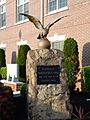
War Memorial near Borough Hall.
-
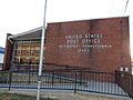
Bridgeport Post Office.
-
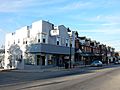
Bridgeport. West 4th Street.
-
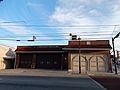
Bridgeport Fire Co No 1.
-
E. 4th St. Taphouse 23.


See also
 In Spanish: Bridgeport (Pensilvania) para niños
