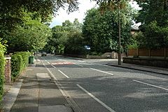
Brooklands, Greater Manchester facts for kids
Quick facts for kids Brooklands |
|
|---|---|
 Brooklands Road |
|
| Population | 24,796 (2011 census) |
| OS grid reference | SJ791905 |
| Metropolitan borough |
|
| Metropolitan county | |
| Region | |
| Country | England |
| Sovereign state | United Kingdom |
| Post town | SALE |
| Postcode district | M33 |
| Dialling code | 0161 |
| Police | Greater Manchester |
| Fire | Greater Manchester |
| Ambulance | North West |
| EU Parliament | North West England |
| UK Parliament |
|
Brooklands is a lively area in Greater Manchester, England. It's about 5.7 miles (9.2 km) southwest of the busy Manchester city centre. In 2011, about 24,796 people lived here. This area is split between two local government districts: Trafford and Manchester.
Contents
What is the History of Brooklands?
The name Brooklands comes from a man named Samuel Brooks. He was a banker and businessman from Manchester. In 1856, Samuel Brooks bought a piece of land in this area. He bought more land later on.
How Did Transport Shape Brooklands?
A railway line called the Manchester, South Junction and Altrincham Railway opened in 1849. It went right through the Brooklands area. There was a road crossing this railway between the Sale and Timperley stations.
In 1855, 45 local residents asked for a train station to be built there. The railway company didn't do anything at first. But in 1859, Samuel Brooks made a deal for a station. He offered an acre of his land for £200. He also promised to pay if the station didn't make money. The area was unofficially called "Brooks's land." Soon, this name became Brooklands, and the station opened on December 1, 1859.
Today, the Manchester Metrolink tram system runs through Brooklands. The Brooklands Station is on the tram route. This route connects the area to Manchester city centre and Altrincham.
In 1862, Samuel Brooks built a private road. It ran southeast from the new station. This road was meant for building nice homes. It still runs all the way to the A538 road, which goes between Altrincham and Wilmslow at Hale. Part of this road used to be an older path called Roaring Gate Lane.
How is Brooklands Governed?
The Brooklands area is part of two different local councils. These councils help manage local services like schools and parks.
Local Council Representatives
People in Brooklands vote for three councillors to join the Trafford Metropolitan Borough Council. These councillors represent the Trafford ward. Currently, Chris Boyes and David Hopps from the Conservative Party are councillors. Steven Longden from the Labour Party is also a councillor.
The area also elects three councillors to the Manchester City Council. These councillors represent the Manchester ward. All three current councillors, Sue Murphy, Sue Cooley, and Glynn Evans, are members of the Labour Party. Sue Murphy is also a Deputy Leader for the Council.
National Parliament Representation
Both of these local wards are represented in the UK Parliament in Westminster. Their Member of Parliament (MP) is Mike Kane. He represents the Wythenshawe and Sale East area.
Notable People Buried in Brooklands Cemetery
Brooklands has a cemetery where several important people are buried.
- James Joule: He was a famous English physicist. A standard unit of energy is named after him.
- Richard Pankhurst: He was a lawyer and politician. He was the husband of Emmeline Pankhurst, a leader in the women's right to vote movement. He was also the father of Adela Pankhurst, Christabel Pankhurst, and Sylvia Pankhurst. He is buried with his parents.
- Rev John Relly Beard: He was a Unitarian minister and educator.
 | Selma Burke |
 | Pauline Powell Burns |
 | Frederick J. Brown |
 | Robert Blackburn |


