
Lake Lanier facts for kids
Quick facts for kids Lake Lanier |
|
|---|---|
 |
|

Lake Lanier
Location in Georgia (U.S. state)

Lake Lanier
Location in the United States
|
|
| Location | Georgia |
| Coordinates | 34°14′14″N 83°56′10″W / 34.23722°N 83.93611°W |
| Type | reservoir, from 1956 |
| Primary inflows | Chattahoochee River, Chestatee River |
| Primary outflows | Chattahoochee River |
| Catchment area | 1,040 sq mi (2,700 km2) |
| Basin countries | United States |
| Surface area | 37,000 acres (150 km2; 58 sq mi) |
| Max. depth | 156 feet (48 m) |
| Water volume | 1,049,400 acre⋅ft (1.2944 km3) |
| Surface elevation | 1,071 ft (326.4 m) summer 1,070 ft (326.1 m) winter |
Lake Lanier (officially Lake Sidney Lanier) is a large reservoir in northern Georgia, USA. It was created in 1956 when the Buford Dam was built on the Chattahoochee River. The lake also gets water from the Chestatee River.
Lake Lanier covers about 38,000 acres (154 square kilometers) of water. It has a very long shoreline, stretching about 692 miles (1,114 kilometers) when the water is at its normal level. The lake is named after Sidney Lanier, a poet. The U.S. Army Corps of Engineers built and manages the lake. Its main jobs are to control floods and provide water. Building the lake meant moving over 250 families and 15 businesses.
The Georgia Department of Natural Resources and local police patrol the lake. The states of Georgia, Alabama, and Florida all share rights to the lake's water. This is because the lake feeds rivers that flow through these states. The Army Corps of Engineers also makes sure enough water is available to protect endangered animals downstream. As more people moved to the Atlanta area, water use increased. During dry periods, Lake Lanier's water levels have dropped very low. This has led to efforts to save water in the region.
Contents
Where is Lake Lanier?
Lake Lanier is located across several counties in Georgia. These include Hall, Forsyth, Dawson, Gwinnett, and Lumpkin counties. The lake fills many small valleys and inlets.
One of the main reasons for the lake is to control floods on the Chattahoochee River. This helps protect the Atlanta region. Since Buford Dam was built, there have been only a few major floods downstream. The biggest flood happened in 2009 after a two-year dry spell.
Building the Reservoir
The lake was originally built for several important reasons. These included making electricity, helping boats travel, controlling floods, and supplying water to the city of Atlanta.
The project cost about $1 billion and started in 1950. Around 700 families had to move from their homes. Their land was bought by the U.S. Army Corps of Engineers to create the lake. Parts of roads and even a race track called Looper Speedway were covered by water.
In 1951, the project almost ran out of money. Atlanta's mayor, William B. Hartsfield, traveled to Washington many times. He asked senators to bring back the funding. He stressed how important the lake was for Atlanta's water supply, especially during dry times. Thanks to his efforts, Congress approved more money. The dam was finished and opened on time in 1956.
Lake Lanier began filling up in 1956. By 1958, the region faced a severe drought. Without Buford Dam and Lake Lanier, the Chattahoochee River would have been almost dry. The lake proved to be very important for water storage.
Since the 1990s, Georgia, Florida, and Alabama have been discussing how to share the water from Lake Lanier. Laws say that states sharing a river should have equal rights to its water. Also, laws like the Endangered Species Act require water to be available for threatened animals living in the Chattahoochee River and Apalachicola Bay.
Dry Periods: 2007–2009

In 2006, the USACE found a problem with a new water level sensor at the dam. It was reading almost two feet higher than the actual lake level. This mistake caused billions of gallons of extra water to be released. This happened when much of Georgia was already experiencing dry conditions.
Georgia's Governor, Sonny Perdue, said the Corps had caused a "manmade drought". Many people in the Atlanta area were using a lot of water for their lawns. Because of the mistake, the governor declared a drought. Rules were put in place to limit outdoor water use. Some areas even banned outdoor watering completely.
In late 2007, Lake Lanier's water level dropped to a new record low. It was the lowest it had been in 25 years. The water level kept dropping daily. However, after some rain, the water level started to rise again in December 2007.
By February 2008, the water level had risen above the previous record lows. This helped end the worst part of the drought crisis. Another dry period happened in late 2008. The water level dropped again but stayed slightly above the 2007 record.
After heavy rains in early 2009, the drought was officially declared over. By October 2009, Lake Lanier was back to its full level. The highest water level ever recorded was in April 1964.
The very low water levels during the droughts revealed parts of the lake bottom that hadn't been seen since the 1950s. This included old roads and building foundations from the homes that were moved. People also found trash, old boat batteries, and sunken boats. Many volunteers helped clean up the lake bottom. Police also found stolen cars and old firearms.
Fun Activities at Lake Lanier

Lake Lanier is a very popular place for fun activities. Many people enjoy boating, houseboating, and jetskiing, especially during summer holidays. Over 7.5 million people visit the lake each year. They enjoy its marinas and the Lake Lanier Islands waterpark.
The lake was even a venue for the 1996 Summer Olympics. The rowing and sprint canoeing events were held here. It also hosted the Canoe Sprint World Championships in 2003.
Lake Lanier has over 90 parks managed by different groups. These parks are located along its 680 miles of shoreline. Twenty-three of these parks have beaches where you can swim. Most parks also have picnic areas, restrooms, and boat ramps. There are also many beaches on islands within the lake.
There is one resort hotel on the lake called Legacy Lodge. Two of the world's largest freshwater marinas, Holiday Marina and Aqualand Marina, are also located on Lake Lanier.
Every year from mid-November through January, Lake Lanier Islands hosts a special event. Over 6 miles (10 kilometers) of Christmas lights decorate the area. This "Magical Nights of Lights" is a drive-through display. It ends with a Christmas village, carnival rides, and a bonfire.
Lake Water Levels
| Water levels at Lake Lanier. | ||||
|---|---|---|---|---|
Day |
Oct 2007 |
Nov 2007 |
Dec 2007 |
Jan 2008 |
| 1 | 1058.73 | 1055.46 | 1051.75 | 1051.31 |
| 2 | 1058.65 | 1055.36 | 1051.69 | 1051.29 |
| 3 | 1058.55 | 1055.28 | 1051.66 | 1051.28 |
| 4 | 1058.43 | 1055.19 | 1051.60 | 1051.28 |
| 5 | 1058.37 | 1054.99 | 1051.55 | 1051.27 |
| 6 | 1058.30 | 1054.80 | 1051.48 | 1051.27 |
| 7 | 1058.25 | 1054.55 | 1051.40 | 1051.26 |
| 8 | 1058.12 | 1054.34 | 1051.36 | 1051.19 |
| 9 | 1058.05 | 1054.08 | 1051.34 | 1051.21 |
| 10 | 1057.90 | 1053.99 | 1051.27 | 1051.18 |
| 11 | 1057.74 | 1053.93 | 1051.22 | 1051.25 |
| 12 | 1057.52 | 1053.71 | 1051.15 | 1051.28 |
| 13 | 1057.44 | 1053.52 | 1051.08 | 1051.28 |
| 14 | 1057.35 | 1053.29 | 1051.02 | 1051.27 |
| 15 | 1057.12 | 1053.07 | 1051.02 | 1051.26 |
| 16 | 1056.93 | 1052.87 | 1050.99 | 1051.33 |
| 17 | 1056.77 | 1052.82 | 1050.95 | 1051.31 |
| 18 | 1056.53 | 1052.76 | 1050.91 | 1051.37 |
| 19 | 1056.39 | 1052.62 | 1050.87 | 1051.38 |
| 20 | 1056.34 | 1052.49 | 1050.82 | 1051.41 |
| 21 | 1056.27 | 1052.33 | 1050.86 | 1051.38 |
| 22 | 1056.20 | 1052.23 | 1050.83 | 1051.42 |
| 23 | 1056.16 | 1052.12 | 1050.84 | 1051.47 |
| 24 | 1056.11 | 1052.07 | 1050.87 | 1051.44 |
| 25 | 1056.03 | 1052.02 | 1050.81 | 1051.42 |
| 26 | 1055.91 | 1052.01 | 1050.79 | 1051.42 |
| 27 | 1055.87 | 1051.97 | 1050.80 | 1051.42 |
| 28 | 1055.80 | 1051.91 | 1050.94 | 1051.41 |
| 29 | 1055.75 | 1051.86 | 1051.03 | 1051.41 |
| 30 | 1055.63 | 1051.81 | 1051.24 | 1051.47 |
| 31 | 1055.55 | 1051.32 | 1051.49 | |
| New low levels are shown bolded. Record lows are dated 1 day later than the table, adding "0.01" foot. (Surface elevation in feet, divide by 3.28 for meters) | ||||
At the end of 2007, Lake Lanier's water level was setting new record lows almost every day. By early November, the water was dropping about 0.2 feet (0.06 meters) daily. The biggest drop was on November 9.
The rate of water dropping slowed down by mid-November. This was thanks to local rains and less water being released from Buford Dam. However, water levels continued to fall almost daily through December 2007.
After more rain and snow in December and January 2008, the water level stabilized. It reached a low of 1050.79 feet (320.28 meters) on December 26, 2007. After Christmas, the water level began to rise steadily.
By February 18, 2008, Lake Lanier's water level had risen above the record lows set in November. This marked the end of the severe drought crisis. By April 21, 2009, the lake had risen to 1063.39 feet (324.12 meters).
Even with reduced water flow from Lake Lanier, areas further south along the Chattahoochee River received enough freshwater. This was due to heavy rainfall in those regions during November and December 2007.
In September and October 2009, the Atlanta area received much more rain than usual. This led to record floods. By October 14, 2009, Lake Lanier had risen back to its full level. The highest level ever recorded was 1077.2 feet (328.3 meters) in April 1964.
In 2011 and 2012, the water levels dropped again, similar to the 2007 droughts. But in the spring and summer of 2013, heavy rains caused the water level to rise very high. By June 2016, parts of Forsyth County faced another severe drought, and water use had to be reduced.
- You can check daily water levels for Lake Lanier (measured by the USACE at Buford Dam) here: [1]
Images for kids
-
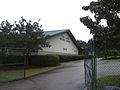
The Lake Lanier Olympic Park hosted the canoe sprint and rowing competitions for the 1996 Summer Olympics, the 2003 ICF Canoe Sprint World Championships, 2016 Pan American Sprint Canoe/Kayak Championships and the ICF Dragon Boat World Championships in 2018. This picture was taken in 2010.

See also
 In Spanish: Lago Lanier para niños
