Burlington, Massachusetts facts for kids
Quick facts for kids
Burlington, Massachusetts
|
||
|---|---|---|
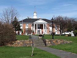
Town Hall
|
||
|
||
| Nicknames:
Burly , B-Town
|
||
| Motto(s):
"Where Technology Goes To Work"
|
||
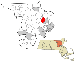
Location in Middlesex County in Massachusetts
|
||
| Country | ||
| State | ||
| County | Middlesex | |
| Region | New England | |
| Settled | 1640 | |
| Incorporated | February 28, 1799 | |
| Government | ||
| • Type | Representative town meeting | |
| Area | ||
| • Total | 11.9 sq mi (30.8 km2) | |
| • Land | 11.8 sq mi (30.6 km2) | |
| • Water | 0.1 sq mi (0.2 km2) | |
| Elevation | 218 ft (66 m) | |
| Population
(2020)
|
||
| • Total | 26,377 | |
| • Density | 2,217/sq mi (856.4/km2) | |
| Demonym(s) | Burlingtonian | |
| Time zone | UTC-5 (Eastern) | |
| • Summer (DST) | UTC-4 (Eastern) | |
| ZIP codes |
01803, 01805
|
|
| Area code(s) | 339 / 781 / 617 | |
| FIPS code | 25-09840 | |
| GNIS feature ID | 0618219 | |
Burlington is a town in Middlesex County, Massachusetts, United States. It's known for being a busy area where technology companies and businesses thrive. In 2020, about 26,377 people lived here. Burlington is sometimes called "Burly" or "B-Town" by locals.
Contents
History of Burlington
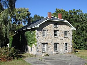
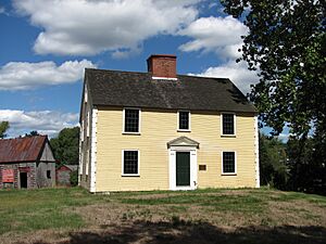
Burlington was first settled in 1641. It became an official town on February 28, 1799. People think its name might come from the English town of Bridlington, but no one knows for sure. Some of the very first houses, like the Francis Wyman House from 1666, are still standing today!
The town is located where the waters of three rivers meet: the Ipswich, Mystic, and Shawsheen rivers. Long ago, from colonial times until the late 1800s, there were mills along Vine Brook. These mills were an important part of the town's early economy.
For most of its history, Burlington was a farming town. Farmers grew hops and rye to sell in Boston. They also made shoes in small shops. Because early railroads didn't come through Burlington, the town didn't grow much at first. It continued to produce food like hams, milk, fruit, and vegetables for the Boston market.
Everything changed when Route 128, a major highway, was built. This highway caused a huge boom in growth! Between 1955 and 1965, Burlington was the fastest-growing town in Massachusetts. In just five years, its population tripled! Many homes and stores were built, giving the town its modern look. Today, Burlington is a mix of homes and businesses.
Geography of Burlington
Burlington is in the Greater Boston Area of eastern Massachusetts. It shares borders with several other towns. To the west is Bedford, to the north is Billerica, and to the northeast is Wilmington. To the southeast is Woburn, and to the south is Lexington.
Burlington is about 12 miles (19 km) northwest of Boston. The highest point in town is Greenleaf Mountain, which is 290 feet (88 meters) above sea level. The lowest point is the Great Meadow, at 150 feet (46 meters) above sea level. The largest body of water is the Mill Pond Reservoir, located in the eastern part of town.
The town covers a total area of 11.9 square miles (30.8 square kilometers). Most of this area, 11.8 square miles (30.6 square kilometers), is land. Only a small part, 0.1 square miles (0.2 square kilometers), is water. Burlington uses several different area codes for phone numbers, including 781, 617, and 339.
People of Burlington (Demographics)
| Historical population | ||
|---|---|---|
| Year | Pop. | ±% |
| 1850 | 545 | — |
| 1860 | 606 | +11.2% |
| 1870 | 626 | +3.3% |
| 1880 | 711 | +13.6% |
| 1890 | 617 | −13.2% |
| 1900 | 593 | −3.9% |
| 1910 | 591 | −0.3% |
| 1920 | 885 | +49.7% |
| 1930 | 1,722 | +94.6% |
| 1940 | 2,275 | +32.1% |
| 1950 | 3,250 | +42.9% |
| 1960 | 12,852 | +295.4% |
| 1970 | 21,980 | +71.0% |
| 1980 | 23,486 | +6.9% |
| 1990 | 23,302 | −0.8% |
| 2000 | 22,876 | −1.8% |
| 2010 | 24,498 | +7.1% |
| 2020 | 26,377 | +7.7% |
| 2022* | 25,966 | −1.6% |
| * = population estimate. Source: United States Census records and Population Estimates Program data. |
||
In 2010, there were 24,498 people living in Burlington. There were 9,668 households (groups of people living together) and 6,374 families. About 32.6% of households had children under 18 living with them. Most households (65.2%) were married couples.
The people in Burlington come from many different backgrounds. In 2010, about 79.2% of the population was White, 3.3% Black or African American, and 13.4% Asian. About 2.4% of the population was Hispanic or Latino.
The average age in Burlington in 2010 was 38 years old. About 23.6% of the population was under 18, and 13.9% was 65 or older.
In 2014, the average income for a household in Burlington was about $95,465 per year. This means Burlington is a fairly wealthy town. Only a small number of people, about 4.7%, lived below the poverty line.
People from Other Countries
As of 2019, about 23.8% of the people living in Burlington were born outside of the United States. This shows that Burlington is a diverse community with people from all over the world.
Fun Things to Do (Arts and Culture)
Places to Visit
- The Burlington Town Common and Simonds Park are in the center of town. You can find many parks and public places for fun activities. These include basketball courts, tennis courts, baseball fields, soccer fields, gyms, and even an indoor skating rink called the Burlington Ice Palace. There's also a skatepark!
- The Burlington Public Library is a great place to read and learn. It's located on Sears Street, right next to the Town Common.
- The Burlington Historical Museum is open during the summer. It's on Bedford Street and is a good place to learn about the town's past.
- The Meeting House of the Second Parish in Woburn is a historic building on Lexington Street, near the Town Common.
- The Burlington Sculpture Park is a cool outdoor art display. It's located between the police station and the Grandview Tavern, across from the Common. You can see sculptures from artists around the world and even have a picnic.
- The Mill Pond Conservation Area is a large natural area in the eastern part of town. It has over 140 acres (0.57 km2) of hills and trails. You can go hiking or bike riding on the many marked and unmarked paths.
- The Mill Pond is inside the Mill Pond Conservation Area. You can fish here if you have a special permit. The pond helps supply drinking water to Burlington. There's even a rope swing on the pond's island that many local kids enjoy!
- The Burlington Landlocked Forest is a huge natural space of 270 acres (1.1 km2). It stretches across Burlington, Bedford, and Lexington. It has 12 miles (19 km) of trails for hiking and mountain biking. You can also find wildlife, old stone walls, meadows, and very old trees here. Most of this land is owned by the Town of Burlington, which has kept it as open space since 1985. In 2017, the town voted to protect this land as open space forever.
- Mary Cummings Park is a large public park on the border of Burlington and Woburn. It was created in 1927 to be a recreational park for everyone. Today, it's managed by the Trustees of Reservation, which helps protect natural and historical places.
- Did you know? Parts of the movie Paul Blart: Mall Cop, starring Kevin James, were filmed at the Burlington Mall! Also, scenes from the movie The Company Men, with Ben Affleck, were filmed in an office building near Route 128.
Education in Burlington
Burlington has a great public school system with six schools. There are four elementary schools (Fox Hill, Francis Wyman, Memorial, and Pine Glen), one middle school (Marshall Simonds), and one high school (Burlington High School).
Students can also attend the Shawsheen Valley Technical High School, which teaches special job skills. Burlington also has a few private schools.
The town offers a "Before and After School Program" for students and a special preschool program. For older students, Northeastern University has a campus in Burlington.
Economy of Burlington
Burlington is home to many important companies. These businesses provide jobs and help the town's economy grow. Some of the companies based here include:
- Avid Technology (known for video and audio editing software)
- Desktop Metal (works with 3D printing)
- Endurance International Group (provides online services for small businesses)
- Greylock Partners (a company that invests in new technology businesses)
- Keurig Dr Pepper (makes popular coffee makers and drinks)
- Lahey Hospital & Medical Center (a major hospital and medical center)
- Nuance Communications (develops speech recognition and AI software)
- Dynatech Corporation (a former technology company)
Getting Around (Infrastructure and Transportation)
Several important roads pass through Burlington, including Routes 128 (which is also I-95), 3, 3A, and 62.
Public transportation is available through MBTA bus routes (like 350, 351, 352, and 354). There are also local buses from Lowell, Lexington (Lexpress), and Burlington (B-Line).
If you want to take the subway (the "T"), the closest stations are Alewife in Cambridge (Red Line) and Wellington Station in Medford (Orange Line). Both have large parking garages. For longer train trips, the MBTA Commuter Rail is available at the Anderson Regional Transportation Center in nearby Woburn, which is about 3 miles (4.8 km) away. You can also catch the Logan Express bus to the airport from there.
Famous People from Burlington
Many talented people have come from Burlington! Here are a few:
- James MacGregor Burns – A historian and political scientist who won a Pulitzer Prize.
- Peter Carruthers and Kitty Carruthers – Silver medalists in Pairs Figure Skating at the 1984 Winter Olympics.
- Roger Cook – The head landscaper for the TV show This Old House.
- Jeremy Dooley – An author and internet personality known from Roosterteeth.com and YouTube.
- Kali Flanagan – An ice hockey player who won a gold medal at the 2018 Winter Olympics.
- Mark Fusco and Scott Fusco – Members of the US Olympic hockey team in the 1984 Winter Olympics.
- David Lovering – The drummer for the famous alternative rock band Pixies.
- Roderick MacKinnon – Won the 2003 Nobel Prize in Chemistry.
- Stephen P. Mugar – The person who started the Star Market chain of supermarkets and was a generous giver to charity.
- Jay Pandolfo – A professional ice hockey player who played for the New Jersey Devils and is now an assistant coach for the Boston Bruins.
- Amy Poehler – A very funny actress and comedian from Saturday Night Live and Parks and Recreation.
- Steve Strachan – An NFL running back who played for the Los Angeles Raiders.
- James Walker – A former president of Harvard University.
- Steven Wright – A well-known actor and comedian.
See also
 In Spanish: Burlington (Massachusetts) para niños


