Calapooya Mountains facts for kids
Quick facts for kids Calapooya Mountains |
|
|---|---|

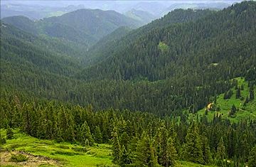
View from Fairview Peak Lookout
|
|
| Highest point | |
| Peak | Balm Mountain |
| Elevation | 6,165 ft (1,879 m) |
| Dimensions | |
| Length | 60 mi (97 km) east–west |
| Naming | |
| Etymology | The Kalapuya Native Americans of the Willamette Valley |
| Geography | |
| Country | United States |
| Range coordinates | 43°29′59″N 122°30′04″W / 43.4998431°N 122.5011587°W |
The Calapooya Mountains are a mountain range in southwestern Oregon, in the United States. They are found in Lane and Douglas counties. These mountains stretch for about 60 miles (97 km) from west of the Cascade Range. They are located between the cities of Eugene to the north and Roseburg to the south.
Contents
What Are the Calapooya Mountains Like?
The Calapooya Mountains are made up of rocks from ancient volcanoes and newer layers of earth. Over time, rivers like the Coast Fork Willamette River have carved deep valleys into these mountains. The soil here is a mix of clay and silt, formed from sandstone and volcanic rocks.
The Calapooya Mountains are part of the Western Cascades. They also include the Calapooya Divide. This divide is a special area that separates the water flowing into two major rivers: the Willamette and the Umpqua.
At their southeastern end, the Calapooyas connect to the main Cascade Range. This is near Cowhorn Mountain, where the Middle Fork Willamette River and the North Umpqua River begin.
Highest Points
The tallest peaks in the Calapooya Mountains are:
- Balm Mountain, which is 6,165 feet (1,879 meters) high.
- Potter Mountain, at 6,145 feet (1,873 meters).
- McGowan Mountain, reaching 6,130 feet (1,868 meters).
These high points are all located near the southeastern part of the range. Other notable peaks include Bohemia Mountain and Fairview Peak, both 5,933 feet (1,808 meters) tall.
Rivers and Streams
Many streams flow from the Calapooya Mountains, feeding into larger rivers.
- Streams like Steamboat, Canton, and Rock creeks flow south into the North Umpqua River.
- Calapooya Creek flows west from the divide into the main Umpqua River.
- To the north and east, streams such as Tumblebug, Staley, Coal, and Packard creeks join the Middle Fork Willamette River.
- Brice, Layng, and Mosby creeks, along with Big River, flow northwest or west into the Coast Fork Willamette River.
The Umpqua River flows west through the Oregon Coast Range to the Pacific Ocean. The Willamette River flows north to the Columbia River, which then flows northwest to the Pacific Ocean.
Weather in the Mountains
The Calapooya Mountains have wet winters and dry summers. The amount of rain and snow increases as you go higher up the mountains. Valleys might get 40 to 50 inches (1,000 to 1,300 mm) of rain each year. But on the mountain peaks, it can be 70 to 80 inches (1,800 to 2,000 mm). Above 4,000 feet (1,200 meters), a lot of this precipitation falls as snow.
History of the Calapooyas
For a long time, the Calapooya Mountains have been a natural barrier. They separated the Willamette Valley from the South Umpqua Valley. This meant they divided Western Oregon from Southern Oregon.
In the 1800s, these mountains separated the lands of the Kalapuya and Umpqua Native American tribes. Later, in the 1840s, the mountains made it hard for white settlers to travel south. They wanted to move into southern Oregon or reach the California gold fields.
The Applegate Trail, created in the late 1840s, was the first reliable path through the western part of the mountains for settlers. Today, Interstate 5 (I-5) mostly follows this historic route between Eugene and Roseburg.
In the 20th century, the mountains became an important source of timber. The eastern parts of the Calapooya Mountains are now within the Umpqua National Forest and Willamette National Forest.
 | Ernest Everett Just |
 | Mary Jackson |
 | Emmett Chappelle |
 | Marie Maynard Daly |

