California Historical Landmarks in Riverside County facts for kids
Here's a look at some amazing historical places in Riverside County, California! These spots are so important that they've been named California Historical Landmarks. They tell us stories about ancient people, early settlers, and even big events like World War II.
You can find all these cool places on a map if you click the "Map of all coordinates" link. It will show you exactly where each landmark is located!
Contents
Ancient Wonders and Early People
Giant Desert Figures: Blythe Intaglios
Imagine huge drawings made on the desert floor! The Blythe Intaglios are giant figures carved into the ground near Blythe. These amazing artworks were created by ancient people. They show animals and human-like shapes, and some are as long as a football field! Scientists believe they are hundreds, maybe even thousands, of years old. They are a mystery that still fascinates us today.
Carved Rock and Painted Rock: Luiseño Art
In the Temescal Valley, you can find two special rocks that tell stories from the past. The Carved Rock has petroglyphs, which are designs carved into the stone by the Luiseño Indians. People say these carvings might show that a chief died there, with symbols of his power and sacred animals.
Nearby is the Painted Rock, which has ancient pictographs, or paintings on the rock. These artworks are a tribute to the earliest people who lived in this area. The Santa Fe Railway even helped protect this rock, and a local club placed a tablet to mark its importance. Both rocks show us the rich history and art of the Luiseño people.
Pochea Indian Village Site
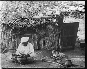
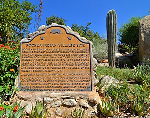
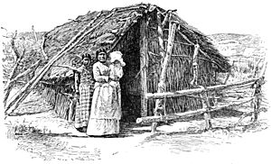
Near Hemet, there's a place called the Ramona Bowl. This area was once the site of the Pochea Indian village. It was an important home for Native American communities long ago. Today, it reminds us of the people who lived here before modern cities were built.
Saahatpa: A Cahuilla Village Story
In Beaumont, there's a landmark for Saahatpa, a village where Chief Juan Antonio and his Cahuilla Indians lived. In the 1840s and early 1850s, Chief Juan Antonio and his warriors helped protect settlers in the San Bernardino area. They settled at Saahatpa in late 1851. Sadly, a smallpox epidemic in 1862–63 caused many deaths, including Chief Juan Antonio and many of his people. After this tragedy, Saahatpa was abandoned. It's a reminder of the challenges faced by Native American communities.
Hemet Maze Stone
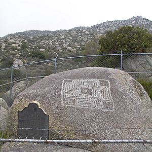
The Hemet Maze Stone is a fascinating rock with a mysterious maze-like pattern carved into it. You can find it in Maze Stone Park in Hemet. No one knows for sure what the maze stone means, but it's a cool example of ancient art and a puzzle from the past.
Early California Life and Journeys
De Anza Crossings: Exploring California
In 1774 and 1775-1776, a Spanish explorer named Juan Bautista de Anza led expeditions through California. Two landmarks in Riverside County remember his journeys. One marks the spot where he crossed the Santa Ana River between what are now Riverside and Jurupa Valley. Another marks the site of his camp in March 1774, located in Coyote Canyon. These spots remind us of the early explorations that shaped California's history.
Old Temescal Road: A Path Through History
The Old Temescal Road in Temescal Valley is more than just a road; it's a pathway through centuries of history! It was first used by the Luiseño and Gabrieleno Indians. Later, explorers and gold seekers traveled this route. From 1858 to 1861, it was part of the famous Butterfield Overland Mail stagecoach route, carrying mail and passengers across the country. It also served as a military road and later became part of California State Route 71. This road has seen so much history!
Temescal Butterfield Stage Station
Along the Old Temescal Road, there was once a Temescal Butterfield stage station. This was a stop for the Butterfield Overland Mail stagecoaches. Travelers could rest, change horses, and get supplies here. While the original marker for the station is no longer there, the area near Breezy Meadow Lane in Temescal Valley is believed to be its location. It's a reminder of a time when stagecoaches were the main way to travel long distances.
Rancho Temescal: Early Settlements
The Rancho Temescal was an important early settlement in Riverside County. Several landmarks tell its story:
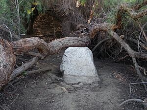
- Serrano Boulder: This boulder marks the spot where Leandro Serrano built the very first house in Riverside County around 1824. It was a simple home on his large ranch.
- Serrano Tanning Vats: In 1819, Luiseño Indians, guided by Leandro Serrano, built two vats to make leather from cow hides. These vats show how people used natural resources and traditional skills to create useful goods.
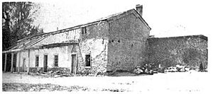
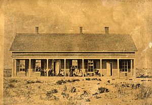
- Site of the Third Serrano Adobe: Leandro Serrano planted orchards and vineyards and built his third adobe house on Rancho Temescal in the 1840s. His family lived there until 1898. These adobes were important homes for early settlers.
Louis Rubidoux House and Grist Mill
Louis Rubidoux was an important figure in early Riverside County. The Site of Louis Rubidoux House in Rubidoux marks where his home once stood. He also built a Rubidoux Grist Mill, where grain was ground into flour. This mill was a vital part of the community, helping to feed the growing population.
Jensen Alvarado Ranch
The Jensen Alvarado Ranch in Riverside is another historic site. It was a working ranch that shows us what life was like for early farmers and ranchers in California. It's a great place to learn about the agricultural history of the region.
Rancho Santa Rosa
The Rancho Santa Rosa in Murrieta was a large ranch that played a role in the development of the area. These ranches were huge land grants that often became centers of farming and cattle raising.
Modern History and Landmarks
World War II Training Camps
During World War II, the deserts of California became a huge training ground for soldiers. Several landmarks in Riverside County remember these important sites:
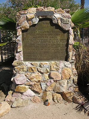
- Camp Coxcomb at Desert Training Center: Located near the Coxcomb Mountains, this was one of the many camps where soldiers trained for desert warfare.
- Camp Granite at Desert Training Center: Near the Granite Mountains, Camp Granite was another key training site.
- Camp Young at the Desert Training Center: This camp, now home to the General George S. Patton Memorial Museum , was the headquarters for the Desert Training Center. It was named after General George S. Patton, who led the training efforts. Thousands of soldiers learned how to fight in harsh desert conditions here.
Blythe Intake: Water for the Desert
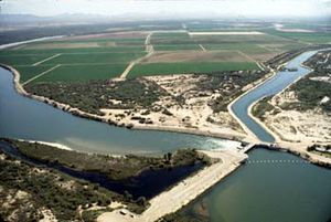
The Blythe Intake is located at the Palo Verde Dam near Blythe. This dam and intake system are crucial for bringing water to the Palo Verde Valley, making it possible for farming and communities to thrive in the desert. It's an important example of how people manage water resources.
Contractor's General Hospital
In Desert Center, there's a landmark for the Contractor's General Hospital. This hospital was important for providing medical care to workers and residents in this remote desert area, especially during the construction of major projects.
Corona Founders Monument
The Corona Founders Monument is located in Corona City Park in Corona. This monument honors the people who founded the city of Corona, recognizing their hard work and vision in creating the community.
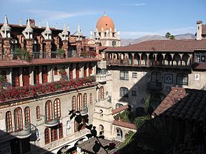
The Mission Inn
The Mission Inn in Riverside is a beautiful and historic hotel. It's known for its unique architecture and has hosted many famous people throughout its history. It's a landmark that shows the grand style and rich past of Riverside.
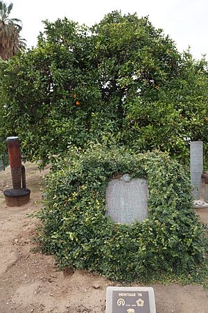
Did you know that a single orange tree in Riverside helped start California's huge citrus industry? The Parent Washington Navel Orange Tree in City Park is that tree! It's the original tree from which many navel orange trees in California descended. It's a living piece of history that shows the importance of agriculture to the state.
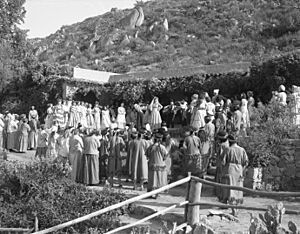
Ramona Bowl
The Ramona Bowl in Hemet is an outdoor amphitheater famous for hosting "The Ramona Pageant." This play tells a romantic story about early California and Native American life. The bowl itself is a landmark, recognized for its cultural importance and beautiful setting.
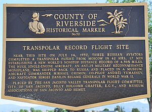
Soviet 1937 Transpolar Flight Landing Site
Imagine flying non-stop over the North Pole! In July 1937, three Soviet pilots made a record-breaking flight from Moscow, covering 11,500 kilometers (about 7,145 miles) in 62 hours and 17 minutes. They planned to land in San Diego but encountered fog and landed instead in a dairy pasture outside San Jacinto. This landing site is now a California Historical Landmark, celebrating an incredible achievement in aviation history.
See also
 | Charles R. Drew |
 | Benjamin Banneker |
 | Jane C. Wright |
 | Roger Arliner Young |


