Cambria, New York facts for kids
Quick facts for kids
Cambria
|
|||
|---|---|---|---|
| Town of Cambria | |||
|
|||

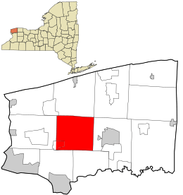
Location in Niagara County and the state of New York.
|
|||
| Country | |||
| State | |||
| County | Niagara | ||
| Named for | Cambria (Wales) | ||
| Government | |||
| • Type | Town Council | ||
| Area | |||
| • Total | 39.71 sq mi (102.85 km2) | ||
| • Land | 39.71 sq mi (102.85 km2) | ||
| • Water | 0.00 sq mi (0.00 km2) | ||
| Elevation | 531 ft (162 m) | ||
| Population
(2020)
|
|||
| • Total | 5,743 | ||
| • Density | 146.08/sq mi (56.40/km2) | ||
| Time zone | UTC-5 (Eastern (EST)) | ||
| • Summer (DST) | UTC-4 (EDT) | ||
| FIPS code | 36-11803 | ||
| GNIS feature ID | 0978775 | ||
Cambria is a small town in Niagara County, New York. In 2020, about 5,743 people lived there. The name "Cambria" comes from an old name for Wales, a country in the United Kingdom.
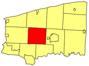
The Town of Cambria is located right in the middle of Niagara County. Important roads like New York State Route 93 and New York State Route 104 run through the town.
Contents
History of Cambria
Some of the first people to settle in Cambria came from Wales. They named the town after their homeland.
The Town of Cambria was officially created in 1808. This was when Niagara County was formed. In fact, Cambria was the very first town in Niagara County. All other towns in the county were later created from parts of Cambria after 1812.
Before 1808, the area that is now Niagara County was part of Genesee County. It was specifically part of the Town of Batavia. Later, Erie County was created. Two towns in Erie County, Willink and Clarence, were originally formed from parts of Cambria.
Geography of Cambria
Cambria covers an area of about 39.9 square miles (102.85 square kilometers). All of this area is land.
The town is located to the west of the City of Lockport. It is also northeast of the famous City of Niagara Falls.
Famous People from Cambria
Cambria has been home to some interesting people:
- Bates Cooke – He was a US Congressman and worked as the New York State Comptroller.
- Jerome B. Chaffee – He became the first senator for the state of Colorado.
- The Seven Sutherland Sisters – This was a singing group known for their very long hair. They traveled and performed with Barnum and Bailey's "Greatest Show on Earth" circus.
Neighboring Towns
Cambria shares its borders with several other towns:
- Town of Lewiston – to the west
- Town of Wheatfield – to the southwest
- Town of Pendleton – to the southeast
- Town of Lockport – to the east
- Town of Wilson – to the north
Main Roads in Cambria
Several important state highways pass through the Town of Cambria:
 New York State Route 31 (Saunders Settlement Rd.) – This road goes east-west through the town.
 New York State Route 93 (Ridge Rd., N. Ridge Rd., Youngstown-Lockport Rd.) – This road runs east-west through the northeastern part of town.
 New York State Route 104 (Ridge Rd.) – This highway travels east-west through the northern part of town.
 New York State Route 270 (Campbell Blvd.) – This road goes north-south through the town.
 New York State Route 425 (Shawnee Rd., Lower Mountain Rd., Cambria-Wilson Rd.) – This road also runs north-south through the town.
 New York State Route 429 (Town Line Rd.) – This road forms the western border of the town.
Population Information
| Historical population | |||
|---|---|---|---|
| Census | Pop. | %± | |
| 1820 | 1,134 | — | |
| 1830 | 1,712 | 51.0% | |
| 1840 | 2,099 | 22.6% | |
| 1850 | 2,366 | 12.7% | |
| 1860 | 2,308 | −2.5% | |
| 1870 | 2,145 | −7.1% | |
| 1880 | 2,267 | 5.7% | |
| 1890 | 2,007 | −11.5% | |
| 1900 | 1,880 | −6.3% | |
| 1910 | 1,749 | −7.0% | |
| 1920 | 1,596 | −8.7% | |
| 1930 | 1,786 | 11.9% | |
| 1940 | 1,925 | 7.8% | |
| 1950 | 2,346 | 21.9% | |
| 1960 | 3,661 | 56.1% | |
| 1970 | 4,193 | 14.5% | |
| 1980 | 4,419 | 5.4% | |
| 1990 | 4,779 | 8.1% | |
| 2000 | 5,391 | 12.8% | |
| 2010 | 5,839 | 8.3% | |
| 2020 | 5,743 | −1.6% | |
| U.S. Decennial Census | |||
As of the year 2000, there were 5,393 people living in Cambria. The town had 1,995 households. About 34.2% of these households had children under 18 living there. The average household had about 2.70 people.
The population was spread out by age. About 25.4% were under 18 years old. The median age in the town was 39 years. This means half the people were younger than 39 and half were older.
Communities and Places in Cambria
Cambria has several smaller communities and notable locations:
- Cambria Center – A small community where Lower Mountain Road and Cambria-Wilson Road meet.
- Cambria Station – Another small community located near the southern border of the town on Shawnee Road.
- Comstock Corners – Found in the southeast corner of the town.
- Hickory Corners – A community located at the eastern town line.
- Molyneaux Corners – This community is in the northeast corner of the town. It is named after an early settler, William Molyneaux.
- North Ridge – A community near the northern town line. The North Ridge United Methodist Church here is a historic building.
- Pekin – This community is on the western town line. Pekin was an important stop on the Underground Railroad, which helped enslaved people find freedom.
- Sanborn – Part of this community is in Cambria, but most of it is in the Town of Lewiston.
- Streeters Corners – A community located north of Cambria Center.
- Warrens Corners – This community is in the northeast corner of the town.
More About Cambria
Niagara County Community College is located in Cambria. It is found northeast of Sanborn, at the corner of Saunders Settlement Road (New York State Route 31) and Town Line Road (New York State Route 429).
See also
 In Spanish: Cambria (Nueva York) para niños


