Carver, Minnesota facts for kids
Quick facts for kids
Carver
|
|
|---|---|
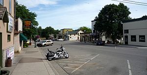
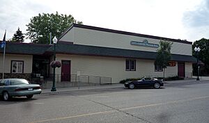
Broadway, downtown Carver
|
|
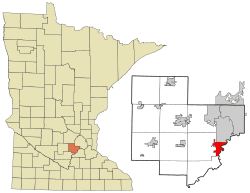
Location of the city of Carver
within Carver County, Minnesota |
|
| Country | United States |
| State | Minnesota |
| County | Carver |
| Area | |
| • Total | 4.65 sq mi (12.05 km2) |
| • Land | 4.45 sq mi (11.53 km2) |
| • Water | 0.20 sq mi (0.52 km2) |
| Elevation | 837 ft (255 m) |
| Population
(2020)
|
|
| • Total | 5,829 |
| • Density | 1,309.01/sq mi (505.45/km2) |
| Time zone | UTC-6 (Central (CST)) |
| • Summer (DST) | UTC-5 (CDT) |
| ZIP code |
55315
|
| Area code(s) | 952 |
| FIPS code | 27-10144 |
| GNIS feature ID | 2393762 |
| Website | www.cityofcarver.com |
Carver is a small city in Carver County, Minnesota, United States. It sits right by the Minnesota River. The city gets its name from an early explorer named Jonathan Carver. Downtown Carver has a special area called the Carver Historic District. This district is famous for its many old, important buildings.
In 2020, about 5,829 people lived in Carver.
Contents
Where is Carver Located?
Carver is a city in Minnesota, a state in the United States. It covers about 4.65 square miles (12.05 square kilometers). Most of this area is land, with a small part being water.
U.S. Highway 212 is a major road that runs through the area.
Carver's Past: A Look Back
How Carver Began
Thousands of years ago, a huge river called the Glacial River Warren flowed through this area. It left behind lots of clay, sand, and gravel. This also created the Minnesota River. For a very long time, from about 1200 B.C. to A.D. 1850, Native American groups lived here.
In 1834, a Wahpeton village was located where Carver is today. It was led by Chief Mazomaini. This village was near where Carver Creek meets the Minnesota River.
- In the late 1600s, Pierre-Charles Le Sueur was the first European to explore the Minnesota River. He explored the region for the King of France.
- In 1766, Jonathan Carver explored the area for the British Empire. He made maps while searching for a water route across North America to the Pacific Ocean. He named a small river flowing into the Minnesota River "Carver's River," which is now called Carver Creek.
- In 1805, a French trader named Jean-Baptiste Faribault set up a trading post nearby. This post was visited by traders, Dakota Indians, and missionaries.
A Growing Town
In 1851, a treaty between the Dakota people and the U.S. Government opened the area for new settlers. Axel Jorgenson, from Norway, was one of the first settlers in 1852. He claimed the land that would become Carver. He first called the area Lukenborg.
In the 1850s, many people wanted to buy land along rivers. Carver was a great spot because it was between parts of the Minnesota River that steamboats could use. This made it perfect for transferring goods. In 1854, Jorgenson sold his land to the Carver Land Company. This group of seven investors planned to build a town. One of the investors, Alexander Ramsey, named the town Carver. The town was officially planned out in 1857.
By 1855, Carver already had many businesses. It had a tailor, a hotel, a blacksmith, and a general store. When the town was planned in 1857, it already had 35 buildings. The first school district in Minnesota was also set up here that same year. Steamboats traveled daily between Carver and St. Paul, bringing passengers and new immigrants. These new settlers bought land and helped the area grow.
An economic downturn in 1857 caused problems for many new towns. A nearby community called Louisville collapsed, and many of its buildings were moved to Carver. In 1858, people thought gold was found in Spring Creek, leading to a small "gold rush." By 1860, many immigrants from Sweden and Germany began to settle in Carver.
In 1862, there were conflicts in the region. Many settlers sought safety in Carver because they could use steamboats to escape to Fort Snelling if needed. Carver was not attacked, but people in nearby towns fled for safety.
Changes and Challenges
When the Minneapolis and St. Louis Railway arrived in 1871, Carver's importance as a river port began to fade. People and goods started traveling by train instead of steamboat. Telegraph service also arrived soon after. In 1877, Carver officially became a village. Phone service connected the town to the Twin Cities in 1893.
Carver's businesses faced tough times during the period of Prohibition (when alcohol was illegal) and the Great Depression (a time of severe economic hardship). This caused the city to struggle for many years. In 1965, a big flood affected the lower part of old Carver. After this, a floodwall was built to protect the city from the Minnesota River.
Bringing Carver Back to Life
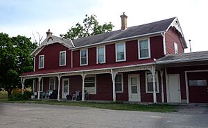
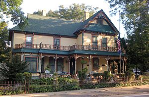
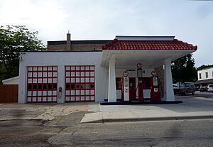
In 1969, a group called Carver-on-the-Minnesota was formed. This group worked to buy and fix up important old buildings. While they made some progress, some important buildings were still lost. In 1980, the Carver Historic District was added to the National Register of Historic Places. This made it one of the first historic districts in Minnesota. Because the city had struggled for a while, many old buildings were saved from being torn down or rebuilt. The historic district now includes 87 important buildings and structures.
In 1989, the City of Carver created the Heritage Preservation Commission. This group helps the city council protect historic places. In 2006, Carver was recognized for its efforts in historic preservation. In 2007, the White House named Carver a Preserve America Community. This honor recognized Carver's commitment to preserving its history.
Who Lives in Carver?
| Historical population | |||
|---|---|---|---|
| Census | Pop. | %± | |
| 1860 | 724 | — | |
| 1870 | 521 | −28.0% | |
| 1880 | 683 | 31.1% | |
| 1890 | 625 | −8.5% | |
| 1900 | 583 | −6.7% | |
| 1910 | 571 | −2.1% | |
| 1920 | 504 | −11.7% | |
| 1930 | 427 | −15.3% | |
| 1940 | 519 | 21.5% | |
| 1950 | 548 | 5.6% | |
| 1960 | 467 | −14.8% | |
| 1970 | 669 | 43.3% | |
| 1980 | 642 | −4.0% | |
| 1990 | 744 | 15.9% | |
| 2000 | 1,266 | 70.2% | |
| 2010 | 3,724 | 194.2% | |
| 2020 | 5,829 | 56.5% | |
| U.S. Decennial Census 2013 Estimate |
|||
Carver's Population in 2010
In 2010, there were 3,724 people living in Carver. There were 1,182 households, which are groups of people living together. The city had about 931 people per square mile.
- Most residents (89.8%) were White.
- About 1.0% were African American.
- About 6.3% were Asian.
- About 2.0% of the population was Hispanic or Latino.
Many households (55.8%) had children under 18 living with them. Most households (72.9%) were married couples. The average household had about 3.15 people.
The average age in Carver was 31.7 years old.
- 36.1% of residents were under 18.
- 36.1% were between 25 and 44 years old.
- About half of the residents were male (50.5%) and half were female (49.5%).
Schools in Carver
St. Nicholas Catholic Church is in the center of Carver. While it doesn't have its own school, many students go to Guardian Angels Catholic School in nearby Chaska. For public elementary school, students often attend East Union Elementary and Clover Ridge Elementary. Many high school students go to Chaska High School. In 2017, Carver Elementary opened, providing another option for younger students.
Famous People from Carver
- William F. Badè, an archeologist and scholar.
See also
 In Spanish: Carver (Minnesota) para niños


