
Kaveri River facts for kids
Quick facts for kids Kaveri |
|
|---|---|

Map of the Kaveri river basin
|
|
| Country | India |
| Physical characteristics | |
| Main source | Talakaveri, Kodagu, Western Ghats, Karnataka Karnataka (ಕರ್ನಾಟಕ), India 1,276 m (4,186 ft) 12°23′N 75°29′E / 12.383°N 75.483°E |
| River mouth | Poompuhar, Tamil Nadu (தமிழ் நாடு) Bay of Bengal, India 0 m (0 ft) 11°21′40″N 79°49′46″E / 11.36111°N 79.82944°E |
| Length | 805 km (500 mi) |
| Discharge (location 2) |
|
| Basin features | |
| Basin size | 81,155 km2 (31,334 sq mi) |
| Tributaries |
|
The Kaveri River, also known as Ponni, is an important river in India. It flows through the states of Karnataka and Tamil Nadu. It is the third longest river in South India, after the Godavari and Krishna. In Tamil Nadu, it is the largest river and divides the state into northern and southern parts.
The Kaveri River starts in the Western Ghats mountains at a place called Talakaveri in Kodagu, Karnataka. It then flows mostly south and east through Karnataka and Tamil Nadu. The river crosses the southern Deccan Plateau and the lowlands in the southeast. Finally, it flows into the Bay of Bengal through two main mouths near Poompuhar, Tamil Nadu. The area around the Kaveri River, especially its delta, is one of the most fertile places in India.

The Kaveri River basin is a large area of about 81,155 square kilometres (31,334 sq mi). Many smaller rivers, called tributaries, flow into the Kaveri. The river's basin covers three states and one Union Territory:
- Tamil Nadu (about 43,856 square kilometres (16,933 sq mi))
- Karnataka (about 34,273 square kilometres (13,233 sq mi))
- Kerala (about 2,866 square kilometres (1,107 sq mi))
- Puducherry (about 160 square kilometres (62 sq mi))
The river begins in southwestern Karnataka and flows southeast for about 800 kilometres (500 mi) before reaching the Bay of Bengal.
In the Mandya district, the Kaveri River forms an island called Shivanasamudra. On either side of this island are the beautiful Shivanasamudra Falls. These waterfalls drop about 100 metres (330 ft). The river is a key source for a large irrigation system. It also helps generate hydroelectric power, which is electricity made from moving water. For centuries, the Kaveri River has supported farming and has been vital for ancient kingdoms and modern cities in South India. Because the river is so important, different Indian states have had disagreements over how to share its water for many decades.
How the Kaveri River is Used

The Kaveri River is mainly used for three important things:
- Providing water for farming (irrigation).
- Supplying water for homes and daily use.
- Generating electricity.
During India's first Five Year Plan, it was estimated that the Kaveri River had a total flow of about 15 cubic kilometres (12,000,000 acre⋅ft). About 60 percent of this water was used for irrigation. For example, the Torekadanahalli pump station sends about 540 million litres (19,000,000 cu ft) of water every day from the Kaveri River to the city of Bangalore, which is about 100 kilometres (62 mi) away.
An interesting fact is that the first hydroelectric plant in Asia was built on the left side of the Sivanasamudra Falls on the Kaveri River in 1902. This plant used the power of the river to create electricity.
Images for kids
-
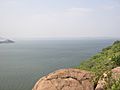
Stanley Reservoir formed by Mettur Dam, the largest dam in Tamil Nadu
-
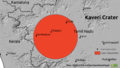
The crater (red circle) surrounded by hills within the Deccan peninsula


See also
 In Spanish: Río Kaveri para niños
