Central Bedfordshire facts for kids
Quick facts for kids
Central Bedfordshire
|
||
|---|---|---|
|
||
|
||

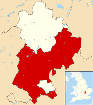
Shown within Bedfordshire
|
||
| Sovereign state | United Kingdom | |
| Constituent country | England | |
| Region | East of England | |
| Ceremonial county | Bedfordshire | |
| Founded | 1 April 2009 | |
| Admin. HQ | Chicksands | |
| Government | ||
| • Type | Unitary authority | |
| • Body | Central Bedfordshire Council | |
| Area | ||
| • Total | 276.3 sq mi (715.7 km2) | |
| Area rank | 52nd | |
| Population
(2005 est.)
|
||
| • Total | 288,648 | |
| • Rank | Ranked 46th | |
| • Density | 1,044.56/sq mi (403.309/km2) | |
| Ethnicity (2021) | ||
| • Ethnic groups |
List
|
|
| Religion (2021) | ||
| • Religion |
List
47.9% Christianity
42.8% no religion 8% other 1.3% Islam |
|
| Time zone | UTC+0 (Greenwich Mean Time) | |
| • Summer (DST) | UTC+1 (British Summer Time) | |
| ONS code | 00KC (ONS) E06000056 (GSS) |
|
Central Bedfordshire is a special area in England, located in the county of Bedfordshire. It's called a unitary authority because it has its own local government that manages many services for the people living there. This area was officially created in 2009.
Contents
How Central Bedfordshire Was Formed
Central Bedfordshire was created on April 1, 2009. This happened as part of a big change in how local government worked in Bedfordshire. Before this, there were different councils for different things.
The old Bedfordshire County Council and other smaller councils were stopped. New unitary authorities were set up instead. These new authorities now handle all the services that the old councils used to provide. Central Bedfordshire was formed from the areas that used to be called Mid Bedfordshire and South Bedfordshire.
The local government for this area is known as the Central Bedfordshire Council.
Voting for Parliament
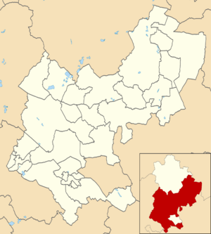
The area of Central Bedfordshire is divided into different parts for voting in national elections. These parts are called parliamentary constituencies. Each constituency elects a Member of Parliament (MP) to represent them in the UK Parliament.
Here are the constituencies that cover parts of Central Bedfordshire:
- Dunstable and Leighton Buzzard
- Hitchin (this area also includes parts of North Hertfordshire)
- Luton South and South Bedfordshire
- Mid Bedfordshire
- North Bedfordshire
Towns and Villages in Central Bedfordshire
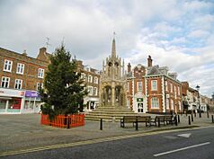
Central Bedfordshire is home to a mix of busy market towns and peaceful rural villages. The biggest town in the area is Leighton Buzzard. Other large towns include Dunstable and Houghton Regis. Dunstable and Houghton Regis are part of a larger urban area that includes Luton.
Here is a list of some of the towns and villages you can find in Central Bedfordshire:
- Ampthill (town)
- Arlesey (town)
- Aspley Guise
- Barton-le-Clay
- Biggleswade (town)
- Blunham
- Broom
- Caddington
- Campton
- Clifton
- Clophill
- Chalton
- Chicksands
- Cranfield
- Dunstable (town)
- Dunton
- Eaton Bray
- Eversholt
- Fairfield
- Flitton
- Flitwick (town)
- Greenfield
- Harlington
- Haynes
- Heath and Reach
- Henlow
- Higham Gobion
- Houghton Conquest
- Houghton Regis (town)
- Husborne Crawley
- Kensworth
- Langford
- Leighton Buzzard (town)
- Lidlington
- Linslade (town)
- Marston Moretaine
- Maulden
- Meppershall
- Millbrook
- Northill
- Old Warden
- Pepperstock
- Potton (town)
- Pulloxhill
- Ridgmont
- Sandy (town)
- Shefford (town)
- Silsoe
- Shillington
- Slip End
- Southill
- Stanford
- Steppingley
- Stotfold
- Sutton
- Tebworth
- Tempsford
- Toddington
- Westoning
- Wingfield
- Wixams (a new town, partly in Central Bedfordshire and partly in the Borough of Bedford)
- Woburn
- Woodside
See also
 In Spanish: Central Bedfordshire para niños
 | Leon Lynch |
 | Milton P. Webster |
 | Ferdinand Smith |


