Chaudière Falls facts for kids
Quick facts for kids Chaudière Falls |
|
|---|---|
|
|
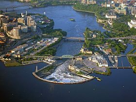
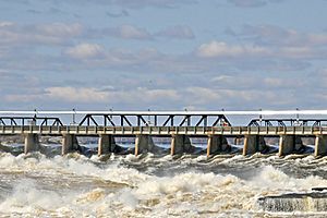
Chaudière Falls in June 2006, at summer water levels
|
|
| Lua error in Module:Infobox_mapframe at line 185: attempt to index field 'wikibase' (a nil value). | |
| Location | Ottawa-Gatineau, Ontario and Quebec, Canada |
| Coordinates | 45°25′14″N 75°43′20″W / 45.42056°N 75.72222°W |
| Total height | 15 metres (49.2 ft) |
| Total width | 60 metres (197 ft) |
| Watercourse | Ottawa River |
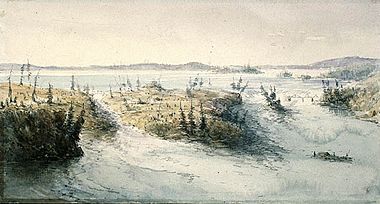
The Chaudière Falls are a beautiful set of waterfalls in the middle of the Ottawa-Gatineau area in Canada. Here, the Ottawa River flows between rocky cliffs. The falls are located near the Chaudière Bridge and close to the Canadian War Museum.
Many islands surround the falls, including Chaudière Island, Albert Island, and Victoria Island. The falls are about 60 meters (200 feet) wide and drop 15 meters (49 feet). In the past, this area was a busy industrial hub, especially in the 1800s. This industry helped the nearby cities grow.
Today, dams and factories have changed how the falls look. In summer, when the Ottawa River is low, the falls almost disappear. This is because water is sent to power stations. For many years, people could not visit the falls. But since 2017, a new park designed by architect Douglas Cardinal has made them open to the public. There are also plans for an Indigenous welcome center on Victoria Island.
Contents
What's in a Name?
The name "Chaudière" was given to the falls by Samuel de Champlain, a French explorer, in 1613. He wrote that the Indigenous people called them "Asticou," meaning "boiler." However, the Algonquin word for boiler or cauldron is "Akikok," and another Algonquin name for the falls is "Akikodjiwan."
The European name, Chutes de la Chaudière, means "Cauldron Falls" in French. Before all the building, the falls looked like a large kettle or cauldron. This is why they got that name.
Some people, like William S. Hunter Jr. in 1855, thought the name came from the shape of the chasm. He said it looked like a kettle, and the swirling water made it seem like it was boiling.
The Mohawk people called the falls "Tsitkanajoh," or the "Floating Kettle." The Onondagas called them "Katsidagweh niyoh," or "Chief Council Fire."
For the Anishinaabe people, who gathered and traded near the falls, the whirlpool was like the bowl of a great peace pipe. The mist rising from the water was like smoke going up to the Creator.
A Look Back in Time
Indigenous History and Travel
Before Europeans arrived, the area around the Chaudière Falls was a very important meeting place for different Indigenous groups. The Ottawa River (called Kichi Sipi) and other waterways were like highways. People used canoes to travel.
The water levels around the falls changed a lot throughout the year, sometimes by 28 feet (8.5 meters). This would flood the islands and surrounding lands. The main people living here were the Algonquin Anishinaabe. They created many portage routes to go around waterfalls and other natural barriers.
Early Explorers and the Fur Trade
Samuel de Champlain was the first European to write about the falls in 1613. He called them chaudière. He described how the water fell with great force, creating a deep basin and large whirlpools. He also wrote about an Indigenous ceremony where people offered tobacco to the falls. This showed how sacred the falls were.
During the fur trade, the Chaudière Falls were a challenge for traders. They had to carry their canoes and goods around the falls. This carrying place is now known as Hull.
European Settlement and Industry
In 1800, Philemon Wright arrived, and this marked the start of the city of Hull. The first bridge, Union Bridge, was built near the falls in 1827.
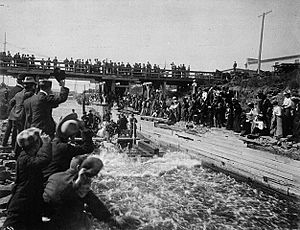
When the logging industry grew, the falls became a problem for floating logs downstream. In 1829, Ruggles Wright built the first timber slide. This allowed logs and timber rafts to bypass the falls on the north side of the river. Later, in 1836, another slide was built on the south side. This slide became a popular tourist attraction. Even King Edward VII and King George V enjoyed "shooting the slides" there.
In the 1800s, some of Canada's biggest sawmills were located near the falls. Important lumber leaders like Henry Franklin Bronson and John Rudolphus Booth worked here.
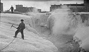
Over time, all the islands and shores around the Chaudière Falls were developed. The river's power was used to run paper mills and power stations. In 1910, a special dam was built to send water to these power stations. The E. B. Eddy Company had many mills here. These operations stopped in 2007. The land was then transferred to Hydro Ottawa and Hydro-Québec to run hydro-electric power plants.
Victoria Island
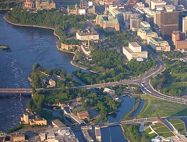
Victoria Island is located in Ontario, between Ottawa and Gatineau. It is part of the Ottawa River where the river gets narrow. You can reach the island using the Chaudière Bridge.
For hundreds of years, First Nations people used this island. They called the area Asinabka, meaning "Place of Glare Rock." Old evidence shows that this spot was a central place for trade and for sharing spiritual and cultural ideas. Its location, where three rivers meet and overlooking fast water, made it very special. Today, the National Capital Commission manages the island.
The island has an Indigenous business called "Aboriginal Experiences." It teaches visitors about First Nations history, offers tours, traditional dances, and craft workshops. In 2012, Attawapiskat Chief Theresa Spence chose this island for a protest. This was because it was close to Parliament Hill and important to Aboriginal peoples.
Inspired by Algonquin chief William Commanda's vision for Asinabka, architect Douglas Cardinal designed plans for an Indigenous healing and peacekeeping center on the island.
Victoria Island has several buildings, including the Aboriginal Experiences Centre and old power stations. The National Capital Commission announced in 2018 that the island would be closed for cleanup work. This work was planned to happen in phases, with the first phase ending in spring 2020.
Zibi Development Project
Zibi is a large building project covering 34 acres (14 hectares). It includes homes, shops, offices, and hotels. It is being built on the north side of the river in Gatineau, and on Chaudière and Albert Islands in Ottawa. This project will reuse old buildings and add new ones near the falls. When finished, about 3,500 people are expected to live there.
The project is called "Zibi," which is the Algonquin Anishinabe word for river. This name was chosen to honor the waterways and the traditional territory of the Algonquin Nation.
Some Indigenous groups, like the Algonquins of Pikwàkanagàn First Nation, are partners in the project. They are working with the developers to get benefits like jobs, training, and business chances. They also want to make sure Algonquin heritage is recognized.
However, some groups and individuals are against the Zibi project. They want the area to be returned to its natural state and managed by the Algonquin people. They believe the islands around the falls are sacred and should be public parkland. They also feel the project does not fully respect Indigenous rights. Important opponents include architect Douglas Cardinal and author John Ralston Saul.
Some Algonquin leaders, like Chief Kirby Whiteduck of Pikwakanagan, have said that the Algonquin people do not need to be "saved" from the Zibi project. They see it as a way to help their communities grow economically.
Generating Power from the Falls
Centrale Hull 2
Centrale Hull 2 is a power station on the Gatineau side of the Chaudière Falls. It has four turbines and can produce 27 megawatts of electricity. Hydro-Québec owns it. It started operating in 1920 with two turbines, and more were added later.
Chaudière Falls Generating Stations
Hydro Ottawa runs two power stations on the Ottawa side. These stations do not use a large dam. Generating Station 2 was built in 1891, and Generating Station No. 4 was built in 1900.
Hydro Ottawa bought the land around the falls in 2012. A project started in 2015 and finished in 2017 increased the power output of these stations from 29 to 58 megawatts. This project put new turbines underground near the falls. This also created new public viewing areas and a park that celebrates both Indigenous and industrial history.
See also
 In Spanish: Cataratas de Chaudière para niños
 | Aaron Henry |
 | T. R. M. Howard |
 | Jesse Jackson |


