Chesapeake Bay Bridge–Tunnel facts for kids
Quick facts for kids Chesapeake Bay Bridge–Tunnel |
|
|---|---|
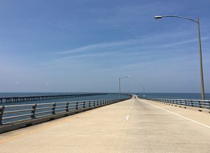
Coming down from the high-level portion near the north end
|
|
| Coordinates | 37°01′48″N 76°05′09″W / 37.029966°N 76.085815°W |
| Carries | 4 lanes (4 on bridges, 2 in tunnels) of |
| Crosses | Chesapeake Bay |
| Locale | Virginia Beach and Norfolk, Chesapeake, Portsmouth to Cape Charles, Virginia, U.S. |
| Official name | Lucius J. Kellam Jr. Bridge–Tunnel |
| Maintained by | Chesapeake Bay Bridge and Tunnel Commission |
| Characteristics | |
| Design | Fixed link: low-level trestle, 2 single-tube tunnels connected by artificial islands, truss bridges, high-level trestle |
| Total length | 17.6 miles (28.3 km) |
| Clearance below | 75 feet (22.9 m) (North Channel) 40 feet (12.2 m) (Fisherman Inlet) |
| History | |
| Opened | April 15, 1964 (northbound) April 19, 1999 (southbound) |
| Statistics | |
| Toll | Cars $14 (Each direction & off-peak. $18 Peak. Round trip discount available.) E-ZPass |
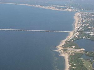
The Chesapeake Bay Bridge–Tunnel (CBBT) is an amazing 17.6-mile (28.3 km) long structure. It crosses the mouth of the Chesapeake Bay in Virginia, USA. This special bridge–tunnel connects the Delmarva Peninsula with the Hampton Roads area.
The CBBT opened in 1964. Before that, people used ferries to cross the bay since the 1930s. In 1999, the bridges were made wider to handle more traffic. A project to widen one of its tunnels started in 2017.
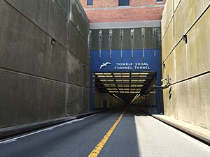
With 12 miles (19 km) of bridges and two one-mile-long (1.6 km) tunnels, the CBBT is unique. It's one of only 14 bridge–tunnel systems in the world. It carries US 13, a major highway. This route saves drivers about 95 miles (153 km) and 1.5 hours. It helps people traveling between Hampton Roads and the Delaware Valley. By 2021, over 140 million vehicles had crossed the CBBT.
The CBBT is managed by the Chesapeake Bay Bridge and Tunnel District. This group works with the Virginia Department of Transportation. The project was paid for by selling bonds, which are like loans. The money from tolls helps pay back these loans and covers daily costs. It's important to know that no tax money was used to build it.
Sometimes, people confuse the CBBT with the Chesapeake Bay Bridge. That bridge is farther north in Maryland. It connects Annapolis and Kent Island.
Contents
Building the Chesapeake Bay Bridge–Tunnel
Why a Bridge–Tunnel Was Needed
In 1606, English settlers arrived at the mouth of the Chesapeake Bay. They named the two land points Cape Henry and Cape Charles. The first permanent English settlement was at Jamestown.
Over time, the bay became a big challenge for travel. It was hard to get from the mainland to the Eastern Shore. This made it difficult for businesses and growth there. Most people on the Eastern Shore were farmers or worked on the water.
From Ferries to a Fixed Crossing
For 350 years, ships and ferries were the main way to cross. From the 1930s to 1954, the Virginia Ferry Corporation ran a ferry service. It carried cars, buses, and people between the Eastern Shore and Virginia Beach. This was called the Little Creek-Cape Charles Ferry.
Even with many large, modern ships, the ferries often faced delays. Heavy traffic and bad weather caused problems. In 1954, the state of Virginia created a special group. This group bought the ferry company to improve service.
When the CBBT opened, the ferry service stopped. Many of the ferry boats were sold. They were used to start a new ferry service in Delaware.
Planning the Big Project
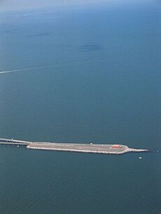
In 1956, studies showed that building a fixed crossing was possible. Engineers looked at different routes. They chose the shortest path, from the Eastern Shore to Virginia Beach.
The route had to cross two major shipping channels. These channels are used by large ships. At first, high bridges were considered. But the United States Navy worried that a bridge could block the Naval Station Norfolk if it collapsed.
To solve this, engineers suggested a bridge–tunnel design. This is like the Hampton Roads Bridge–Tunnel, but much bigger. The tunnels would go under the main shipping channels. They would be connected by four artificial islands. Each island is about five acres (2.0 ha) in size. The engineering firm Sverdrup & Parcel designed the CBBT.
Building the Original Structure
In 1960, the Chesapeake Bay Ferry Commission sold $200 million in bonds. These bonds helped pay for the construction. No tax money was used for building the CBBT. Future tolls would pay back the bonds.
Construction began in October 1960. Building the tunnels involved digging a large ditch. Pre-made tunnel sections were then lowered into the ditch from barges. Divers bolted the sections together. Then, water was pumped out, and the tunnels were covered with earth.
The construction was very difficult. Workers faced strong storms like nor'easters and hurricanes. The Ash Wednesday Storm of 1962 destroyed some parts of the project. Seven workers died during the construction.
In April 1964, after 42 months, the Chesapeake Bay Bridge–Tunnel opened. The ferry service was then stopped. The group that built and runs the CBBT is a public agency. It is supported by the tolls collected from drivers.
Lucius J. Kellam Jr. was the first chairman of the commission. He helped make the bridge–tunnel a reality. The facility was renamed in his honor in 1987. He served as chairman for 39 years.
Keeping the CBBT Modern
Widening the Bridges (1999)
In 1999, new parallel two-lane bridges were built. This cost $197 million. These new bridges helped ease traffic and made the crossing safer. Once the new bridges were ready, traffic moved to them. The original bridges were then repaired and updated. This cost $20 million.
The 1995–1999 project made the above-water part of the CBBT four lanes wide. It also added wider shoulders for the new southbound lanes. This also helped protect against a full closure if a bridge was hit by a ship. The parallel bridges are not right next to each other. This reduces the chance that both would be damaged at once.
Adding a Second Thimble Shoal Tunnel (Projected 2027)
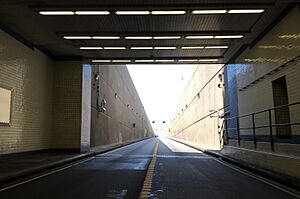
In 2013, a project was approved to build a second tunnel. This tunnel will go under the Thimble Shoal channel. It is expected to cost about $756 million. A special machine called Chessie is digging the tunnel. It's 325 ft (99 m) long and can dig about 50 ft (15 m) per day.
Construction started in 2017. A pier, shop, and restaurant on South Thimble Island closed in September 2017. They will not be replaced. The tunnel is expected to be finished by 2027.
- Tunnel length: about one mile (1.6 km)
- Tunnel diameter:
- Inside: 39 feet (12 m)
- Outside: 42 feet (13 m)
- Construction cost: $755,987,318
- Construction method: Bored tunnel
- Maximum tunnel depth: 134 feet (41 m) below the surface
- Soil removed: about 500,000 cubic yards (380,000 m3) of soil
- Concrete pieces: The tunnel will use about 9,000 concrete pieces.
Adding a Second Chesapeake Channel Tunnel (Projected 2035–2040)
A parallel Chesapeake Channel Tunnel will also be added. This will make the entire CBBT a four-lane highway. This project is planned to start in 2035. It could open to traffic around 2040.
In 2021, the U.S. Department of Transportation loaned $338.6 million for the tunnels. This money helps pay for building both parallel tunnels.
How the CBBT Works and Is Maintained
Tolls are collected at both ends of the CBBT. You pay tolls when you go in each direction. As of 2024, the toll for cars is $16 for off-peak times. It's $21 during peak times (Friday to Sunday, May 15 to September 15). If you make a return trip within 24 hours, it costs less with an EZ-Pass.
All toll lanes have gates. These gates are for safety and to turn around vehicles that can't cross. For example:
- Strong winds can be dangerous. Some vehicles are not allowed when winds are over 40 miles per hour (64 km/h). If winds are very strong, all traffic might be stopped.
- Hazardous materials need special checks. This is to keep the tunnels safe.
- Tunnels have a height limit of 13 feet 6 inches (4.11 m). Tall trucks can damage the tunnels.
- If there's an accident or closure, gates stop drivers from entering.
Bicycles are not allowed on the CBBT. But a shuttle van is available for cyclists for $15. You need to call ahead to arrange it.
The bridge must be checked and serviced every five years. Since this takes about five years, the process is always ongoing.
The CBBT has its own police department. They enforce Virginia laws on the bridge–tunnel. Emergency call boxes are placed every half-mile.
Exploring the CBBT and Nearby Areas
The CBBT is more than just a way to get from one place to another. It's also a destination itself. For travelers, it can save over 90 miles (140 km) of driving. This is true for those going between places like Ocean City, MD and Virginia Beach.
On the Delmarva peninsula, north of the bridge, you can visit Kiptopeke State Park. You can also see the Eastern Shore National Wildlife Refuge. To the south, near Virginia Beach, there are places like First Landing State Park and the Virginia Aquarium and Maritime Science Center.
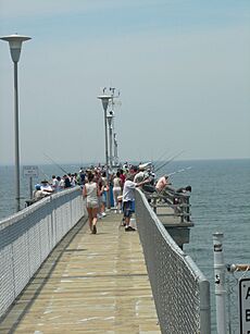
There used to be a scenic overlook and a restaurant on South Thimble Island. You could watch ships like U.S. Navy warships and cargo vessels. There was also a 625-foot-long (191 m) fishing pier. People caught fish like bluefish and trout there. Bird watchers also came to see birds. The restaurant, gift shop, and pier closed in September 2017. The pier will reopen in 2027 after the tunnel project is done.
How Big Is the CBBT?
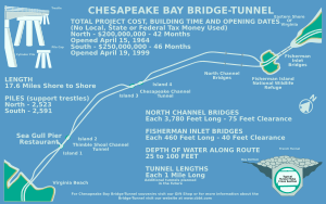
The Chesapeake Bay Bridge–Tunnel has some key features. It has two one-mile (1.6 km) tunnels. These tunnels go under the main shipping channels. There are also two pairs of high-level bridges. These are the North Channel Bridge and the Fisherman Inlet Bridge. The North Channel Bridge has 75 ft or 22.9 m of clearance. The Fisherman Inlet Bridge has 40 ft or 12.2 m of clearance.
The rest of the CBBT is made of 12 miles (19 km) of low-level bridges called trestles. There are also two miles (3.2 km) of causeway and four artificial islands.
The CBBT is 17.6 miles (28.3 km) long from shore to shore. Including the roads leading to it, the whole facility is 23 miles (37 km) long. The columns that hold up the bridges are called piles. If you laid them end-to-end, they would stretch for about 100 miles (160 km). That's like the distance between New York City and Philadelphia.
Incidents and Closures
The CBBT has been closed for several days three times after being hit by boats:
- In December 1967, a coal barge hit the bridge. It was closed for two weeks.
- In January 1970, a U.S. Navy ship hit the bridge during a storm. It knocked out a 375-foot (114 m) section. The bridge was closed for 42 days.
- In 1972, another barge hit the bridge. It was closed for two weeks for repairs.
Other smaller incidents have caused shorter closures for inspections. For example, a barge strike in June 2011 closed it for four hours.
Some accidents have happened where vehicles have gone off the bridge into the water. In 2017 and 2020, trucks crashed through the guardrails.
Images for kids


