Coen, Queensland facts for kids
Quick facts for kids CoenQueensland |
|||||||||||||||
|---|---|---|---|---|---|---|---|---|---|---|---|---|---|---|---|
 |
|||||||||||||||
| Population | 320 (2021 census) | ||||||||||||||
| • Density | 0.0329/km2 (0.085/sq mi) | ||||||||||||||
| Postcode(s) | 4871 | ||||||||||||||
| Elevation | 199 m (653 ft) | ||||||||||||||
| Area | 9,735.2 km2 (3,758.8 sq mi) | ||||||||||||||
| Time zone | AEST (UTC+10:00) | ||||||||||||||
| Location | |||||||||||||||
| LGA(s) | Shire of Cook | ||||||||||||||
| State electorate(s) | Cook | ||||||||||||||
| Federal Division(s) | Leichhardt | ||||||||||||||
|
|||||||||||||||
|
|||||||||||||||
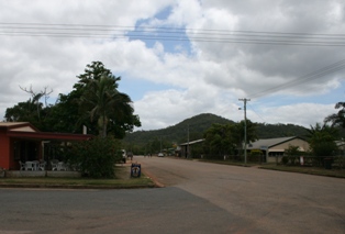
Coen is a small town in Queensland, Australia. It is located in the Shire of Cook, which is part of the Cape York Peninsula in far northern Queensland. Coen is inland but still considered a coastal area.
The town sits on the Peninsula Developmental Road. This is the main road that leads to the very tip of Cape York. Because of this, Coen is a busy place, especially during the dry season. Many tourists and visitors pass through the town on their way north. In 2021, about 320 people lived in Coen.
Contents
Where is Coen Located?
The area of Coen is on the western side of the Cape York Peninsula. The Coral Sea is to its east. The Archer River forms part of Coen's northern border. The Coen River makes up part of its western border. The main road, the Peninsula Developmental Road, runs through the area from north to south.
A Look Back at Coen's History
How Coen Got Its Name
In 1623, a Dutch explorer named Jan Carstenszoon was sailing on a ship called Pera. He named a river on the Cape York Peninsula after Jan Pieterszoon Coen. He was a very important leader of the Dutch East Indies. Today, that river is called the Archer River. The name Coen River is now used for one of its smaller rivers.
Gold Rush Days
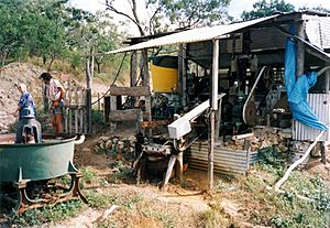
In 1876, people found gold near the Coen River. This led to a small gold rush. In May 1877, gold miners and prospectors built a small fort there. This was the start of the Coen settlement.
The first gold rush ended quickly. But the area became busy again in 1883. Coen grew as a center for several small goldmines. In 1893, a very rich mine called the Great Northern mine started booming. This made Coen a much bigger town. The Coen Post Office opened on June 20, 1893. The Great Northern mine kept working until 1916. It produced a lot of gold before it closed.
A Special Police Tracker
On July 3, 2014, a man named Barry Port retired from the Queensland Police. He was Australia's last Aboriginal police tracker. For 36 years, he used his amazing tracking skills. He helped the police find criminals, missing people, and even people hiding on ships.
Education in Coen
Coen Campus is a primary school for students from Prep to Year 6. It is part of the Cape York Aboriginal Australian Academy. You can find it on the Peninsula Developmental Road.
There are no high schools in Coen or very close by. Older students can learn through distance education. They can also go to boarding schools in other towns.
What Coen Offers Today
Coen is an important place for the region. It provides services and supplies for people traveling on the long road to Weipa and other towns up north. It's a popular stop for tourists driving to the tip of Cape York.
The town has many useful facilities:
- An airstrip at Coen Airport, about 24 kilometres (15 mi) north of town.
- A public library.
- A hotel/motel and a guest house.
- Two general stores and places to get fuel.
- A hospital and a police station.
- Camping grounds.
- A primary school and kindergarten.
- A ranger base.
There are also regular flights to Lockhart and Cairns four times a week. Our Lady of the Way Catholic Church is located on Armbrust Street. There is also a boat ramp at Port Stewart. You can use it to get into the Stewart River. The Cook Shire Council manages this boat ramp.
Fun Things to Do in Coen
Coen is a great place for people who love birds. There are good places to stay. You can see many different kinds of birds here. These birds live in rainforests, monsoon forests, and coastal forests.
Coen's Climate
Coen has a tropical savanna climate. This means it has clear wet and dry seasons. During the day, temperatures are usually over 30 °C (86 °F) for most of the year.
The dry season runs from May to October. In the coolest months (May to August), temperatures can drop below 10 °C (50 °F). In the months leading up to the wet season (September to November), temperatures can go above 35 °C (95 °F).
The wet season is from December to March. It has lots of heavy rain and high humidity. This is also when monsoon troughs and tropical cyclones can happen.
| Climate data for Coen | |||||||||||||
|---|---|---|---|---|---|---|---|---|---|---|---|---|---|
| Month | Jan | Feb | Mar | Apr | May | Jun | Jul | Aug | Sep | Oct | Nov | Dec | Year |
| Record high °C (°F) | 38.4 (101.1) |
38.0 (100.4) |
36.0 (96.8) |
34.5 (94.1) |
34.7 (94.5) |
34.3 (93.7) |
33.6 (92.5) |
35.2 (95.4) |
37.6 (99.7) |
39.5 (103.1) |
40.6 (105.1) |
40.0 (104.0) |
40.6 (105.1) |
| Mean daily maximum °C (°F) | 32.1 (89.8) |
31.2 (88.2) |
31.1 (88.0) |
30.6 (87.1) |
29.9 (85.8) |
28.8 (83.8) |
28.5 (83.3) |
29.5 (85.1) |
31.1 (88.0) |
32.8 (91.0) |
34.1 (93.4) |
33.7 (92.7) |
31.1 (88.0) |
| Mean daily minimum °C (°F) | 23.4 (74.1) |
23.4 (74.1) |
23.1 (73.6) |
21.9 (71.4) |
20.1 (68.2) |
17.8 (64.0) |
17.1 (62.8) |
17.4 (63.3) |
18.7 (65.7) |
20.7 (69.3) |
22.4 (72.3) |
23.3 (73.9) |
20.8 (69.4) |
| Record low °C (°F) | 19.2 (66.6) |
20.0 (68.0) |
17.9 (64.2) |
12.2 (54.0) |
11.5 (52.7) |
9.5 (49.1) |
7.5 (45.5) |
7.8 (46.0) |
11.0 (51.8) |
10.0 (50.0) |
16.3 (61.3) |
18.5 (65.3) |
7.5 (45.5) |
| Average rainfall mm (inches) | 306.1 (12.05) |
303.5 (11.95) |
256.2 (10.09) |
74.5 (2.93) |
11.4 (0.45) |
3.4 (0.13) |
1.4 (0.06) |
1.5 (0.06) |
0.8 (0.03) |
13.2 (0.52) |
58.9 (2.32) |
152.2 (5.99) |
1,183.1 (46.58) |
| Average rainy days | 19.4 | 19.7 | 17.5 | 7.8 | 3.4 | 1.4 | 1.2 | 1.0 | 0.7 | 1.8 | 5.4 | 11.4 | 90.7 |
| Average relative humidity (%) | 72.5 | 77.5 | 74.0 | 67.0 | 65.0 | 62.5 | 60.0 | 56.0 | 51.5 | 49.5 | 53.5 | 62.0 | 62.6 |
| Source: Australian Bureau of Meteorology | |||||||||||||
See also
 In Spanish: Coen (Australia) para niños
 | Jessica Watkins |
 | Robert Henry Lawrence Jr. |
 | Mae Jemison |
 | Sian Proctor |
 | Guion Bluford |


