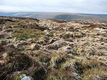
Coity Mountain facts for kids
Quick facts for kids Coity Mountain |
|
|---|---|
| Mynydd Coety | |

On Coity Mountain
|
|
| Highest point | |
| Elevation | 578 m (1,896 ft) |
| Prominence | 231 m (758 ft) |
| Listing | Marilyn, Dewey, council top (Torfaen, Blaenau Gwent) |
| Geography | |
| Location | Torfaen / Blaenau Gwent, Wales |
| Parent range | Brecon Beacons (outlier) |
| OS grid | SO231079 |
| Topo map | OS Landranger 161 |
Coity Mountain (also called Coety Mountain, and Mynydd Coety in Welsh) is a mountain in South Wales. It has a flat top and sits between the towns of Blaenavon and Abertillery.
The highest point of Coity Mountain is also the highest point for two local areas: Torfaen and Blaenau Gwent. The very top of the mountain is sometimes known as Twyn Ffynhonnau Goerion.
About 2 kilometers (1.2 miles) southeast of the main summit is another important part of the mountain. This is called Mynydd Varteg Fawr, which is 549 meters (1,801 feet) high.
Near Mynydd Varteg Fawr, you can find a special memorial stone. It is known as the "Dog Stone." This stone remembers a dog named Carlo, an Irish Setter. Carlo was accidentally shot by his owner while they were hunting on August 12, 1864.
Other notable parts of the mountain include Mulfran (524 meters or 1,719 feet). Its name means cormorant in Welsh. This spot overlooks the town of Brynmawr. There is also Mynydd James, which is just east of the town of Blaina.
A large part of Coity Mountain, including its summit, is part of the Blaenavon Industrial Landscape World Heritage Site. This means it's a very important historical area. Many old coal mines are hidden beneath the mountain. One famous mine, the Big Pit National Coal Museum, is located under the mountain.
What Coity Mountain is Made Of
Coity Mountain is made from different types of rock. These rocks are from the Carboniferous period, which was millions of years ago. You can find sandstones and mudstones here.
One important type of rock is called Pennant Sandstone. You can see this rock sticking out in places around the flat top of the mountain. People used to dig up this stone for building. You can still see some old, unused quarries (places where stone was dug) on the mountain.
The lower parts of the mountain have rocks from the Coal Measures. These areas have been heavily mined for coal. You can see large areas where coal was dug up, especially on the northeastern side.
During the last ice age, Coity Mountain likely stood above the ice. This is because you won't find any glacial till (rock and dirt left by glaciers) on its slopes. However, there are areas of peat (decayed plant matter) and loose rock. You might also see small landslides on the steeper parts of the mountain.
How to Explore Coity Mountain
There are several public paths that cross Coity Mountain. However, none of these paths go right over the very top of the summit.
You can also find many tracks for vehicles and smaller walking paths. These paths go around the sides of the mountain and along its wide main ridge.
Most of Coity Mountain is considered "access land." This means you are generally allowed to walk freely on foot across most of the mountain. This right comes from the Countryside and Rights of Way Act 2000.
 | Calvin Brent |
 | Walter T. Bailey |
 | Martha Cassell Thompson |
 | Alberta Jeannette Cassell |

