
Connell, Washington facts for kids
Quick facts for kids
Connell, Washington
|
|
|---|---|
| City of Connell | |

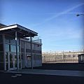
Connell City Hall pictured in 2021
|
|

Location of Connell, Washington
|
|
| Country | United States |
| State | Washington |
| County | Franklin |
| Government | |
| • Type | Mayor–council |
| Area | |
| • Total | 7.69 sq mi (19.91 km2) |
| • Land | 7.69 sq mi (19.91 km2) |
| • Water | 0.00 sq mi (0.00 km2) |
| Elevation | 846 ft (258 m) |
| Population
(2020)
|
|
| • Total | 5,441 |
| Time zone | UTC-8 (Pacific (PST)) |
| • Summer (DST) | UTC-7 (PDT) |
| ZIP code |
99326
|
| Area code | 509 |
| FIPS code | 53-14485 |
| GNIS feature ID | 1504104 |
| Website | cityofconnell.com |
Connell is a city located in Franklin County, Washington, United States. In 2020, the city had a population of 5,441 people. It's a smaller city with a rich history and a focus on agriculture.
Contents
Connell's History
How Connell Started
Before 1883, the area where Connell now stands was open land for cattle and horses. The community began in 1883. It was a meeting point for two important railroads: the Northern Pacific Railroad and the Oregon Railroad and Navigation Company.
The new town was first named Palouse Junction. It was named by Jacob Cornelius Connell, who worked for the railroad. Palouse Junction was special because it wasn't built on a river, unlike many other towns on the railroad line. It also served as a gateway to the Palouse region. Water for the trains and the town came from public wells dug by the railroad. Sometime between 1886 and 1900, the town's name was changed to Connell.

The Northern Pacific Railroad stopped serving the station in 1890. However, the Union Pacific Railroad took over in 1901, and Connell started to grow again. A school district was created around 1900-1904. In 1902, the Franklin County Bank opened in Connell. The Connell Land and Improvement Company was also started that year. The county also allowed a company to begin piping water into the town.
Early attempts to bring water were not enough. The next year, a new well was dug that found water at 268 feet deep. In 1903, new land lots were sold on the west side of the tracks. A new business area began to develop there. Many existing buildings were moved to these new spots.
Connell's Growth and Today
By this time, Connell was almost as important as Pasco in Franklin County. Sadly, a large fire in July 1905 destroyed much of the business district. But the damaged areas were quickly rebuilt using brick. Connell officially became a city on November 28, 1910. For most of the 1900s, dryland wheat farming was very important to Connell.
Today, Connell's main industries include food processing and agricultural chemicals. It is also home to a large employment center. The North Franklin School District is located here. It includes a high school, junior high, grade school, and administrative offices.
In 1998, the city planned to improve its water system. This plan included getting more water rights for future growth. By 2007, the water system plan was finished. New waterlines were installed to replace old pipes. Water reservoirs were updated, and more wells were added to the system.
The city also improved its main road, Columbia Avenue. They rebuilt industrial streets and received a grant to fix part of Clark Street. This road connects downtown to Highway 260 and serves the junior and senior high schools.
Connell's Location
Connell covers an area of about 7.87 square miles, all of which is land.
The town is located in a low area. This area was formed where three coulees meet: Providence Coulee from the north, Washtucna Coulee from the east, and Esquatzel Coulee to the southeast. The land rises a few hundred feet from the coulee floors to the higher land around Connell. Small streams flow through these coulees at certain times of the year.
U.S. Route 395 goes through Connell. This road connects Connell to Interstate 90 at Ritzville to the northeast. It also connects to Interstate 82 at the Tri-Cities to the southwest. State Route 260 starts west of Connell. It passes through the town as it heads east along Washtucna Coulee to Washtucna.
Connell's Climate
Connell has a semi-arid climate. This means it gets very little rain. It is known for having the least amount of snow in Eastern Washington on average.
| Climate data for Connell, Washington | |||||||||||||
|---|---|---|---|---|---|---|---|---|---|---|---|---|---|
| Month | Jan | Feb | Mar | Apr | May | Jun | Jul | Aug | Sep | Oct | Nov | Dec | Year |
| Record high °F (°C) | 63 (17) |
76 (24) |
84 (29) |
99 (37) |
101 (38) |
107 (42) |
112 (44) |
114 (46) |
102 (39) |
90 (32) |
75 (24) |
67 (19) |
114 (46) |
| Mean daily maximum °F (°C) | 35.5 (1.9) |
43.3 (6.3) |
54.4 (12.4) |
64.1 (17.8) |
73.2 (22.9) |
81.0 (27.2) |
90.4 (32.4) |
88.5 (31.4) |
78.2 (25.7) |
64.1 (17.8) |
46.9 (8.3) |
37.3 (2.9) |
63.1 (17.3) |
| Mean daily minimum °F (°C) | 22.4 (−5.3) |
27.4 (−2.6) |
32.0 (0.0) |
36.0 (2.2) |
42.4 (5.8) |
48.7 (9.3) |
54.5 (12.5) |
53.2 (11.8) |
46.0 (7.8) |
37.3 (2.9) |
30.4 (−0.9) |
25.2 (−3.8) |
38.0 (3.3) |
| Record low °F (°C) | −28 (−33) |
−30 (−34) |
6 (−14) |
11 (−12) |
21 (−6) |
28 (−2) |
31 (−1) |
31 (−1) |
19 (−7) |
4 (−16) |
−12 (−24) |
−29 (−34) |
−30 (−34) |
| Average precipitation inches (mm) | 1.1 (28) |
0.9 (23) |
0.9 (23) |
0.8 (20) |
0.8 (20) |
0.7 (18) |
0.3 (7.6) |
0.3 (7.6) |
0.5 (13) |
0.8 (20) |
1.4 (36) |
1.4 (36) |
9.9 (252.2) |
| Source: Weatherbase | |||||||||||||
Population Over Time
| Historical population | |||
|---|---|---|---|
| Census | Pop. | %± | |
| 1920 | 311 | — | |
| 1930 | 321 | 3.2% | |
| 1940 | 365 | 13.7% | |
| 1950 | 465 | 27.4% | |
| 1960 | 906 | 94.8% | |
| 1970 | 1,161 | 28.1% | |
| 1980 | 1,981 | 70.6% | |
| 1990 | 2,005 | 1.2% | |
| 2000 | 2,956 | 47.4% | |
| 2010 | 4,209 | 42.4% | |
| 2020 | 5,441 | 29.3% | |
| U.S. Decennial Census 2020 |
|||
Images for kids
-
A building in Connell

See also
 In Spanish: Connell (Washington) para niños
