
Corinna, Maine facts for kids
Quick facts for kids
Corinna, Maine
|
|
|---|---|

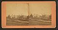
Downtown in 1908
|
|

Corinna, Maine
Location in Maine

Corinna, Maine
Location in the United States
|
|
| Country | United States |
| State | Maine |
| County | Penobscot |
| Incorporated | 1816 |
| Area | |
| • Total | 39.46 sq mi (102.20 km2) |
| • Land | 38.68 sq mi (100.18 km2) |
| • Water | 0.78 sq mi (2.02 km2) |
| Elevation | 312 ft (95 m) |
| Population
(2020)
|
|
| • Total | 2,221 |
| • Density | 57/sq mi (22.2/km2) |
| Time zone | UTC-5 (Eastern (EST)) |
| • Summer (DST) | UTC-4 (EDT) |
| ZIP code |
04928
|
| Area code(s) | 207 |
| FIPS code | 23-14310 |
| GNIS feature ID | 0582419 |
Corinna is a small town located in Penobscot County, Maine, in the United States. In 2020, about 2,221 people lived there. Corinna is part of the larger Bangor area. The main part of the town, called the village of Corinna, is in the southern section.
Contents
History of Corinna
Early Days and Naming
Corinna was first known as T4 R4 NWP. This was a way to describe its location in the wilderness. In 1804, a doctor from Boston named Dr. John Warren bought a large piece of land, about 23,040 acres (93.2 km²). He paid only two cents per acre!
To help people settle there, Dr. Warren gave away some land. He also built a special building that had both a gristmill (for grinding grain) and a sawmill (for cutting wood). The town officially became Corinna on December 11, 1816. It was named after Dr. Warren's daughter.
Growth and Industries
The first homes in Corinna were made from cut logs. Over time, Corinna became a farming community. Mills powered by water were built near Corundel Lake. These mills helped the town grow.
When the Dexter and Newport Railroad arrived in 1865–1866, Corinna started to become a small mill town. Many factories opened. These included sawmills, places that smoothed wood, and woolen textile mills that made cloth. There was also a factory that made doors, window sashes, and blinds. Other businesses included boot and shoemaking shops and an iron foundry (where metal is melted and shaped).
The Eastland Woolen Mill made woolen materials for many years, from the 1930s until it closed in 1997. After it closed, the building was taken down. Today, Corinna is mostly a bedroom community. This means many people who live there travel to nearby cities like Bangor for work.
Important Buildings

The Stewart Free Library was built in 1898. It was a gift to the town from Levi M. Stewart, a rich man from Minneapolis who was born in Corinna. The library was designed by William Harrison Grimshaw. It is a very special building and is listed on the National Register of Historic Places. This means it's an important historical site. The library has beautiful old rooms and a grand front with a clocktower. It looks more like a big courthouse than a small-town library.
The Corinna Union Academy was a school that taught students in Corinna for many years, from 1851 to 1968.
A special monument is located near the river. It honors soldiers from Corinna who served their country. It is made of marble and has the names of these brave individuals carved into it.
Geography and Climate
Location and Water
Corinna covers about 39.46 square miles (102.2 km²). Most of this area is land, with a small part being water. The town is next to Corundel Lake. Water from Corinna flows into the East Branch Sebasticook River and Alder Stream. Both of these are part of the Kennebec River system. A river system like this is called a watershed.
Roads and Trails
Corinna is located where three main roads meet: Route 7, Route 11, and Route 43. It is in the middle of several other towns, including Exeter, St. Albans, Dexter, and Newport. It's about 8 miles (13 km) north of Interstate 95.
Corinna is also on the Newport/Dover-Foxcroft Rail Trail. This trail was once a railroad line. The train tracks were removed in 1993, and now it's a path for walking and biking.
Weather in Corinna
Corinna has a humid continental climate. This means it has big changes in temperature throughout the year. Summers are warm to hot, and often humid. Winters are cold, and sometimes very cold.
| Climate data for Corinna, Maine (1991–2020 normals, extremes 1947–present) | |||||||||||||
|---|---|---|---|---|---|---|---|---|---|---|---|---|---|
| Month | Jan | Feb | Mar | Apr | May | Jun | Jul | Aug | Sep | Oct | Nov | Dec | Year |
| Record high °F (°C) | 62 (17) |
63 (17) |
86 (30) |
92 (33) |
97 (36) |
96 (36) |
97 (36) |
97 (36) |
95 (35) |
85 (29) |
76 (24) |
63 (17) |
97 (36) |
| Mean maximum °F (°C) | 48.7 (9.3) |
48.7 (9.3) |
58.1 (14.5) |
74.3 (23.5) |
85.3 (29.6) |
89.8 (32.1) |
90.2 (32.3) |
89.4 (31.9) |
85.8 (29.9) |
75.2 (24.0) |
63.4 (17.4) |
52.2 (11.2) |
92.9 (33.8) |
| Mean daily maximum °F (°C) | 28.2 (−2.1) |
31.9 (−0.1) |
41.0 (5.0) |
54.0 (12.2) |
66.9 (19.4) |
75.1 (23.9) |
80.5 (26.9) |
79.6 (26.4) |
72.0 (22.2) |
59.1 (15.1) |
46.0 (7.8) |
34.2 (1.2) |
55.7 (13.2) |
| Daily mean °F (°C) | 17.1 (−8.3) |
19.3 (−7.1) |
29.6 (−1.3) |
42.6 (5.9) |
54.7 (12.6) |
63.8 (17.7) |
69.2 (20.7) |
67.7 (19.8) |
59.8 (15.4) |
47.9 (8.8) |
36.7 (2.6) |
25.0 (−3.9) |
44.4 (6.9) |
| Mean daily minimum °F (°C) | 6.0 (−14.4) |
6.8 (−14.0) |
18.2 (−7.7) |
31.2 (−0.4) |
42.5 (5.8) |
52.4 (11.3) |
58.0 (14.4) |
55.8 (13.2) |
47.6 (8.7) |
36.6 (2.6) |
27.3 (−2.6) |
15.8 (−9.0) |
33.2 (0.7) |
| Mean minimum °F (°C) | −18.9 (−28.3) |
−16.6 (−27.0) |
−7.5 (−21.9) |
18.0 (−7.8) |
29.2 (−1.6) |
38.5 (3.6) |
46.3 (7.9) |
43.4 (6.3) |
32.2 (0.1) |
23.1 (−4.9) |
10.7 (−11.8) |
−6.5 (−21.4) |
−22.5 (−30.3) |
| Record low °F (°C) | −38 (−39) |
−39 (−39) |
−28 (−33) |
−3 (−19) |
21 (−6) |
29 (−2) |
35 (2) |
31 (−1) |
20 (−7) |
15 (−9) |
−6 (−21) |
−31 (−35) |
−39 (−39) |
| Average precipitation inches (mm) | 3.36 (85) |
2.82 (72) |
3.44 (87) |
3.83 (97) |
3.64 (92) |
4.02 (102) |
3.22 (82) |
3.59 (91) |
3.56 (90) |
4.77 (121) |
4.11 (104) |
4.34 (110) |
44.70 (1,135) |
| Average snowfall inches (cm) | 18.0 (46) |
17.7 (45) |
13.3 (34) |
4.4 (11) |
0.2 (0.51) |
0.0 (0.0) |
0.0 (0.0) |
0.0 (0.0) |
0.0 (0.0) |
0.7 (1.8) |
4.4 (11) |
16.4 (42) |
78.1 (198) |
| Average precipitation days (≥ 0.01 in) | 10.0 | 9.0 | 10.0 | 11.0 | 12.0 | 12.0 | 12.0 | 11.0 | 10.0 | 11.0 | 12.0 | 11.0 | 128.0 |
| Average snowy days (≥ 0.1 in) | 7.0 | 7.0 | 5.0 | 2.0 | 0.0 | 0.0 | 0.0 | 0.0 | 0.0 | 0.0 | 2.0 | 6.0 | 29.0 |
| Source: NOAA | |||||||||||||
Population Data
How Many People Live Here?
The number of people living in Corinna has changed over time. Here's a quick look at the population from past years:
| Historical population | |||
|---|---|---|---|
| Census | Pop. | %± | |
| 1820 | 411 | — | |
| 1830 | 1,079 | 162.5% | |
| 1840 | 1,704 | 57.9% | |
| 1850 | 1,550 | −9.0% | |
| 1860 | 1,597 | 3.0% | |
| 1870 | 1,513 | −5.3% | |
| 1880 | 1,503 | −0.7% | |
| 1890 | 1,207 | −19.7% | |
| 1900 | 1,170 | −3.1% | |
| 1910 | 1,237 | 5.7% | |
| 1920 | 1,394 | 12.7% | |
| 1930 | 1,485 | 6.5% | |
| 1940 | 1,515 | 2.0% | |
| 1950 | 1,752 | 15.6% | |
| 1960 | 1,895 | 8.2% | |
| 1970 | 1,700 | −10.3% | |
| 1980 | 1,887 | 11.0% | |
| 1990 | 2,196 | 16.4% | |
| 2000 | 2,145 | −2.3% | |
| 2010 | 2,198 | 2.5% | |
| 2020 | 2,221 | 1.0% | |
| U.S. Decennial Census | |||
2010 Census Facts
In 2010, there were 2,198 people living in Corinna. These people lived in 926 households, with 622 of them being families. The town had about 56.8 people per square mile (21.9 people per km²).
Most of the people in Corinna (97.2%) were White. About 28.8% of households had children under 18 living with them. The average age of people in Corinna was 43 years old.
Things to See and Do
- Corinna Historical Society Museum: This museum tells the story of Corinna's past.
Education in Corinna
Corinna is part of Regional School Unit #19. Mike Hammer is the Superintendent of Schools, meaning he is in charge of the schools in the area.
Famous People from Corinna
- Grenville C. Emery: He started the Harvard-Westlake School.
- Sam Fifield: A politician from Wisconsin.
- Gilbert Patten: A well-known author.
Images for kids
-
Soldiers' Monument c. 1912
-
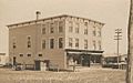
Odd Fellows' Hall c. 1912
-
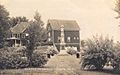
Fisher residence c. 1870


,_Maine,_from_Robert_N._Dennis_collection_of_stereoscopic_views.jpg)
See also
 In Spanish: Corinna (Maine) para niños
