
Crawford County, Iowa facts for kids
Quick facts for kids
Crawford County
|
|
|---|---|

County Courthouse, Denison
|
|

Location within the U.S. state of Iowa
|
|
 Iowa's location within the U.S. |
|
| Country | |
| State | |
| Founded | 1851/1855 |
| Named for | William Harris Crawford |
| Seat | Denison |
| Largest city | Denison |
| Area | |
| • Total | 715 sq mi (1,850 km2) |
| • Land | 714 sq mi (1,850 km2) |
| • Water | 0.8 sq mi (2 km2) 0.1% |
| Population
(2020)
|
|
| • Total | 16,525 |
| • Density | 23.112/sq mi (8.924/km2) |
| Time zone | UTC−6 (Central) |
| • Summer (DST) | UTC−5 (CDT) |
| Congressional district | 4th |
Crawford County is a place in the state of Iowa, USA. It is a county in the central part of the state. In 2020, about 16,525 people lived there.
Its main town, called the county seat, is Denison. The county is named after William Harris Crawford. He was a US senator from Georgia. He also worked as the US Secretary of the Treasury.
Contents
History
In 1851, the state of Iowa decided to create 50 new counties. Crawford County was one of them. At first, it did not have many people. So, it was managed by Shelby County for things like taxes and laws.
By 1855, more people had moved to Crawford County. They asked to become their own county. This request was approved. Then, Crawford County set up its own government. At that time, the county did not include all the land it has today.
In 1865, four areas from Monona County were added to Crawford County. After a few more changes, the county's borders were set in 1872.
Geography
Crawford County covers about 715 square miles (1,852 square kilometers). Most of this area is land. Only a very small part is water.
Major roads
 U.S. Highway 30: This road goes across the southern part of the county.
 U.S. Highway 59: This road runs north and south through the middle of the county. It passes through Schleswig and Denison.
 Iowa Highway 37: This road cuts through the southwest corner of the county.
 Iowa Highway 39: This road goes from Denison to Kiron and then into other counties.
 Iowa Highway 141: This road enters the southeast part of the county.
Neighboring counties
Crawford County shares borders with these counties:
- Ida County – to the north
- Sac County – to the northeast
- Carroll County – to the east
- Audubon County – to the southeast
- Shelby County – to the south
- Harrison County – to the southwest
- Monona County – to the west
- Woodbury County – to the northwest
Population
| Historical population | |||
|---|---|---|---|
| Census | Pop. | %± | |
| 1860 | 383 | — | |
| 1870 | 2,530 | 560.6% | |
| 1880 | 12,413 | 390.6% | |
| 1890 | 18,894 | 52.2% | |
| 1900 | 21,685 | 14.8% | |
| 1910 | 20,041 | −7.6% | |
| 1920 | 20,614 | 2.9% | |
| 1930 | 21,028 | 2.0% | |
| 1940 | 20,538 | −2.3% | |
| 1950 | 19,741 | −3.9% | |
| 1960 | 18,569 | −5.9% | |
| 1970 | 19,116 | 2.9% | |
| 1980 | 18,935 | −0.9% | |
| 1990 | 16,775 | −11.4% | |
| 2000 | 16,942 | 1.0% | |
| 2010 | 17,096 | 0.9% | |
| 2020 | 16,525 | −3.3% | |
| 2023 (est.) | 16,013 | −6.3% | |
| US Decennial Census 1790-1960 1900-1990 1990-2000 2010-2018 |
|||

2020 Census

In 2020, the county had 16,525 people living in it. This means there were about 23 people for every square mile. Most people (about 89%) said they belonged to one race. There were 6,855 homes, and 6,255 of them were lived in.
Here is a look at the different groups of people in Crawford County in 2020:
| Group | Number of People | Percentage |
|---|---|---|
| White | 10,625 | 64.3% |
| Black or African American | 383 | 2.32% |
| Native American | 31 | 0.2% |
| Asian | 303 | 1.83% |
| Pacific Islander | 4 | 0.02% |
| Other/Mixed | 267 | 1.62% |
| Hispanic or Latino | 4,912 | 29.72% |
2010 Census
In 2010, the county had 17,096 people. There were 6,943 homes, and 6,413 of them were lived in.
Towns and Cities
Crawford County has several towns and cities. The largest city is Denison.
Cities
Former cities
Some places that used to be cities in Crawford County are:
Townships
A township is a smaller area within a county. Crawford County has many townships:
- Boyer
- Charter Oak
- Denison
- East Boyer
- Goodrich
- Hanover
- Hayes
- Iowa
- Jackson
- Milford
- Morgan
- Nishnabotny
- Otter Creek
- Paradise
- Soldier
- Stockholm
- Union
- Washington
- West Side
- Willow
City populations
This table shows how many people lived in each city in Crawford County in 2020.
† county seat (main town)
| Rank | City/Town | Population (2020) |
|---|---|---|
| 1 | † Denison | 8,373 |
| 2 | Schleswig | 830 |
| 3 | Manilla | 775 |
| 4 | Charter Oak | 535 |
| 5 | Dow City | 485 |
| 6 | Vail | 396 |
| 7 | Westside | 285 |
| 8 | Kiron | 267 |
| 9 | Deloit | 250 |
| 10 | Ricketts | 109 |
| 11 | Arion | 97 |
| 12 | Buck Grove | 34 |
| 13 | Aspinwall | 33 |
| 14 | Dunlap (mostly in Harrison County) | 0 (1,038 total) |
Education
Crawford County has several school districts. These districts manage the public schools in the area.
- Ar-We-Va Community School District
- Boyer Valley Community School District
- Charter Oak-Ute Community School District
- Denison Community School District
- East Sac County Community School District
- IKM-Manning Community School District
- Maple Valley-Anthon Oto Community School District
- Odebolt Arthur Battle Creek Ida Grove Community School District
- Schleswig Community School District
Some school districts that used to be here are:
- Battle Creek-Ida Grove Community School District
- IKM Community School District
- Manning Community School District
- Maple Valley Community School District
- Odebolt-Arthur Community School District
- Wall Lake View Auburn Community School District
Images for kids
-
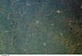
View of Crawford County and nearby areas from the International Space Station on July 14, 2002. Denison is just above the center.

See also
 In Spanish: Condado de Crawford (Iowa) para niños
