Woodbury County, Iowa facts for kids
Quick facts for kids
Woodbury County
|
||
|---|---|---|

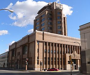
Woodbury County Courthouse in Sioux City
|
||
|
||

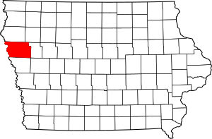
Location within the U.S. state of Iowa
|
||
 Iowa's location within the U.S. |
||
| Country | ||
| State | ||
| Founded | 1851 | |
| Named for | Levi Woodbury | |
| Seat | Sioux City | |
| Largest city | Sioux City | |
| Area | ||
| • Total | 878 sq mi (2,270 km2) | |
| • Land | 872.59 sq mi (2,260.0 km2) | |
| • Water | 4.79 sq mi (12.4 km2) 0.55% | |
| Population
(2020)
|
||
| • Total | 105,941 | |
| • Density | 120.66/sq mi (46.588/km2) | |
| Time zone | UTC−6 (Central) | |
| • Summer (DST) | UTC−5 (CDT) | |
| Congressional district | 4th | |
Woodbury County is a place in Iowa, a state in the United States. In 2020, about 105,941 people lived here. This makes it the sixth-biggest county in Iowa by population.
The main city, or 'county seat,' is Sioux City. Woodbury County is part of the larger Sioux City metropolitan area, which is like a big city region.
Contents
History of Woodbury County
Woodbury County started in 1851 with a different name: Wahkaw County. In 1853, the Iowa Legislature (which makes laws) changed its name. They named it after Levi Woodbury.
Levi Woodbury (1789–1851) was an important person. He was a senator and a governor of New Hampshire. He also worked as a Supreme Court justice from 1844 until he passed away.
The first main city of Wahkaw County was a village called Thompsonville, which no longer exists. When the county name changed to Woodbury, the new main city became Sergeant's Bluff. Today, this city is known as Sergeant Bluff. In 1856, the county's main city moved to Sioux City.
The Winnebago Tribe of Nebraska, also known as the Ho-Chunk people, owns land in Woodbury County. This land is part of their reservation.
Geography of Woodbury County
Woodbury County is located on the western side of Iowa. Its western border is the Missouri River.
The county covers about 878 square miles. Most of this area, about 873 square miles, is land. The rest, about 4.9 square miles, is water. This makes Woodbury County the third-largest county in Iowa by land area.
Main Roads in Woodbury County
Public Transportation
- Sioux City Transit
- List of intercity bus stops in Iowa
Counties Next to Woodbury County
- Plymouth County (north)
- Cherokee County (northeast)
- Ida County (east)
- Monona County (south)
- Thurston County, Nebraska (southwest)
- Dakota County, Nebraska (west)
- Union County, South Dakota (northwest)
Population and People in Woodbury County
| Historical population | |||
|---|---|---|---|
| Census | Pop. | %± | |
| 1860 | 1,119 | — | |
| 1870 | 6,172 | 451.6% | |
| 1880 | 14,996 | 143.0% | |
| 1890 | 55,632 | 271.0% | |
| 1900 | 54,610 | −1.8% | |
| 1910 | 67,616 | 23.8% | |
| 1920 | 92,171 | 36.3% | |
| 1930 | 101,669 | 10.3% | |
| 1940 | 103,627 | 1.9% | |
| 1950 | 103,917 | 0.3% | |
| 1960 | 107,849 | 3.8% | |
| 1970 | 103,052 | −4.4% | |
| 1980 | 100,884 | −2.1% | |
| 1990 | 98,276 | −2.6% | |
| 2000 | 103,877 | 5.7% | |
| 2010 | 102,172 | −1.6% | |
| 2020 | 105,941 | 3.7% | |
| 2023 (est.) | 105,951 | 3.7% | |
| U.S. Decennial Census 1790-1960 1900-1990 1990-2000 2010-2018 2022 |
|||
2020 Census Information

The 2020 census counted 105,941 people in Woodbury County. This means there were about 121 people living per square mile. Most people (90.93%) said they belonged to one race.
There were 42,701 homes in the county, and 39,904 of them were lived in.
| Race | Number of People | Percentage |
|---|---|---|
| White (Not Hispanic) | 72,237 | 68.2% |
| Black or African American (Not Hispanic) | 5,076 | 4.8% |
| Native American (Not Hispanic) | 1,893 | 1.8% |
| Asian (Not Hispanic) | 2,957 | 2.8% |
| Pacific Islander (Not Hispanic) | 651 | 0.61% |
| Other/Mixed (Not Hispanic) | 4,381 | 4.14% |
| Hispanic or Latino | 18,746 | 17.7% |
Cities and Towns in Woodbury County
Cities
Unincorporated Communities
These are smaller places that are not officially cities or towns.
- Climbing Hill (a census-designated place)
- Discord
- Holly Springs
- Luton
- Midway
- Owego
Townships
Townships are smaller areas within a county.
- Arlington
- Banner
- Concord
- Floyd
- Grange
- Grant
- Kedron
- Lakeport
- Liberty
- Liston
- Little Sioux
- Miller
- Morgan
- Moville
- Oto
- Rock
- Rutland
- Sioux City
- Sloan
- Union
- West Fork
- Willow
- Wolf Creek
- Woodbury
Population Ranking of Communities (2020 Census)
This table shows how many people live in each city or town in Woodbury County, from largest to smallest.
† county seat
| Rank | City/Town/etc. | Type | Population (2020 Census) |
|---|---|---|---|
| 1 | † Sioux City (partially in Plymouth County) | City | 85,791 (85,797 total) |
| 2 | Sergeant Bluff | City | 5,015 |
| 3 | Moville | City | 1,687 |
| 4 | Sloan | City | 1,042 |
| 5 | Lawton | City | 943 |
| 6 | Correctionville | City | 766 |
| 7 | Anthon | City | 545 |
| 8 | Pierson | City | 337 |
| 9 | Danbury | City | 320 |
| 10 | Salix | City | 295 |
| 11 | Bronson | City | 294 |
| 12 | Hornick | City | 255 |
| 13 | Cushing | City | 230 |
| 14 | Smithland | City | 181 |
| 15 | Climbing Hill | CDP | 97 |
| 16 | Oto | City | 72 |
See also
 In Spanish: Condado de Woodbury para niños
 | Sharif Bey |
 | Hale Woodruff |
 | Richmond Barthé |
 | Purvis Young |


