Thurston County, Nebraska facts for kids
Quick facts for kids
Thurston County
|
|
|---|---|
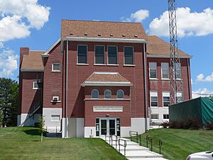
Thurston County courthouse in Pender
|
|
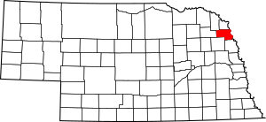
Location within the U.S. state of Nebraska
|
|
 Nebraska's location within the U.S. |
|
| Country | |
| State | |
| Founded | 1889 |
| Named for | John Mellen Thurston |
| Seat | Pender |
| Largest village | Pender |
| Area | |
| • Total | 396 sq mi (1,030 km2) |
| • Land | 394 sq mi (1,020 km2) |
| • Water | 2.5 sq mi (6 km2) 0.6%% |
| Population
(2020)
|
|
| • Total | 6,773 |
| • Density | 17.104/sq mi (6.604/km2) |
| Time zone | UTC−6 (Central) |
| • Summer (DST) | UTC−5 (CDT) |
| Congressional district | 1st |
Thurston County is a county located in the northeastern part of Nebraska, a state in the United States. In 2020, about 6,773 people lived here. The main town, or county seat, where the county government is located, is Pender.
If you look at Nebraska's license plates, Thurston County is shown by the number 55. This number was given because it had the 55th largest number of vehicles registered when the system started in 1922.
Thurston County is special because it is home to two Native American reservations. These are for the Omaha and Ho-Chunk (also known as Winnebago) tribes. In fact, these two reservations make up all the land in the county!
Contents
History of Thurston County
For hundreds of years before Europeans arrived, different groups of indigenous peoples lived along the rivers in this area. The Omaha tribe lived here and in much of Nebraska and western Iowa. They had moved west from the Ohio Valley in the early 1600s.
Thurston County was officially created by European Americans in 1889. The land used to be part of Dakota and Burt counties. The county was named after John M. Thurston, who was a US Senator.
Geography and Nature
Thurston County is located on the eastern side of Nebraska. Its eastern border is the Missouri River, which separates it from the state of Iowa. A creek called Logan Creek flows through the western part of the county.
The county covers a total area of about 396 square miles. Most of this is land (394 square miles), and a small part (2.5 square miles) is water. As mentioned, all the land in Thurston County is part of the Omaha and Winnebago Indian reservations.
Main Roads in Thurston County
Neighboring Counties
Thurston County shares its borders with several other counties:
- Dakota County to the north
- Woodbury County, Iowa to the northeast (across the river)
- Monona County, Iowa to the east (across the river)
- Burt County to the southeast
- Cuming County to the southwest
- Wayne County to the west
- Dixon County to the northwest
People of Thurston County
| Historical population | |||
|---|---|---|---|
| Census | Pop. | %± | |
| 1870 | 31 | — | |
| 1880 | 109 | 251.6% | |
| 1890 | 3,176 | 2,813.8% | |
| 1900 | 6,517 | 105.2% | |
| 1910 | 8,704 | 33.6% | |
| 1920 | 9,589 | 10.2% | |
| 1930 | 10,462 | 9.1% | |
| 1940 | 10,243 | −2.1% | |
| 1950 | 8,590 | −16.1% | |
| 1960 | 7,237 | −15.8% | |
| 1970 | 6,942 | −4.1% | |
| 1980 | 7,186 | 3.5% | |
| 1990 | 6,936 | −3.5% | |
| 2000 | 7,171 | 3.4% | |
| 2010 | 6,940 | −3.2% | |
| 2020 | 6,773 | −2.4% | |
| 2023 (est.) | 6,557 | −5.5% | |
| US Decennial Census 1790-1960 1900-1990 1990-2000 2010 2020 2022 |
|||
In 2020, the people living in Thurston County were mostly Native American (57.5%) and non-Hispanic White (36.1%). There were also smaller groups of African American and Asian people, and about 3.8% were Hispanic.
In 2000, there were 7,171 people living in the county. The average family size was about 3 to 4 people. Many households had children under 18 living with them. The median age of people in the county was 30 years old.
The towns of Emerson, Rosalie, Pender, and Thurston have mostly White residents. The towns of Macy, Walthill, and Winnebago have mostly Native American residents.
Towns and Areas
Thurston County has several villages and one census-designated place. It is also divided into smaller areas called townships.
Villages
Census-Designated Place
Townships
- Anderson
- Blackbird
- Bryan
- Dawes
- Flournoy
- Merry
- Omaha
- Pender
- Perry
- Thayer
- Winnebago
Education in Thurston County
Children in Thurston County attend schools in various school districts. These districts work to provide education for students across the county.
- Bancroft-Rosalie Community Schools
- Emerson-Hubbard Public Schools
- Homer Community Schools
- Lyons-Decatur Northeast Schools
- Pender Public Schools
- Umoⁿhoⁿ Nation Public Schools
- Wakefield Public Schools
- Walthill Public Schools
- Winnebago Public Schools
Images for kids
See also
 In Spanish: Condado de Thurston (Nebraska) para niños
 | James Van Der Zee |
 | Alma Thomas |
 | Ellis Wilson |
 | Margaret Taylor-Burroughs |


